MyTopo
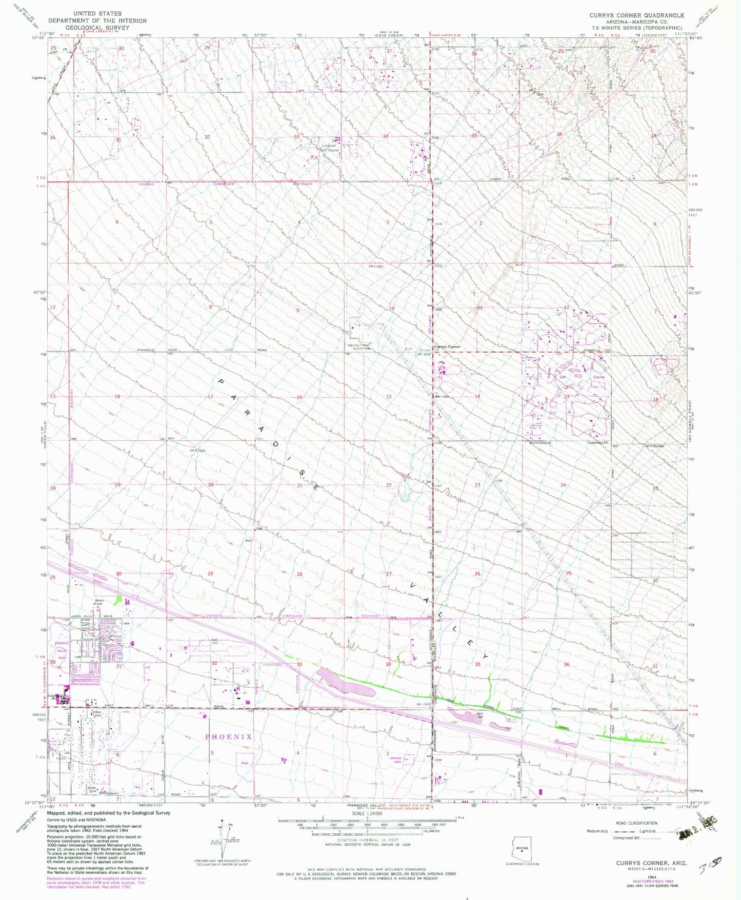
Classic USGS Currys Corner Arizona 7.5'x7.5' Topo Map
Couldn't load pickup availability
Historical USGS topographic quad map of Currys Corner in the state of Arizona. Map scale may vary for some years, but is generally around 1:24,000. Print size is approximately 24" x 27"
This quadrangle is in the following counties: Maricopa.
The map contains contour lines, roads, rivers, towns, and lakes. Printed on high-quality waterproof paper with UV fade-resistant inks, and shipped rolled.
Contains the following named places: Abrazo Health Scottsdale Campus, Barix Clinics of Arizona, Basking Ridge, Bell Acres Mobile Home Park, Church of Christ on Tatum Boulevard, Copper Canyon Elementary School, Cornerstone Baptist Church, Country Trace, Currys Corner, Desert Dawn Private School, Desert Highlands, Desert Life Christian Church, Desert Ridge, Desert Springs Bible Church, Desert Sun Academy, Desert Trails Elementary School, Desert Village Shopping Center, Destiny Center International Church, El Dorado Private School, Explorer Middle School, Foothills Elementary School, Freedom Academy, Freedom Inn at Scottsdale, Grayhawk Elementary School, Grayhawk Golf Club, Greenway Park V, Happy Valley Ranch, Heritage North Ranch, Highlands Church, HonorHealth Scottsdale Thompson Peak Medical Center, Horseshoe Trails Elementary School, Immanuel Bible Church, Ironwood Golf Course, KARZ-AM (Phoenix), Kierland Golf Club, KOOL-AM (Phoenix), La Casa de Cristo Lutheran, Life Care Center of Paradise Valley, Living Water Lutheran Church, Loyalton of Phoenix, Maricopa County Superior Court Northeast Regional Center, Mayo Clinic Hospital, Montclair Terrace, Montessori Day Public School Charter, Mountain Valley Church, North Ranch Elementary School, North Ridge Community Church, Oakhurst, Old Verde Canal, Paradise Peak West Mobile Home Park, Paradise Valley Community Center, Paradise Valley Community Church, Paradise Valley High School, Paradise Valley Hospital Emergency Department Heliport, Paradise Valley Miranda, Paradise Valley Substation, Parde Jewish Day School, Phoenix Fire Department Station 37, Phoenix Fire Department Station 49, Phoenix Fire Department Station 52, Phoenix Police Department Desert Horizon Precinct, Pinnacle Paradise, Pinnacle Peak Country Club Estates, Pinnacle Peak Country Club Golf Course, Pinnacle Peak Elementary School, Pinnacle Peak Estates I, Pinnacle Peak Estates II, Pinnacle Peak Estates III, Pinnacle Peak Shadows, Pinnacle Peak Substation, Pinnacle Peak Village, Pinnacle Presbyterian Church, Promenade at Scottsdale Shopping Center, Quail Valley, Rancho Santa Fe, Redeemer Lutheran Church, Resurrection Lutheran Church, Sahkoo Park, Saint Bernadette Catholic Church, Saint Joan of Arc Catholic Church, Saint Joan of Arc Catholic Preschool and Kindergarten, Sandalwood, Santa Maria Adult Day Health Care, Scottsdale Fire Department Station 11 DC Ranch, Scottsdale Fire Department Station 13 Desert Foothills, Scottsdale Horsemens Park, Scottsdale Kachina Post Office, Scottsdale Police Department District 4, Scottsdale Public Library Appaloosa Branch, Scottsdale Towne Centre Shopping Center, Sonora Village Shopping Center, Sonoran Trails Middle School, Star Technology Professional Center, Sunset Ridge I, Tatum Point Shopping Center, The Country Club at DC Ranch, Tournament Players Golf Club Scottsdale Champions Course, Tournament Players Golf Club Scottsdale Stadium Course, Whispering Wind Academy, Wildfire Elementary School, Wildfire Golf Club, Windsong, ZIP Codes: 85050, 85054


