MyTopo
Classic USGS Curtin Oregon 7.5'x7.5' Topo Map
Couldn't load pickup availability
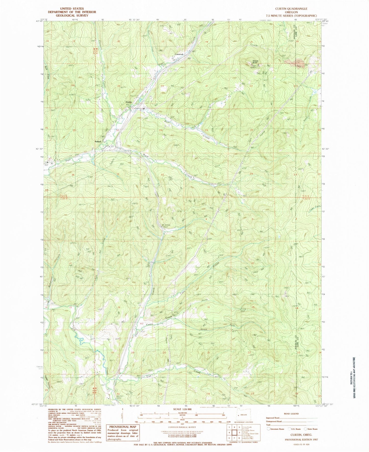
Historical USGS topographic quad map of Curtin in the state of Oregon. Map scale may vary for some years, but is generally around 1:24,000. Print size is approximately 24" x 27"
This quadrangle is in the following counties: Douglas, Lane.
The map contains contour lines, roads, rivers, towns, and lakes. Printed on high-quality waterproof paper with UV fade-resistant inks, and shipped rolled.
Contains the following named places: Anlauf, Anlauf Creek, Anlauf Post Office, Bear Creek, Buck Creek, Comstock, Comstock Cemetery, Comstock Post Office, Cox Creek, Curtin, Curtin Post Office, Curtis Creek, Cuttock Butte, Doolittle Butte, Gretna, Indian Burial Ground, Lake Diane, Lawrence Reservoir, Lees Creek, North Douglas County Fire and Emergency Medical Services Station 4, Pass Creek County Park, Pheasant Creek, Redford Butte, Salt Creek, Schafer Creek, Seeley Creek, Simpson Creek, Siuslaw, Sliter Butte, Spike Buck Butte, Ward Creek, Wards Butte, Wehmeyer Creek