MyTopo
Classic USGS Curtis Ridge Utah 7.5'x7.5' Topo Map
Couldn't load pickup availability
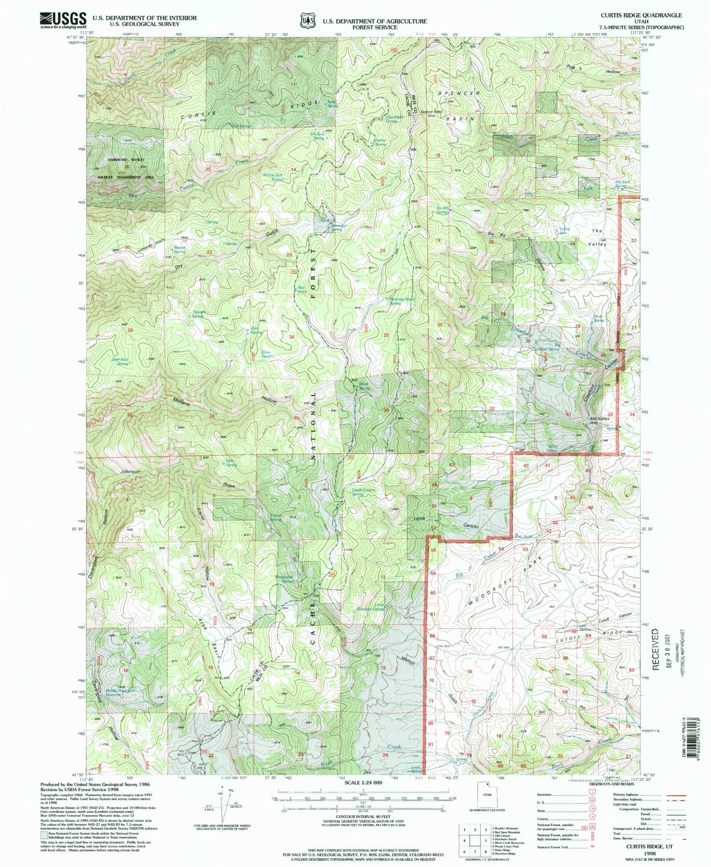
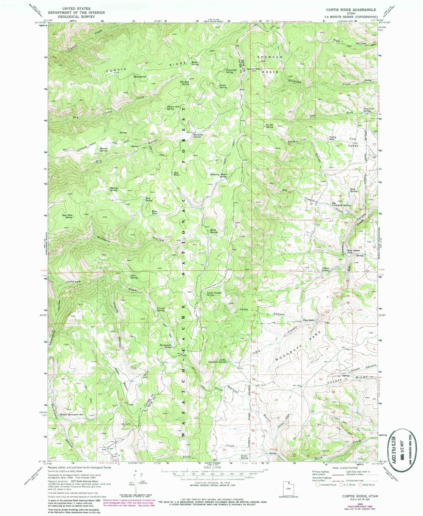
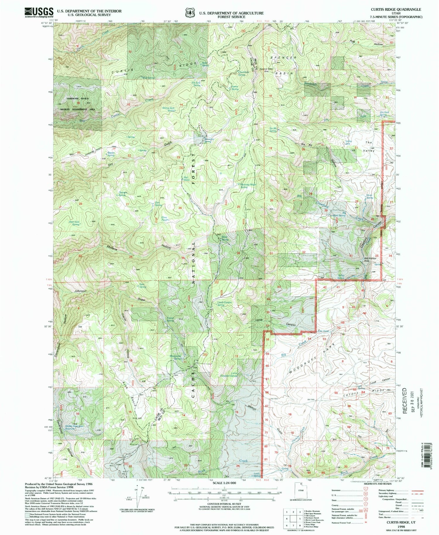
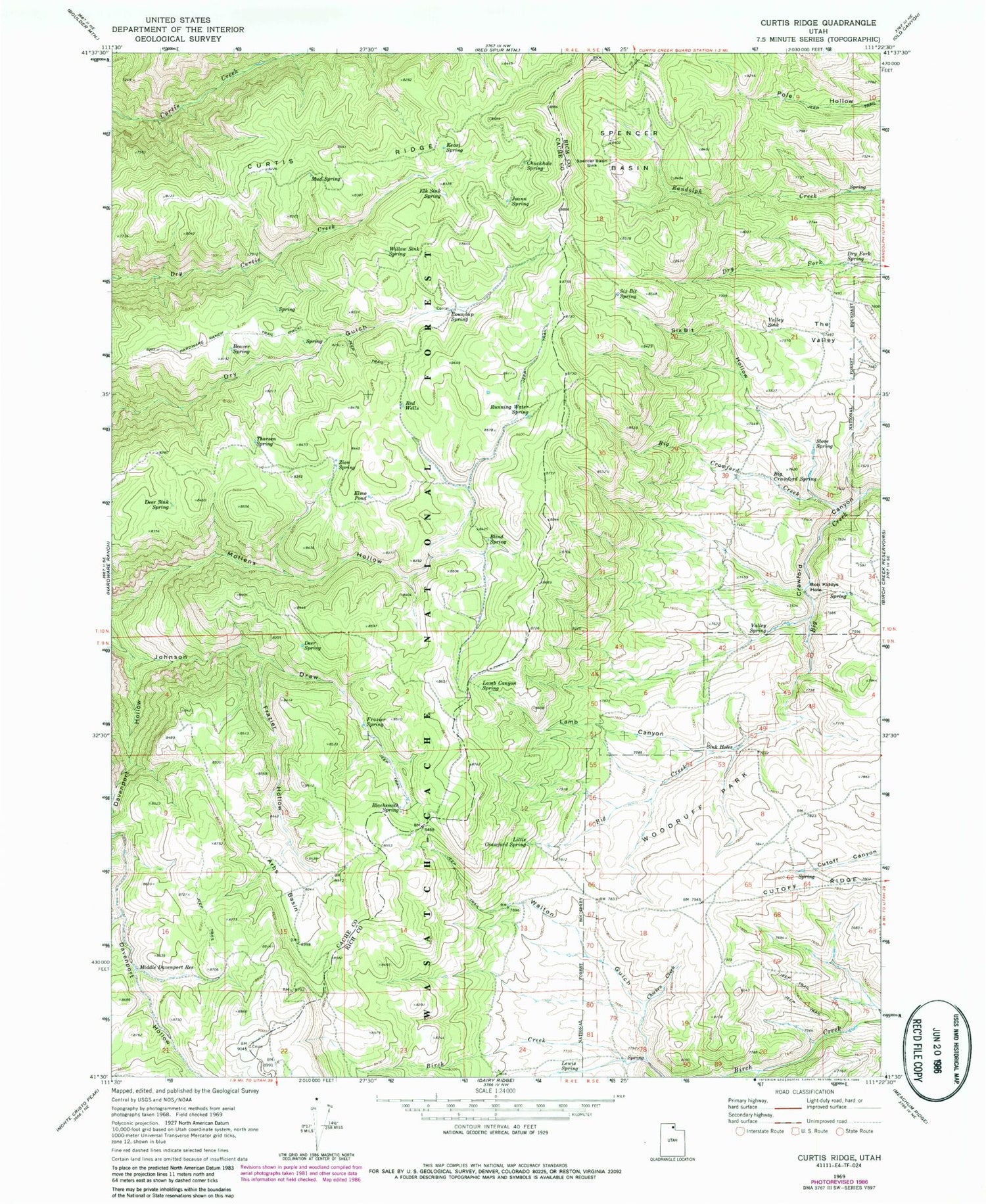
Historical USGS topographic quad map of Curtis Ridge in the state of Utah. Typical map scale is 1:24,000, but may vary for certain years, if available. Print size: 24" x 27"
This quadrangle is in the following counties: Cache, Rich.
The map contains contour lines, roads, rivers, towns, and lakes. Printed on high-quality waterproof paper with UV fade-resistant inks, and shipped rolled.
Contains the following named places: Thousand Dollar Ridge, Arbs Basin, Beaver Spring, Big Crawford Creek, Big Crawford Spring, Blacksmith Spring, Blind Spring, Bob Kiddys Hole, Chicken Creek, Chuckhole Spring, Curtis Ridge, Davenport Hollow, Deer Sink Spring, Deer Spring, Dry Fork Spring, Elk Sink Spring, Elmo Pond, Frazier Hollow, Frazier Spring, Hardware Ranch Trail, Joann Spring, Kearl Spring, Lamb Canyon, Lamb Canyon Spring, Lewis Spring, Little Crawford Spring, Middle Davenport Reservoir, Mud Spring, Red Wells, Roundup Spring, Running Water Spring, Six Bit Hollow, Six Bit Spring, Spence Basin Sink, Spencer Basin, Stove Spring, The Valley, Thorsen Spring, Valley Sink, Valley Spring, Walton Gulch, Willow Sink Spring, Woodruff Park, Zion Spring, Pine Spring