
MyTopo
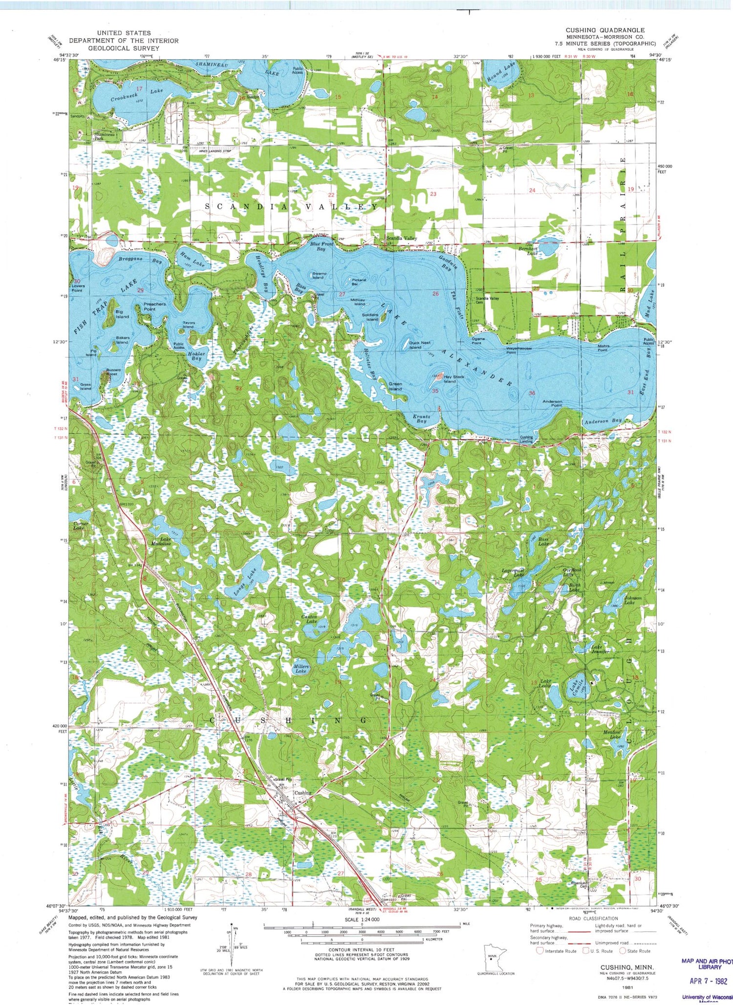
Classic USGS Cushing Minnesota 7.5'x7.5' Topo Map
Couldn't load pickup availability
Historical USGS topographic quad map of Cushing in the state of Minnesota. Typical map scale is 1:24,000, but may vary for certain years, if available. Print size: 24" x 27"
This quadrangle is in the following counties: Morrison.
The map contains contour lines, roads, rivers, towns, and lakes. Printed on high-quality waterproof paper with UV fade-resistant inks, and shipped rolled.
Contains the following named places: Bass Lake, Bernhart Lake, Betesta Church, Big Island, Grass Island, Corner Lake, Crookneck Lake, Cushing, Lake Madaline, Lagerquist Lake, Ham Lake, Hay Stack Island, Johnson Lake, Bakers Island, Lake Camile, Longs Lake, Meadow Lake, Mud Lake, Pig Island, Roseland Roselund Cemetery, Round Lake, Scandia Valley Cemetery, Scandia Valley Town Hall, School Number 119, School Number 64, School Number 67, School Number 77, Soldiers Island, Hines Farm Airport, Lake Alexander, Township of Cushing, Township of Scandia Valley, Loberg Wildlife Pond Dam, Lake Leslie, Lake Jennifer, Birch Lake, Overlook Lake, Millers Lake, Canton Lake, Krantz Bay, East End Bay, Cushing Landing, Anderson Point, Anderson Bay, Mohrs Point, Weyerhaeuser Point, Ogema Point, Green Island, Holister Bay, The Flats, Duck Nest Island, Midway Island, Pickerel Bar, Swamp Island, Goodwin Bay, Blue Front Bay, Bass Bay, Hohler Bay, Tayors Island, Preachers Point, Buzzard Roost, Headleys Bay, Braggans Bay, Shamineau Park, Cushing Union Cemetery, Cushing, Cushing Post Office, Bethany Lutheran Church, Cushing Baptist Church, Fishtrap Lake Campground, Scandia Valley Fire Department


