
MyTopo
Classic USGS Cushman Montana 7.5'x7.5' Topo Map
Regular price
$16.95
Regular price
Sale price
$16.95
Unit price
per
Couldn't load pickup availability
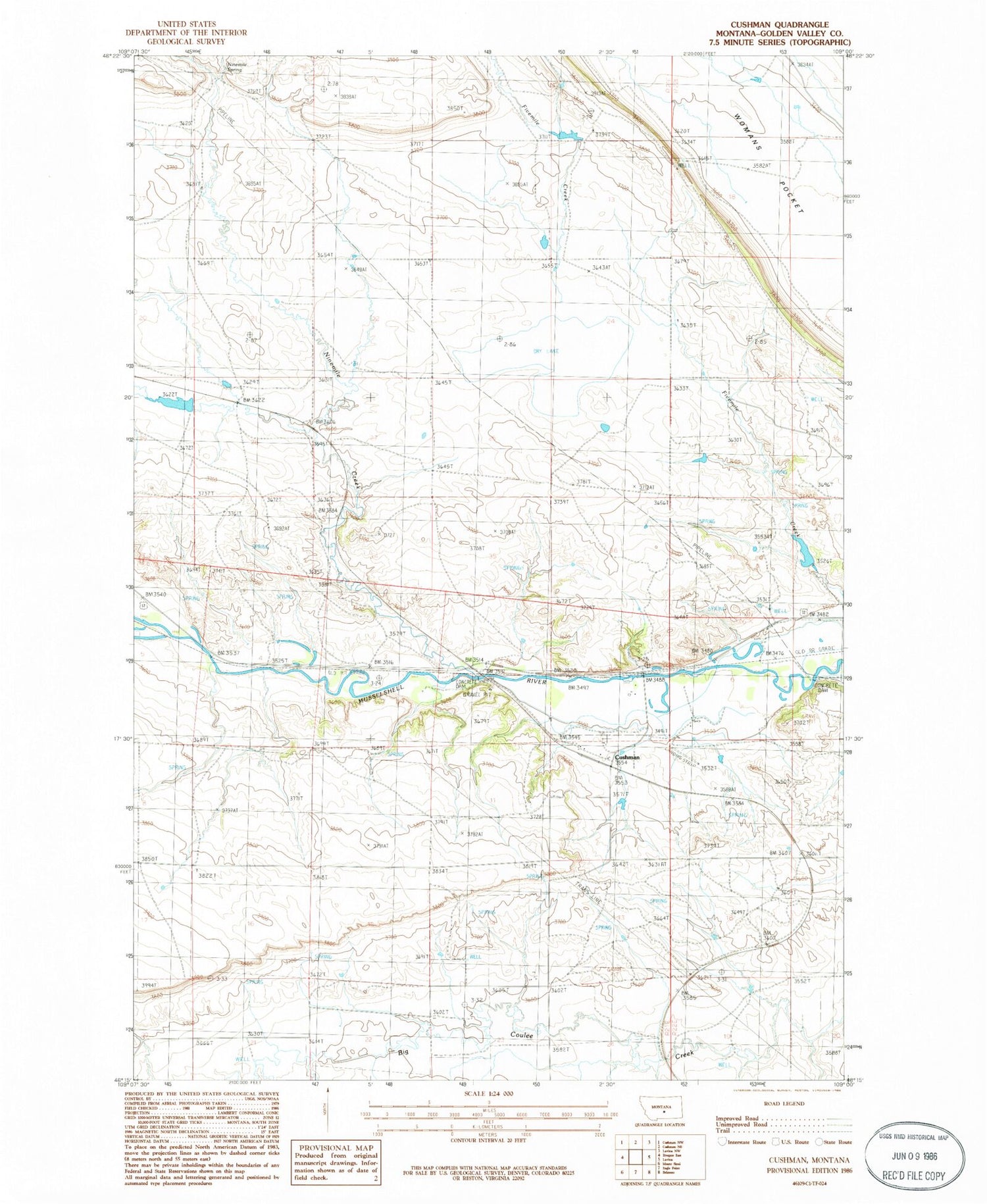
Historical USGS topographic quad map of Cushman in the state of Montana. Map scale may vary for some years, but is generally around 1:24,000. Print size is approximately 24" x 27"
This quadrangle is in the following counties: Golden Valley.
The map contains contour lines, roads, rivers, towns, and lakes. Printed on high-quality waterproof paper with UV fade-resistant inks, and shipped rolled.
Contains the following named places: 06N21E22BDA_01 Well, 06N21E24CAA_01 Well, 06N22E19CDAB01 Well, Burgoyne Post Office, Burgoyne Siding, Cushman, Cushman Post Office, Fratt, Gerdts Dam, Ninemile Creek, Ninemile Spring, Olden Post Office, Slayton, Slayton Junction, Slayton Post Office, Vebar


