MyTopo
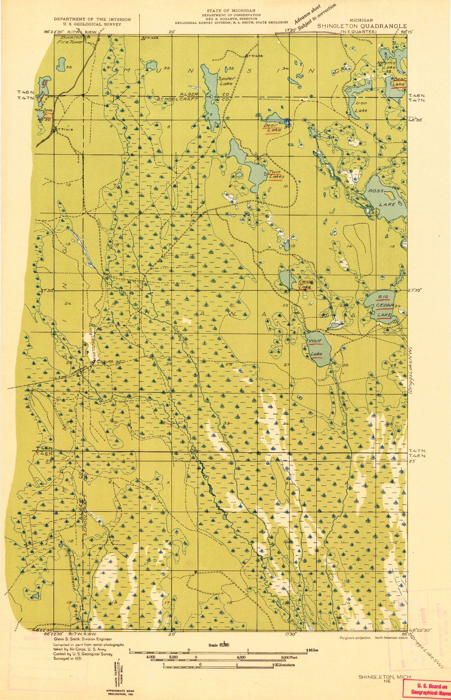
Classic USGS Cusino Michigan 7.5'x7.5' Topo Map
Couldn't load pickup availability
Historical USGS topographic quad map of Cusino in the state of Michigan. Map scale may vary for some years, but is generally around 1:24,000. Print size is approximately 24" x 27"
This quadrangle is in the following counties: Alger, Schoolcraft.
The map contains contour lines, roads, rivers, towns, and lakes. Printed on high-quality waterproof paper with UV fade-resistant inks, and shipped rolled.
Contains the following named places: Bear Creek, Canoe Lake, Canoe Lake State Forest Campground, Creighton Marsh, Cusino, Cusino Lake, Cusino Lake State Forest Campground, Cusino Post Office, Cusino Station, Gemini Lakes, North Gemini Lake State Forest Campground, Ross Lake, Ross Lake State Forest Campground, Shotgun Creek, Silver Lake, South Gemini Lake State Forest Campground, Stoner Creek, Stoner Pond, Worchester Lake, ZIP Code: 49884