MyTopo
Classic USGS Custer Montana 7.5'x7.5' Topo Map
Couldn't load pickup availability
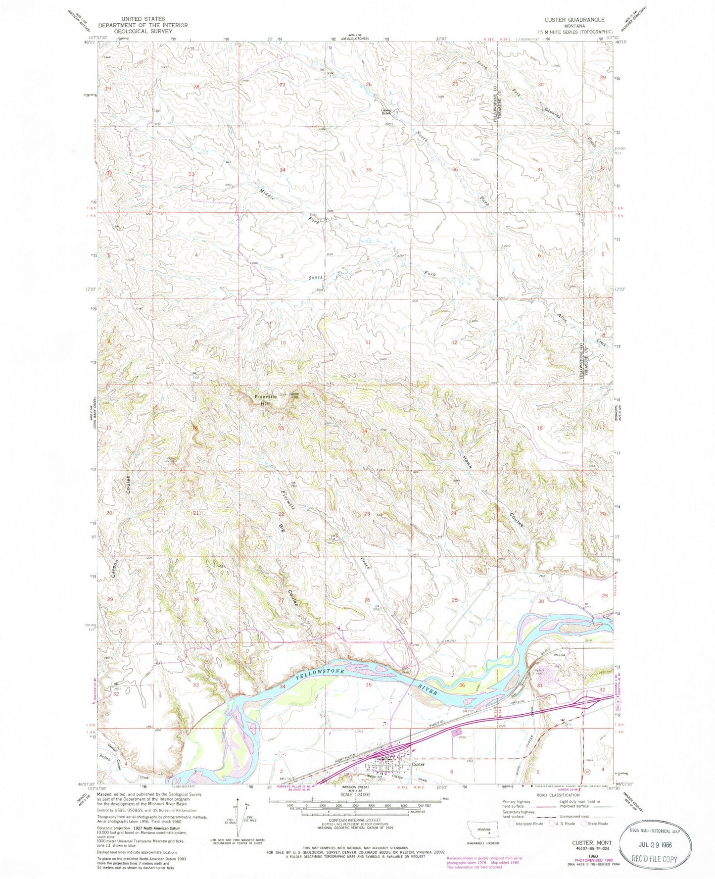
Historical USGS topographic quad map of Custer in the state of Montana. Map scale may vary for some years, but is generally around 1:24,000. Print size is approximately 24" x 27"
This quadrangle is in the following counties: Treasure, Yellowstone.
The map contains contour lines, roads, rivers, towns, and lakes. Printed on high-quality waterproof paper with UV fade-resistant inks, and shipped rolled.
Contains the following named places: 05N33E10BBAC01 Well, 05N33E26D___01 Well, 05N33E32ABCB01 Well, 05N33E32DABC01 Well, Big Coulee, Bighorn Tunnel, Buffalo Creek, Custer, Custer Census Designated Place, Custer Post Office, Custer Volunteer Fire Department, Fivemile Creek, Fivemile Hill, Hawk Coulee, Larsen Ranch, Middle Fork Allen Creek, North Fork Allen Creek, Ruff Airport, South Fork Allen Creek