MyTopo
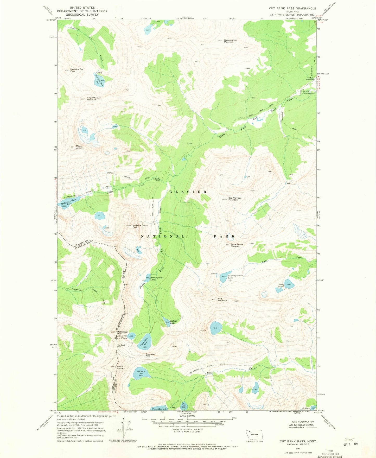
Classic USGS Cut Bank Pass Montana 7.5'x7.5' Topo Map
Couldn't load pickup availability
Historical USGS topographic quad map of Cut Bank Pass in the state of Montana. Typical map scale is 1:24,000, but may vary for certain years, if available. Print size: 24" x 27"
This quadrangle is in the following counties: Flathead, Glacier.
The map contains contour lines, roads, rivers, towns, and lakes. Printed on high-quality waterproof paper with UV fade-resistant inks, and shipped rolled.
Contains the following named places: Amphitheater Mountain, Atlantic Creek, Atlantic Falls, Bad Marriage Mountain, Boy Lake, Cut Bank Campground, Cut Bank Pass, Cut Bank Pass Trail, Cut Bank Ranger Station, Eagle Plume Mountain, Mount James, Katoya Lake, Kupunkamint Mountain, Lonely Lakes, McClintock Peak, Medicine Grizzly Lake, Medicine Grizzly Peak, Medicine Grizzly Trail, Medicine Owl Lake, Medicine Owl Peak, Mount Morgan, Morning Star Lake, Oldman Lake, Pitamakan Lake, Pitamakan Pass, Red Mountain, Running Crane Lake, Seven Winds of the Lake, Sky Lake, Young Man Lake, Pitamakan Pass Trail