
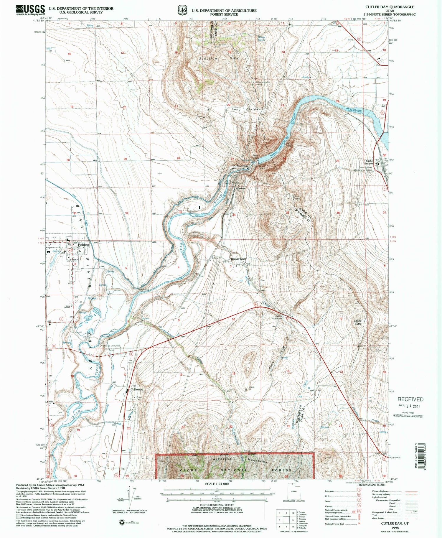
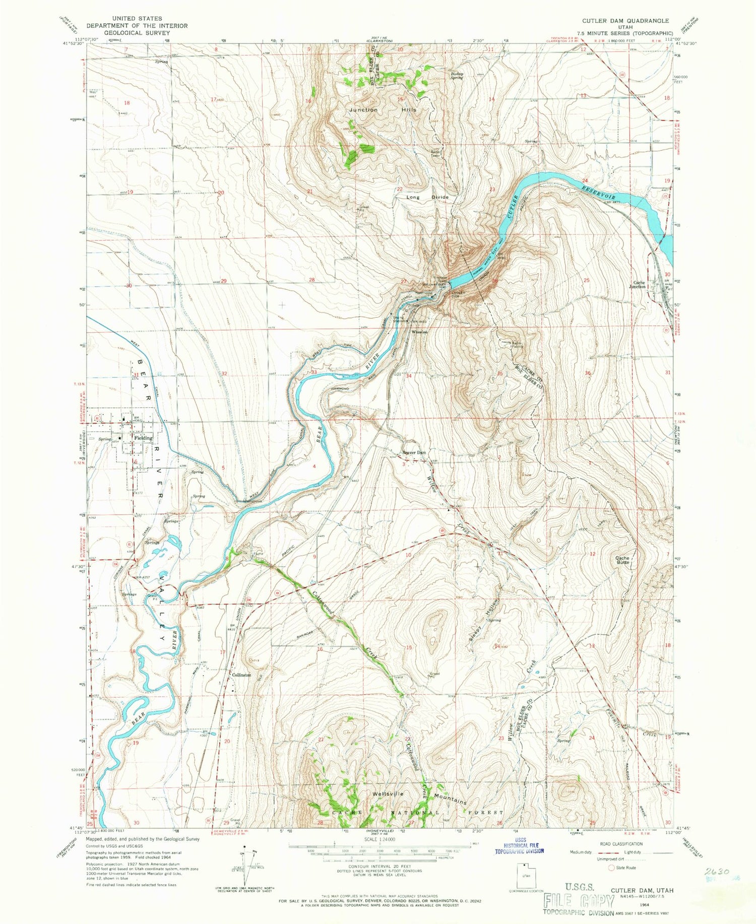
MyTopo
Classic USGS Cutler Dam Utah 7.5'x7.5' Topo Map
Couldn't load pickup availability
Historical USGS topographic quad map of Cutler Dam in the state of Utah. Map scale may vary for some years, but is generally around 1:24,000. Print size is approximately 24" x 27"
This quadrangle is in the following counties: Box Elder, Cache.
The map contains contour lines, roads, rivers, towns, and lakes. Printed on high-quality waterproof paper with UV fade-resistant inks, and shipped rolled.
Contains the following named places: Beaver Dam, Beaver Dam Cemetery, Bishop Spring, Black Rock, Cache Butte, Cache Census Designated Place, Cache Junction, Collinston, Cottonwood Creek, Cutler Dam, East Garland Cemetery, Fielding, Fielding Elementary School, Fielding Fire Department, Fielding Post Office, Hammond Main Canal, Historical Monument Stage Station, Junction Hills, Long Divide, Poulsen Family Cemetery, Sleepy Hollow, The Church of Jesus Christ of Latter Day Saints, The Slough, Town of Fielding, West Side Canal, Wheelon, Willow Creek, ZIP Codes: 84306, 84311


