MyTopo
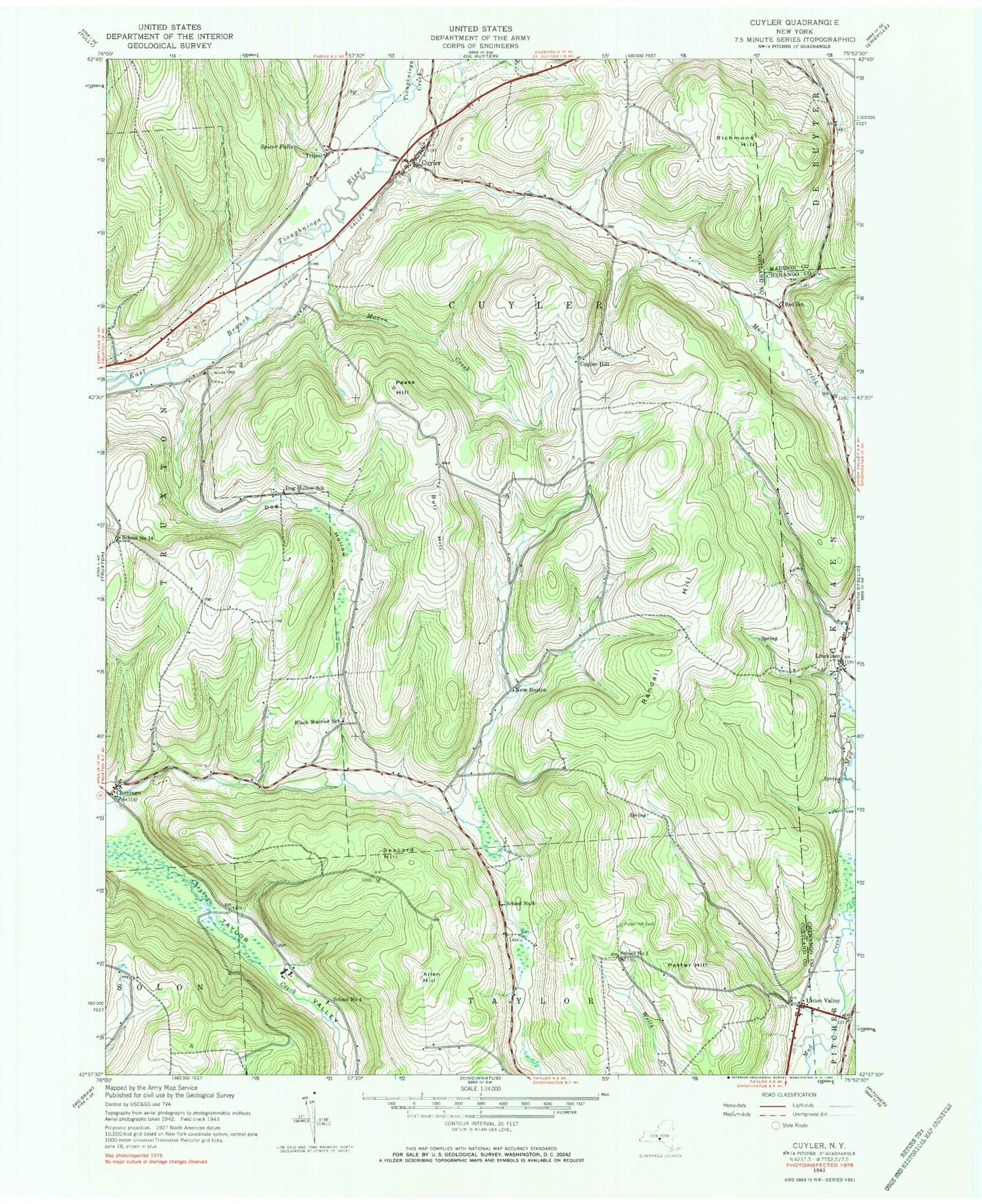
Classic USGS Cuyler New York 7.5'x7.5' Topo Map
Couldn't load pickup availability
Historical USGS topographic quad map of Cuyler in the state of New York. Map scale may vary for some years, but is generally around 1:24,000. Print size is approximately 24" x 27"
This quadrangle is in the following counties: Chenango, Cortland, Madison.
The map contains contour lines, roads, rivers, towns, and lakes. Printed on high-quality waterproof paper with UV fade-resistant inks, and shipped rolled.
Contains the following named places: Allen Hill, Black Warrior School, Bull Hill, Cheningo, Cheningo Cemetery, Cuyler, Cuyler Cemetery, Cuyler Fire Department, Cuyler Hill Cemetery, Cuyler Volunteer Fire Department Station 2, Dog Hollow, Dog Hollow School, Forest Lake Campground, Frosty Morning Farm, Guyler Hill, Lincklaen, Maxon Creek, New Boston, Pease Hill, Potter Hill, Potter Hill Cemetery, Randall Hill, Red School, Richmond Hill, School Number 1, School Number 14, School Number 4, School Number 7, School Number 8, Seacord Hill, Spicer Falls, Tioughnioga Creek, Town of Cuyler, Tripoli, Union Valley, Union Valley Cemetery, West Branch Tioughnioga Creek, Winne Cemetery, ZIP Code: 13158