MyTopo
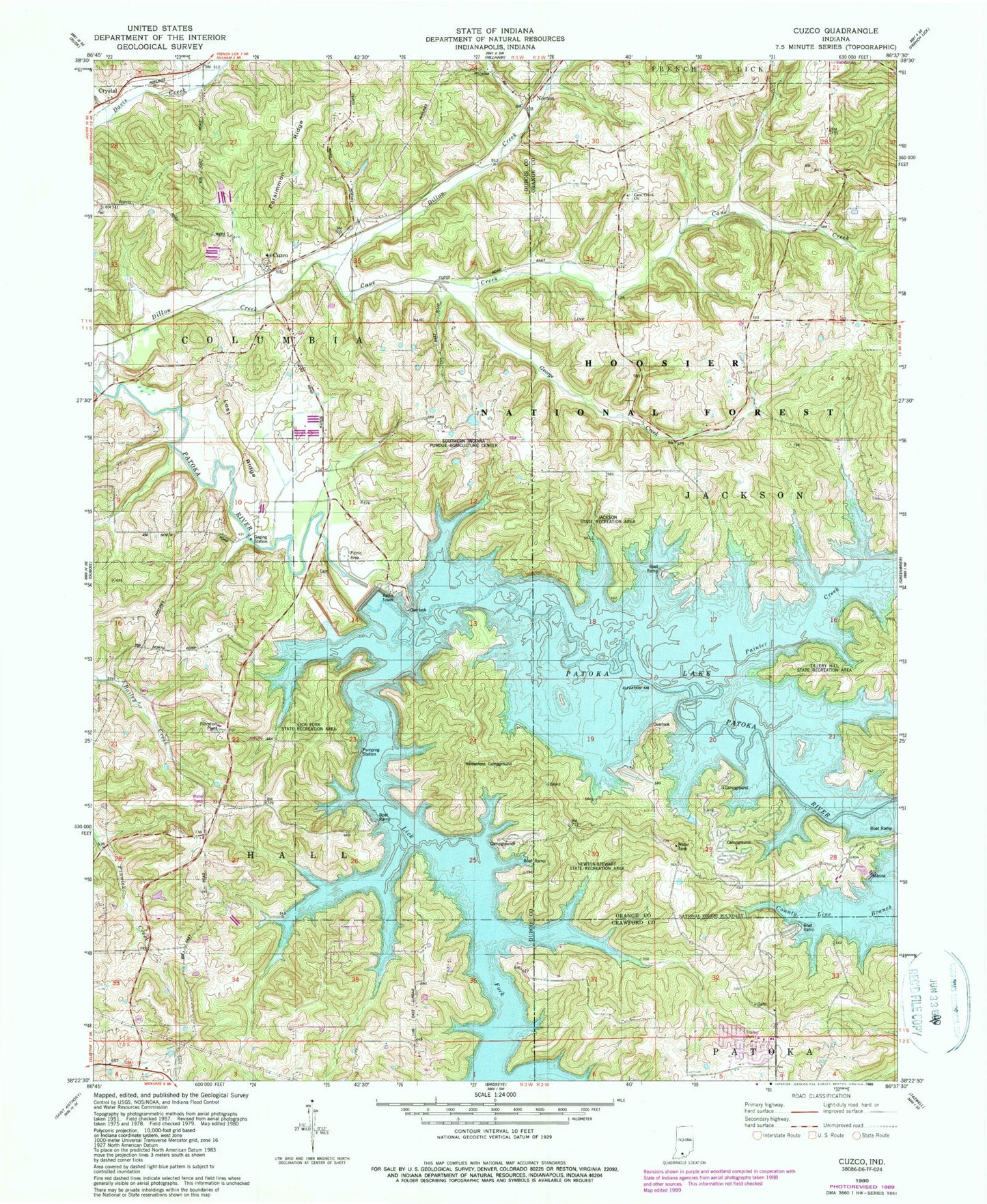
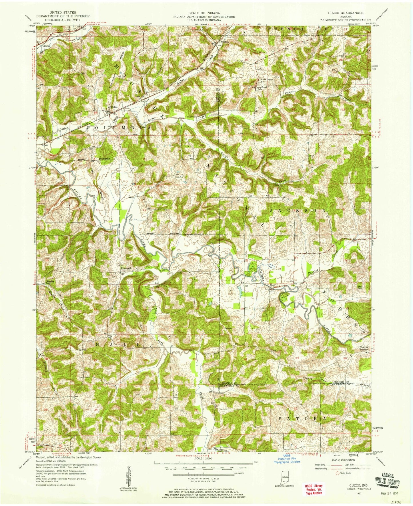
Classic USGS Cuzco Indiana 7.5'x7.5' Topo Map
Couldn't load pickup availability
Historical USGS topographic quad map of Cuzco in the state of Indiana. Typical map scale is 1:24,000, but may vary for certain years, if available. Print size: 24" x 27"
This quadrangle is in the following counties: Crawford, Dubois, Orange.
The map contains contour lines, roads, rivers, towns, and lakes. Printed on high-quality waterproof paper with UV fade-resistant inks, and shipped rolled.
Contains the following named places: Bender School, Cane Creek, Cane Creek Church, Cane Creek School, Cuzco, Dillon Creek, Ellsworth, Lost Ridge, Norton, Persimmon Ridge, Ritter Creek, Swift Cemetery, Lick Fork, Painter Creek, Jackson State Recreation Area, Lick Fork State Recreation Area, Southern Indiana Purdue Agriculture Center, Newton-Stewart State Recreation Area, Patoka Lake, Patoka Lake Dam, Township of Columbia, Township of Hall, Township of Jackson