MyTopo
Classic USGS Cygnet Lake Montana 7.5'x7.5' Topo Map
Couldn't load pickup availability
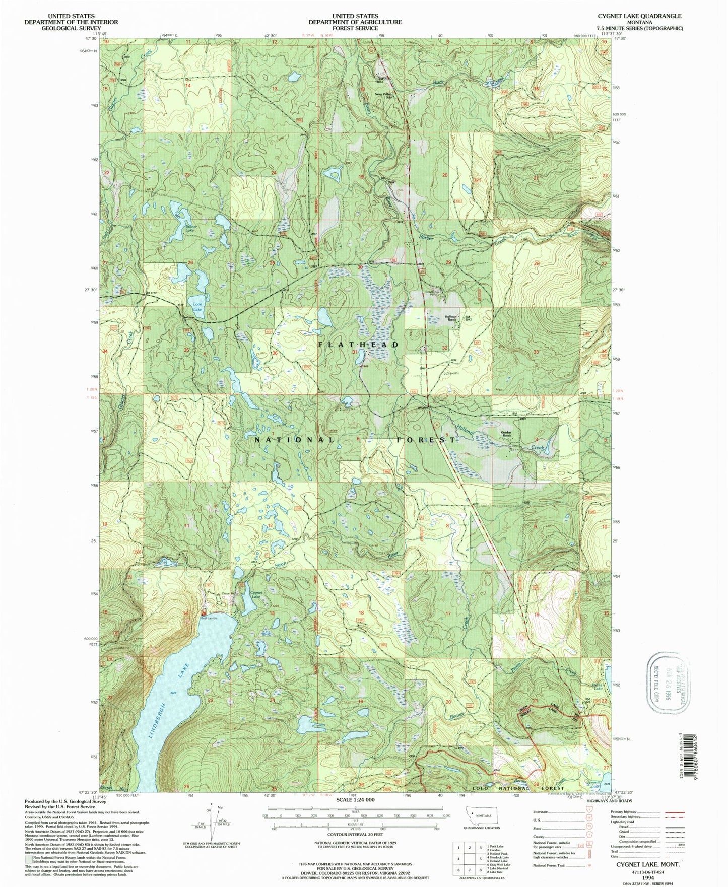
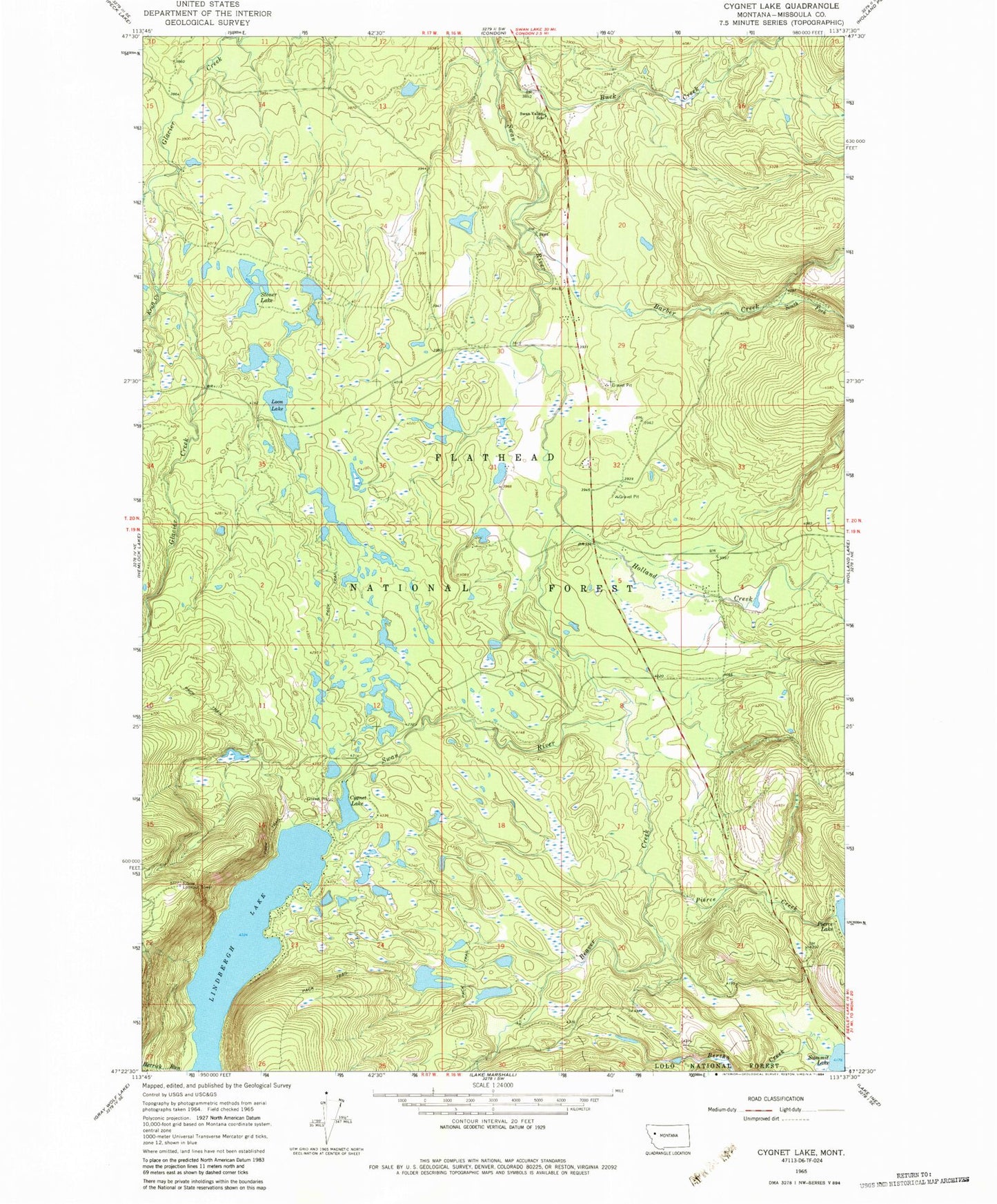
Historical USGS topographic quad map of Cygnet Lake in the state of Montana. Map scale may vary for some years, but is generally around 1:24,000. Print size is approximately 24" x 27"
This quadrangle is in the following counties: Missoula.
The map contains contour lines, roads, rivers, towns, and lakes. Printed on high-quality waterproof paper with UV fade-resistant inks, and shipped rolled.
Contains the following named places: 19N16W05ABCC01 Well, 19N16W05ABCC02 Well, 19N16W06BDBA01 Well, 19N16W07DBDD01 Well, 19N16W21AADA01 Well, 19N16W21ABAB01 Well, 19N16W21ABC_01 Well, 20N16W18DCDB01 Well, 20N16W20BCCB01 Well, 20N16W20CCCB01 Well, 20N16W29BCBB01 Well, 20N16W32ABCA01 Well, 20N16W32BCDA01 Well, 20N17W36BAAA01 Well, 20N17W36BAAB01 Well, Barber Creek, Beaver Creek, Buck Creek, Cygnet Lake, Elbow Lookout Tower, Gordon Ranch, Holland Creek, Hultman 33 Ranch, Kraft Creek, Lairds, Lindbergh Campground, Lindbergh Lake, Loon Lake, Pierce Creek, Pierce Lake, South Fork Barber Creek, Stoner Lake, Summit Lake, Swan Valley School, Windfall Creek