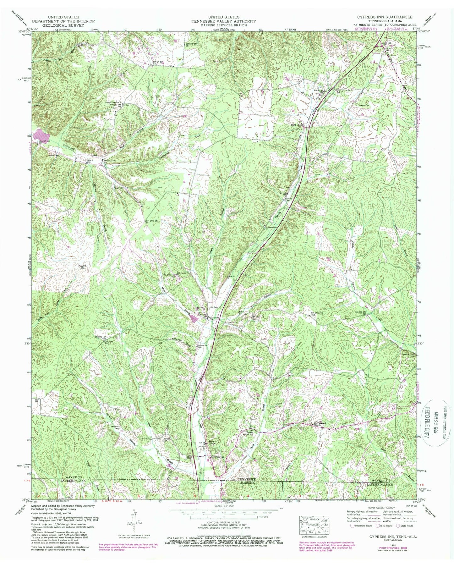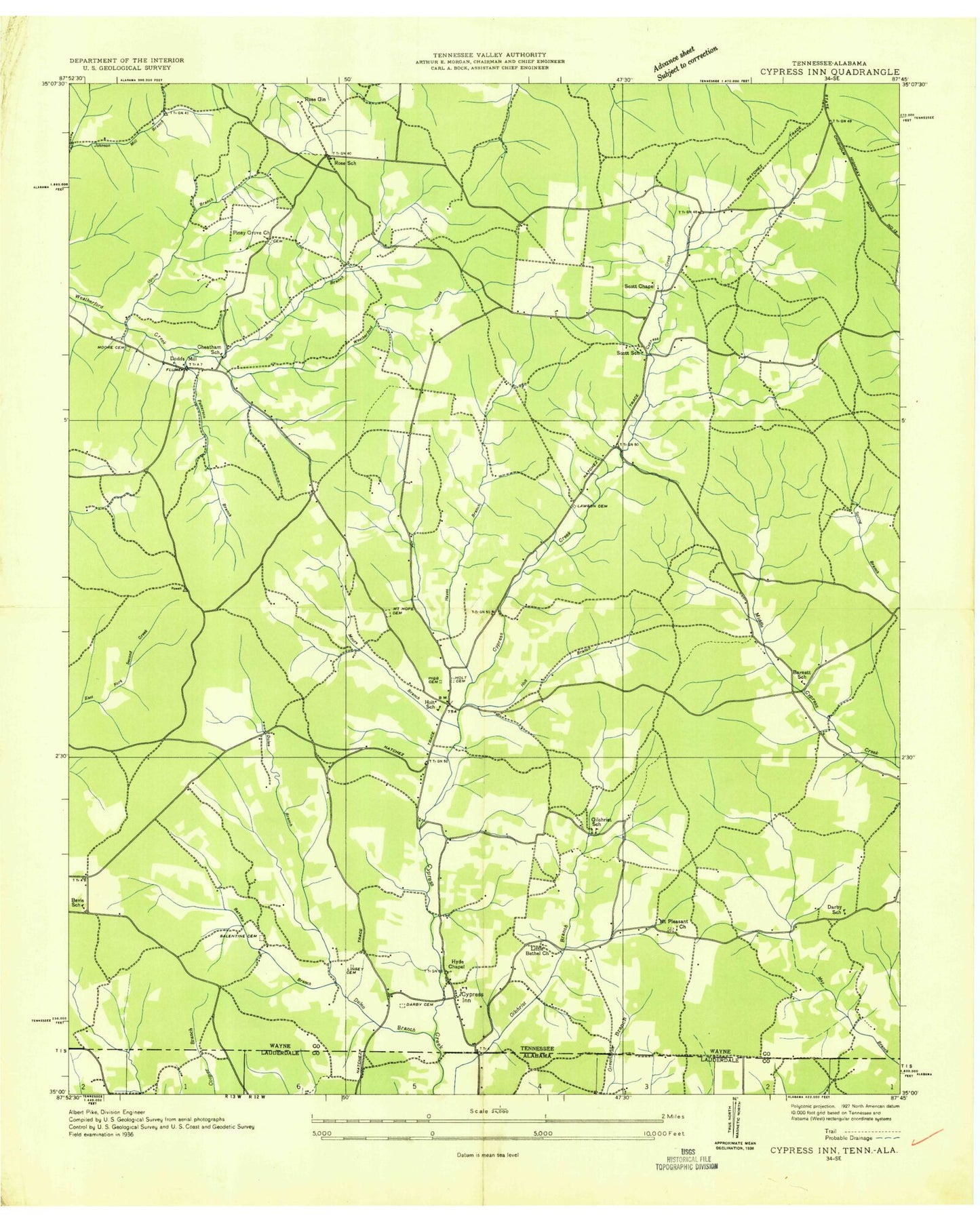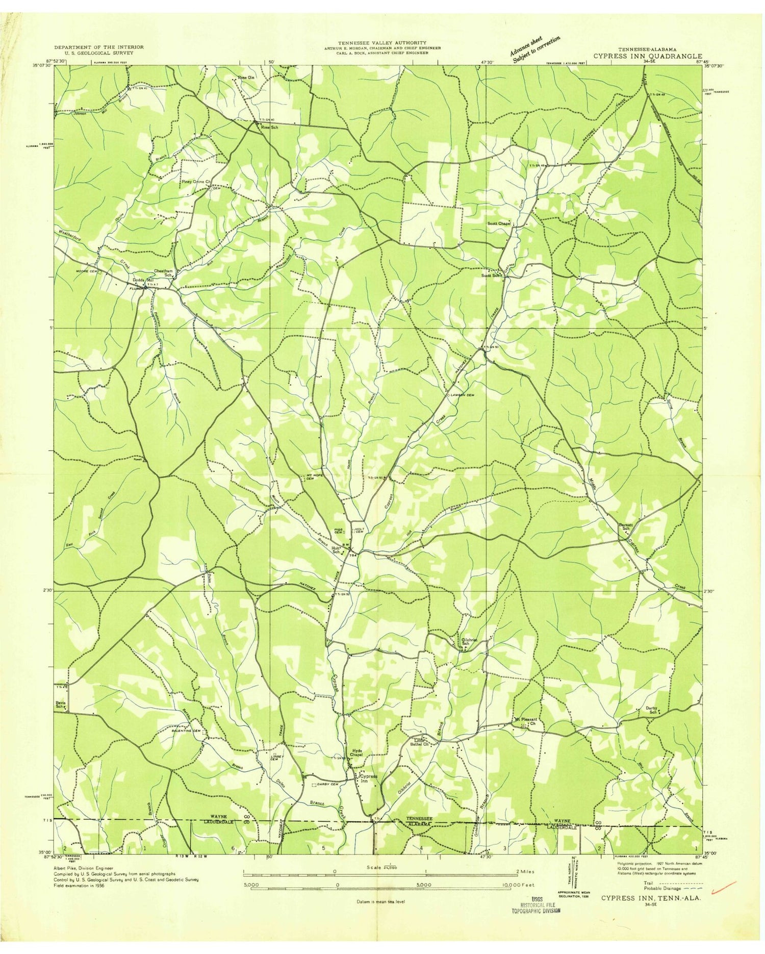
MyTopo
Classic USGS Cypress Inn Tennessee 7.5'x7.5' Topo Map
Couldn't load pickup availability
Historical USGS topographic quad map of Cypress Inn in the states of Tennessee, Alabama. Map scale may vary for some years, but is generally around 1:24,000. Print size is approximately 24" x 27"
This quadrangle is in the following counties: Lauderdale, Wayne.
The map contains contour lines, roads, rivers, towns, and lakes. Printed on high-quality waterproof paper with UV fade-resistant inks, and shipped rolled.
Contains the following named places: Balentine Cemetery, Barkley Branch, Barkley Cemetery, Barnett School, Berry School, Bevis Ridge, Bevis School, Brewer Cemetery, Cheatham School, Cooper Branch, Cooper Cemetery, Cypress Inn, Cypress Inn Post Office, Cypress Inn Volunteer Fire Department, Darby Cemetery, Darby School, Dodds Mill, Dulin Branch, Gilchrist Branch, Gilchrist School, Gray Cemetery, Hayes Branch, Holt, Holt Branch, Holt Cemetery, Holt School, Hyde Chapel, Jackson Cemetery, Lawson Cemetery, Little Bethel Church, Lutts-Cypress Inn Division, McAllister Cemetery, Moore Branch, Moore Cemetery, Mount Hope Cemetery, Mount Hope Church, Mount Pleasant Cemetery, Mount Pleasant Church, Old Chestnut Grove Cemetery, Old Darby Cemetery, Old Dodd Cemetery, Old Hayes Cemetery, Patterson Branch, Pigg Cemetery, Piney Grove Cemetery, Piney Grove Church, Powell Cemetery, Rich Branch, Rose Gin, Rose School, Scott Chapel, Scott School, Upvine Branch, Weatherford-Bear Lake Number One B, Whittens Stand, Wright Cemetery, ZIP Code: 38452