MyTopo
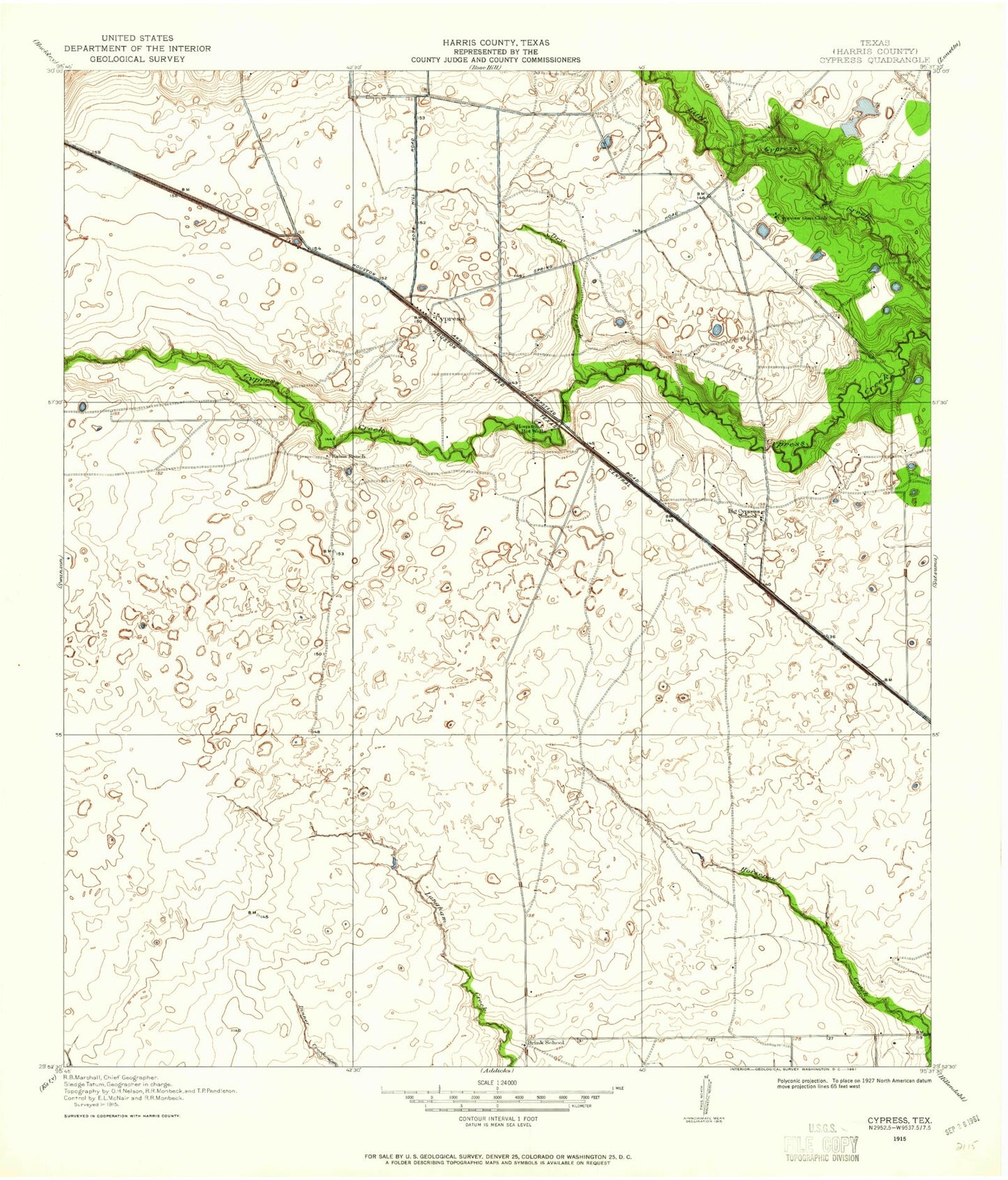
Classic USGS Cypress Texas 7.5'x7.5' Topo Map
Couldn't load pickup availability
Historical USGS topographic quad map of Cypress in the state of Texas. Map scale may vary for some years, but is generally around 1:24,000. Print size is approximately 24" x 27"
This quadrangle is in the following counties: Harris.
The map contains contour lines, roads, rivers, towns, and lakes. Printed on high-quality waterproof paper with UV fade-resistant inks, and shipped rolled.
Contains the following named places: Amhurst, Arnold Junior High School, Ault Elementary School, Bonaire, Brookhollow Baptist Church, Calvary Community Church, Campbell Road Church of Christ, Carlton Pre - Vocational Center, Chappell Ridge, Christ the Redeemer Catholic Church, Church of Christ - Cy- Fair, Copeland Elementary School, Copperfield Annex Post Office, Copperfield Baptist Church, Copperfield Southcreek Village, Copperfield Village Shopping Center, Cornerstone United Methodist Church, Cy - Fair Volunteer Fire Department Station 11, Cy - Fair Volunteer Fire Department Station 3, Cy - Fair Volunteer Fire Department Station 4, Cy - Fair Volunteer Fire Department Station 7, Cy - Fair Volunteer Fire Department Station 8, Cy - Fair Volunteer Fire Department Station 9, Cy Fair Baptist Church, Cy Fair Volunteer Fire Department, Cy-Fair High School, Cy-Fair High School Baseball Field, Cy-Fair High School Football Stadium and Track, Cy-Fair Volunteer Fire Station 3, Cypress, Cypress Falls High School, Cypress Falls High School Baseball Field, Cypress Falls High School Football Field, Cypress Falls High School Softball Field, Cypress Falls Senior High School, Cypress Farms Lake Number 1, Cypress Farms Lake Number 1 Dam, Cypress Farms Lake Number 2, Cypress Farms Lake Number 2 Dam, Cypress Point, Cypress Pointe Baptist Church, Cypress Post Office, Cypress Springs High School, Dry Creek, Dry Creek Airport, Easton Commons Plaza Shopping Center, Enchanted Valley, Fairfield Baptist Church, Fiest Elementary School, Goodson Middle School, Hamilton Junior High School, Hearthstone, Hearthstone Heliport, Hegar Lake, Hegar Lake Dam, Heritage Presbyterian Church, Highland Village, Holmsley Elementary School, Hot Wells, Inwood Park, Jehovahs Witnesses Church, Knigge Cemetery, Labay Junior High School, Lamkin Elementary School, Langham Creek High School, Lobo Stadium, Lowery Elementary School, Meisterwood, Middlegate Village, Millsap Elementary School, Muller Cemetery, North Cypress Medical Center, Northmead Village, Paddock, Prince of Peace Lutheran Church, Roeder Cemetery, Saint Cuthberts Episcopal Church, Somerall, Southdown Village, Tealbrook, Tealbrook Reservation, Town Square Shopping Center, Weiser Air Park, ZIP Codes: 77095, 77429, 77433