MyTopo
Classic USGS Dabney Tank Texas 7.5'x7.5' Topo Map
Couldn't load pickup availability
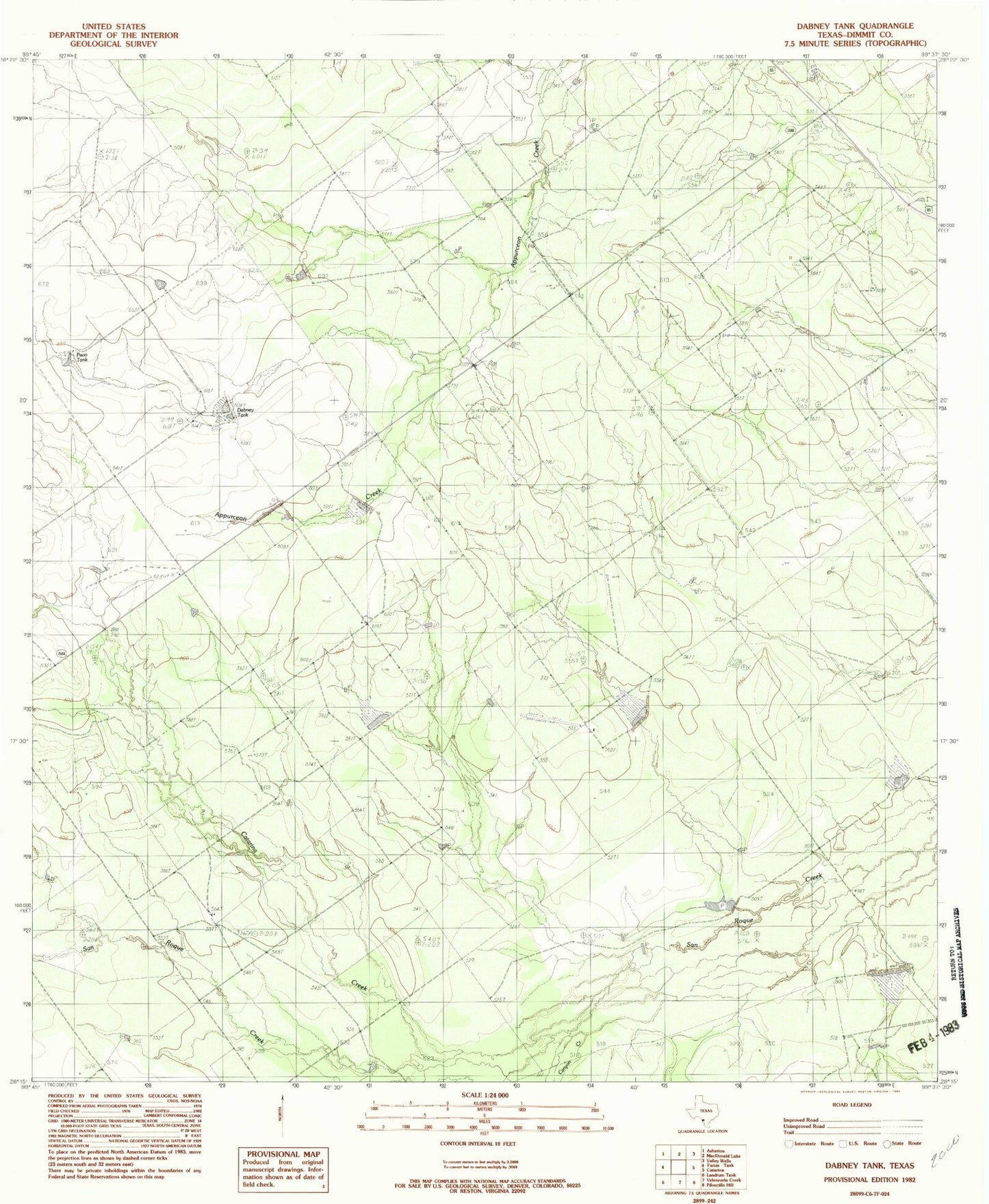
Historical USGS topographic quad map of Dabney Tank in the state of Texas. Map scale may vary for some years, but is generally around 1:24,000. Print size is approximately 24" x 27"
This quadrangle is in the following counties: Dimmit.
The map contains contour lines, roads, rivers, towns, and lakes. Printed on high-quality waterproof paper with UV fade-resistant inks, and shipped rolled.
Contains the following named places: Asherton Division, Beinhorn Lake, Beinhorn Lake Dam, Bonito Creek, Bonito South Branch, Catarina Creek, Catarina Lake, Catarina Lake Dam, GM Ranch, H A Dillon, Jess Lunn, San Ysidro Ranch Airport, Saunders Lake, Saunders Lake Dam, Stumberg Lake, Stumberg Lake Dam, Velenzuela Creek, ZIP Code: 78836