MyTopo
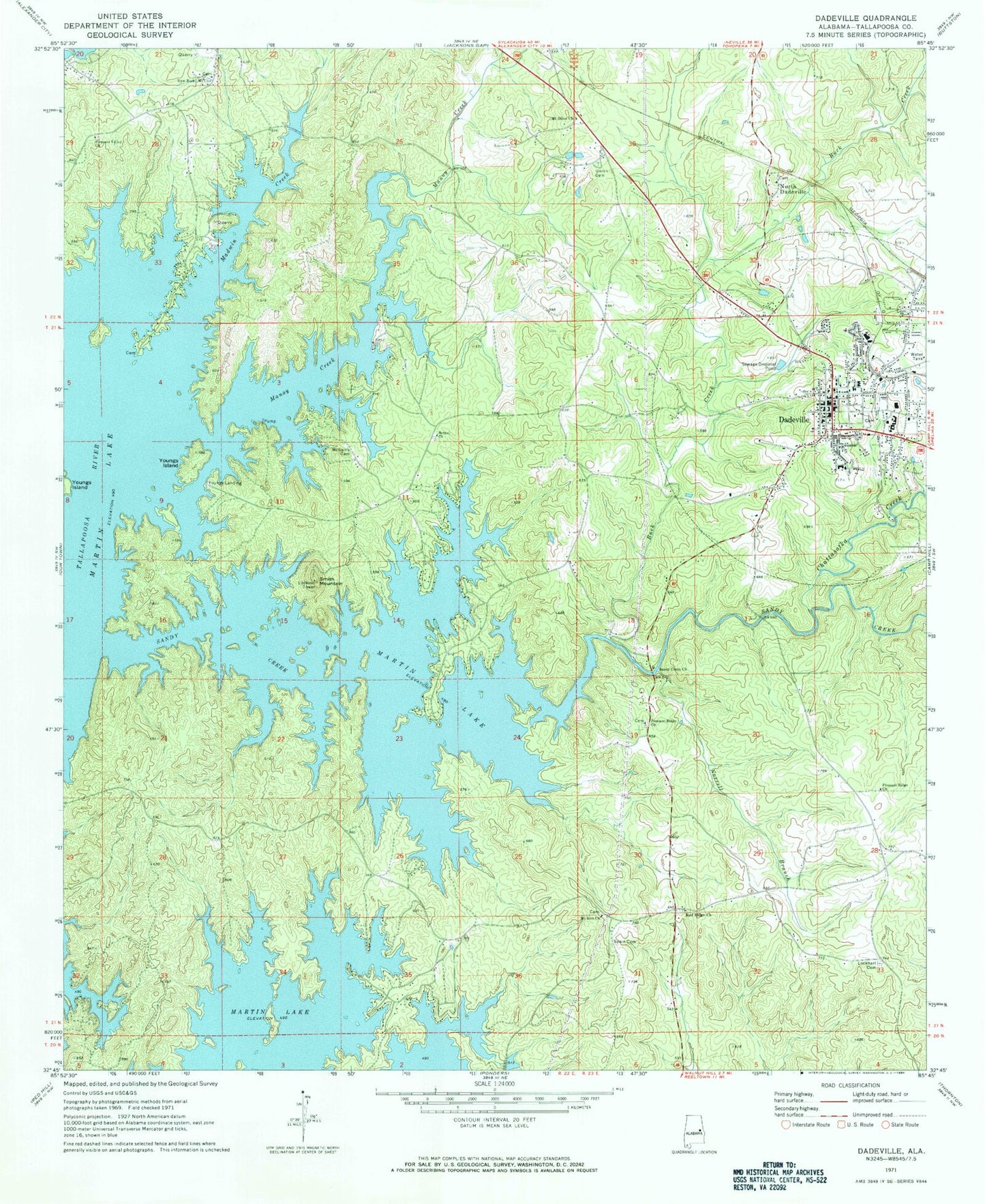
Classic USGS Dadeville Alabama 7.5'x7.5' Topo Map
Couldn't load pickup availability
Historical USGS topographic quad map of Dadeville in the state of Alabama. Map scale may vary for some years, but is generally around 1:24,000. Print size is approximately 24" x 27"
This quadrangle is in the following counties: Tallapoosa.
The map contains contour lines, roads, rivers, towns, and lakes. Printed on high-quality waterproof paper with UV fade-resistant inks, and shipped rolled.
Contains the following named places: Beaver Lake, Bethel Church, Buck Creek, Chattasofka Creek, City of Dadeville, Dadeville, Dadeville Baptist Church, Dadeville Division, Dadeville Elementary School, Dadeville Fire Department, Dadeville Grammar School, Dadeville High School, Dadeville Police Department, Dadeville Post Office, Farrow Dennis Graveyard, First Methodist Church of Dadeville, Greenbriar, Haven Chapel Methodist Church, Lockhart Cemetery, Madwin Creek, Manoy Creek, Mount Olive Baptist Church, Mount Zion Church, New Rocky Mount Baptist Church, Norrell Branch, North Dadeville, Oakfuskee, Old Rocky Mount Cemetery, Ozella, Pace's Point Fire Department, Pace's Point Volunteer Fire and Rescue, Piney Point, Pleasant Ridge Baptist Church, Pleasant Ridge Cemetery, Pleasant Ridge Church, Pleasant Valley Church, Red Ridge Cemetery, Red Ridge United Methodist Church, River Bend, Sandy Creek, Sandy Creek Church, Shady Grove Church, Shepard Graveyard, Smith Mountain, Spain Cemetery, Still Waters Dam, Still Waters Volunteer Fire Station, Stillwaters Volunteer Fire and Rescue Station 2, Tallapoosa County, Tallapoosa County High School, Tallapoosa County Sheriff's Office, Thomas Mine, Union Cemetery, WDLK-AM (Dadeville), Williams Cemetery, Younds Landing, Youngs Ferry, Youngs Island, ZIP Code: 36853