MyTopo
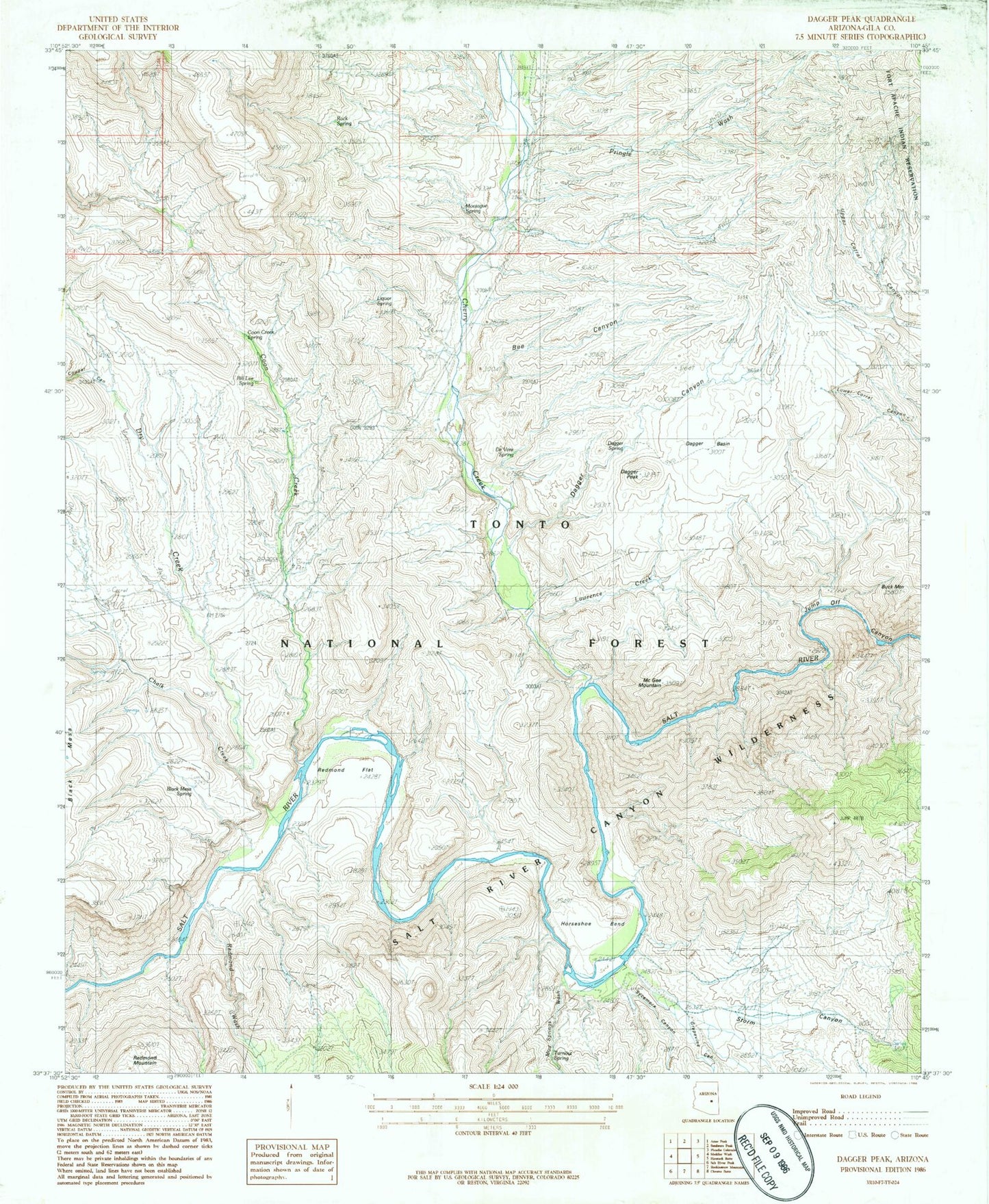
Classic USGS Dagger Peak Arizona 7.5'x7.5' Topo Map
Couldn't load pickup availability
Historical USGS topographic quad map of Dagger Peak in the state of Arizona. Map scale may vary for some years, but is generally around 1:24,000. Print size is approximately 24" x 27"
This quadrangle is in the following counties: Gila.
The map contains contour lines, roads, rivers, towns, and lakes. Printed on high-quality waterproof paper with UV fade-resistant inks, and shipped rolled.
Contains the following named places: Bee Canyon, Bill Lee Spring, Black Mesa Spring, Buck Mountain, Burnt Canyon Tank, Chalk Creek, Cherry Creek, Cliff Hanger Rapid, Coon Creek, Coon Creek Spring, Corkscrew Rapid, Cougar Canyon, Dagger, Dagger Basin, Dagger Canyon, Dagger Peak, Dagger Ranch, Dagger Spring, DeVore Spring, Dry Creek, Dry Creek Well, Grapevine Canyon, Horseshoe Bend, Jump-Off Canyon, Lawrence Creek, Liquor Spring, McGee Mountain, Montague Spring, Montague Well, Mud Springs Wash, Natural Well, Pringle Wash, Pringle Well, Quartzite Rapid, Redmond Flat, Redmond Wash, Rock Spring, Salt River Canyon Wilderness, Storm Canyon, Storm Canyon Well, Sycamore Canyon, The Sleeper Rapid, Turnout Spring, Winter Pasture Tank