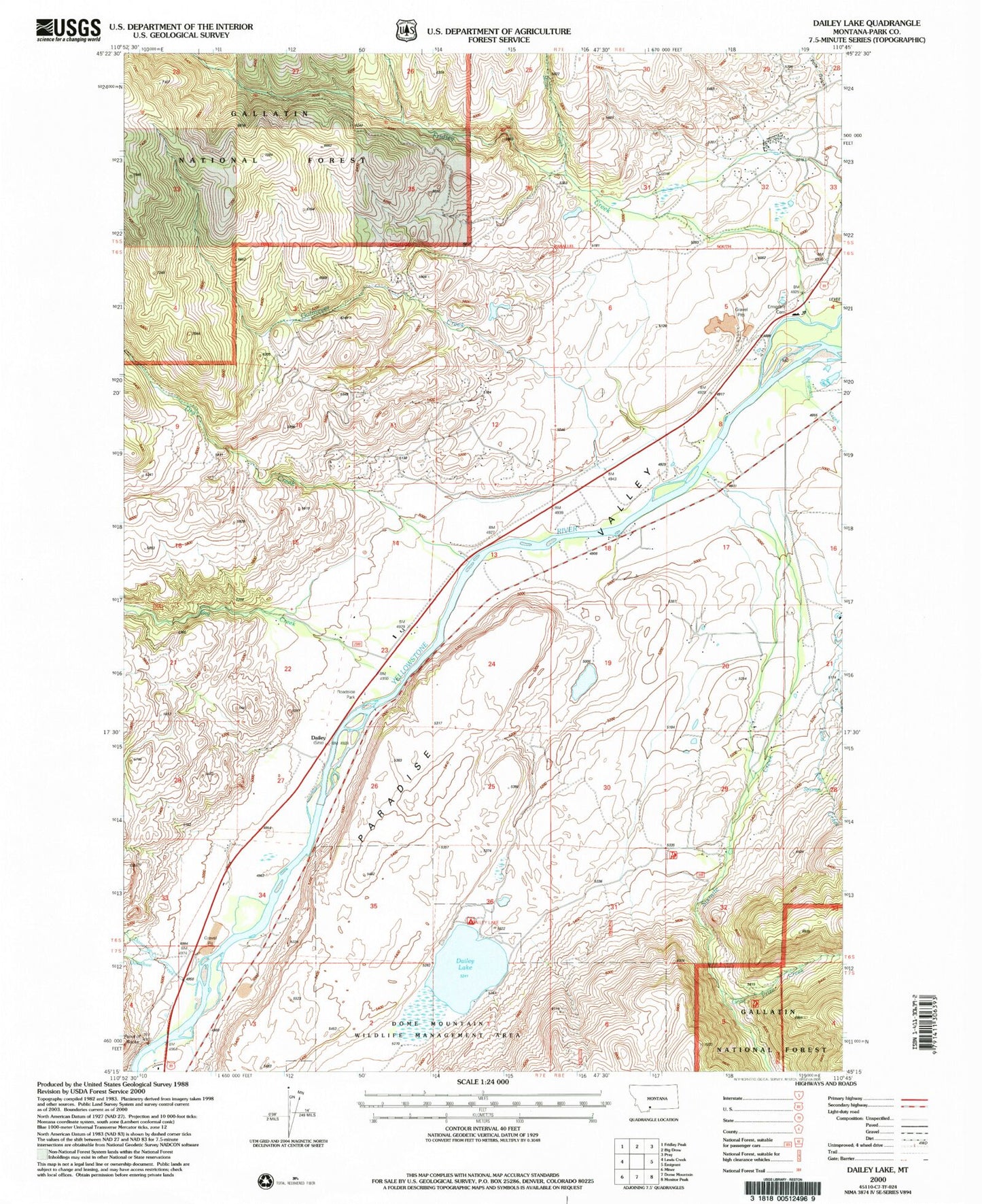
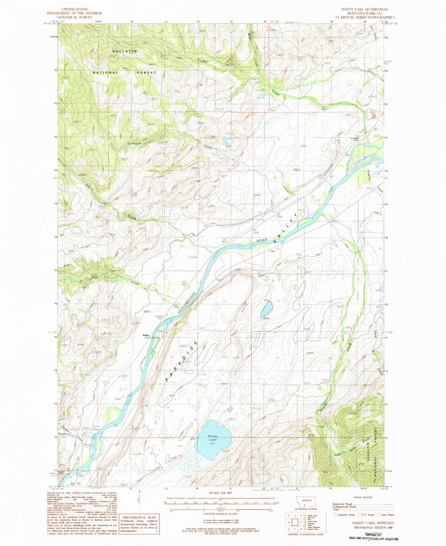
MyTopo
Classic USGS Dailey Lake Montana 7.5'x7.5' Topo Map
Couldn't load pickup availability
Historical USGS topographic quad map of Dailey Lake in the state of Montana. Map scale may vary for some years, but is generally around 1:24,000. Print size is approximately 24" x 27"
This quadrangle is in the following counties: Park.
The map contains contour lines, roads, rivers, towns, and lakes. Printed on high-quality waterproof paper with UV fade-resistant inks, and shipped rolled.
Contains the following named places: Absaroka-Beartooth Wilderness Historical Marker, Big Creek, Big Creek School, Bottlers Ranch, Dailey, Dailey Lake, Dailey Lake Campground, Dailey Lake Dam, Dailey Lake Fishing Access Site, Dailey School, Donahue Creek, Dry Creek, Emigrant Cemetery, Emigrant Creek, Emigrant Creek Bridge, Emigrant Gulch Historical Marker, Emigrant Post Office, Emigrant Rest Area, Fridley Creek, Glastonbury, Gold Prize Creek, Gold Run Creek, Goldmeyer Creek, Little Donahue Creek, Merriman, Miller Creek, Mountain View School, North Glastonbury, Point of Rocks, Point of Rocks Fishing Access Site, Pole Gulch, Sixmile Creek, South Glastonbury, South Glastonbury Census Designated Place, Tulley and Lowrys Spur, Yastremski Dam