MyTopo
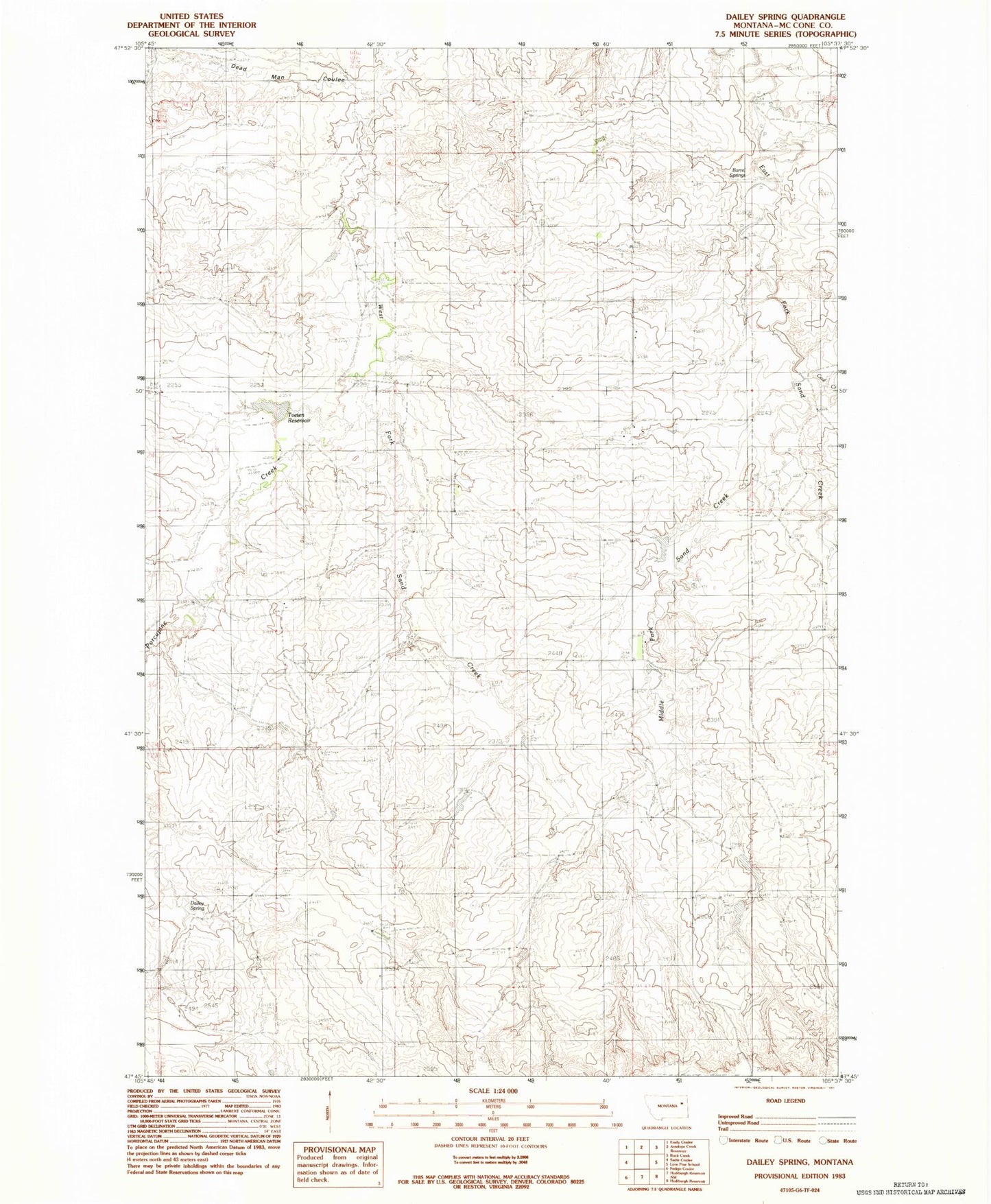
Classic USGS Dailey Spring Montana 7.5'x7.5' Topo Map
Couldn't load pickup availability
Historical USGS topographic quad map of Dailey Spring in the state of Montana. Map scale may vary for some years, but is generally around 1:24,000. Print size is approximately 24" x 27"
This quadrangle is in the following counties: McCone.
The map contains contour lines, roads, rivers, towns, and lakes. Printed on high-quality waterproof paper with UV fade-resistant inks, and shipped rolled.
Contains the following named places: 24N47E18CB__01 Well, 24N47E35BBBA01 Well, 24N47E35BBBC01 Well, Barrel Springs, Coal Creek, Dailey Spring, Dead Man Coulee, F Whitmus Number 2 Dam, Fiske Dam, Kellogg Post Office, Middle Fork Sand Creek, Porcupine Creek, Sand Creek, Sand Creek Post Office, Tveten Reservoir, Whitmus Stock Reservoir Dam