
MyTopo
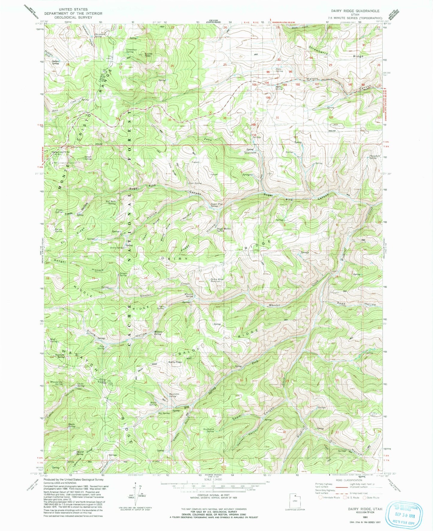
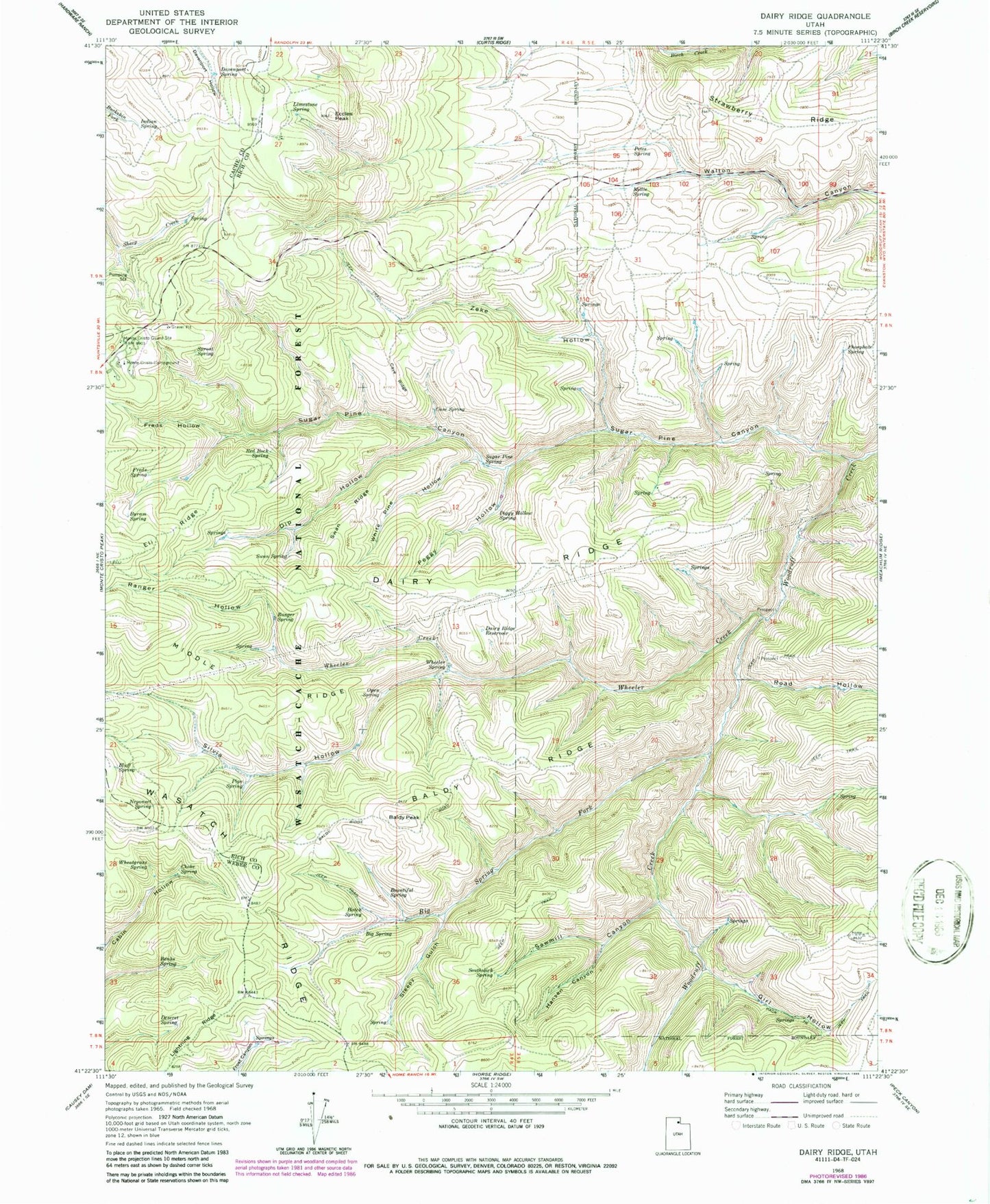
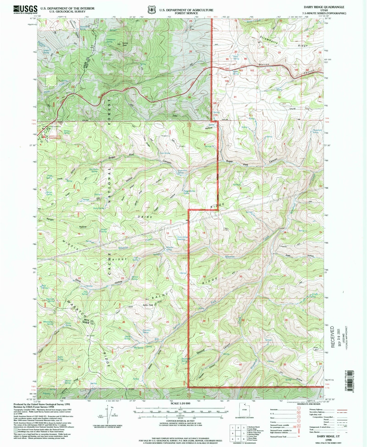
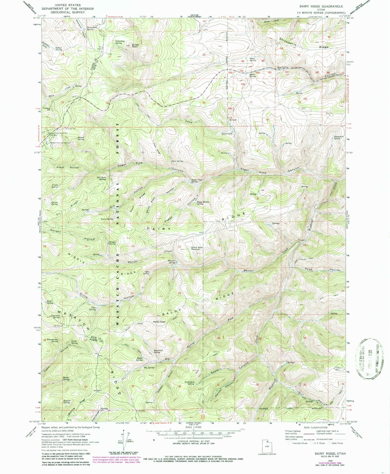
Classic USGS Dairy Ridge Utah 7.5'x7.5' Topo Map
Couldn't load pickup availability
Historical USGS topographic quad map of Dairy Ridge in the state of Utah. Map scale may vary for some years, but is generally around 1:24,000. Print size is approximately 24" x 27"
This quadrangle is in the following counties: Cache, Rich, Weber.
The map contains contour lines, roads, rivers, towns, and lakes. Printed on high-quality waterproof paper with UV fade-resistant inks, and shipped rolled.
Contains the following named places: Baldy Peak, Baldy Ridge, Banks Spring, Big Spring, Big Spring Fork, Bluff Spring, Bountiful Spring, Byram Spring, Cave Ridge, Cave Spring, Choke Spring, Dairy Ridge, Dairy Ridge Reservoir, Davenport Spring, Deseret Spring, Desert Spring, Dip Hollow, Eccles Peak, Eli Ridge, Freds Hollow, Freds Spring, Front Hollow Spring, Girl Hollow, Hansen Canyon, Hatch Spring, Indian Spring, Lightning Ridge, Limestone Spring, Millie Spring, Monte Cristo Campground, Monte Cristo Guard Station, Neponset Spring, Open Spring, Peggy Hollow, Peggy Hollow Spring, Petes Spring, Phosphate Spring, Pipe Spring, Ranger Hollow, Ranger Spring, Red Rock Spring, Road Hollow, Sawmill Canyon, Silvia Hollow, Sleepy Gulch, Southwick Spring, Sprout Spring, Strawberry Ridge, Sugar Pine Canyon, Sugar Pine Spring, Swan Ridge, Swan Spring, Wheatgrass Spring, Wheeler Creek, Wheeler Spring, White Pine Hollow, William Spring, Zeke Hollow, Zeke Hollow Corral