MyTopo
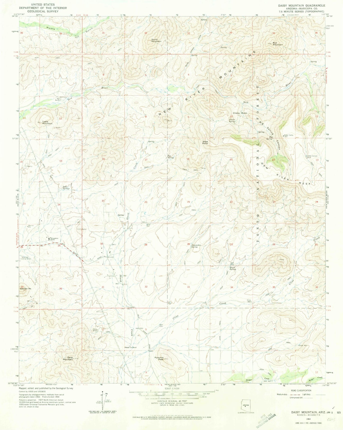
Classic USGS Daisy Mountain Arizona 7.5'x7.5' Topo Map
Couldn't load pickup availability
Historical USGS topographic quad map of Daisy Mountain in the state of Arizona. Typical map scale is 1:24,000, but may vary for certain years, if available. Print size: 24" x 27"
This quadrangle is in the following counties: Maricopa.
The map contains contour lines, roads, rivers, towns, and lakes. Printed on high-quality waterproof paper with UV fade-resistant inks, and shipped rolled.
Contains the following named places: Cline Creek, Big Spring, Big Spring Canyon, Cholla Basin, Cholla Spring, Cline Well, Daisy Mine, Daisy Mountain, East Fork North Canyon Creek, Fig Spring, Gavilan Peak, Hells Canyon Tank, King Well, Moore Well, North Canyon Creek, North Mountain, Odell Well, Pyramid Peak, Quail Spring, Red Mountain, Shangri La Ranch, Shoemaker Spring, Soda Springs, Table Mountain, Tee Ranch, Thirtytwo Well, Upper Well, West Point, Wranglers Roost, Sharman Landing Strip (historical), New River Census Designated Place, Catholic Community of the Good Shepherd, New River Bible Chapel, New River First Assembly of God Church, The Church of Jesus Christ of Latter Day Saints, Daisy Mountain Fire Department Station 141