MyTopo
Classic USGS Dalbo Minnesota 7.5'x7.5' Topo Map
Couldn't load pickup availability
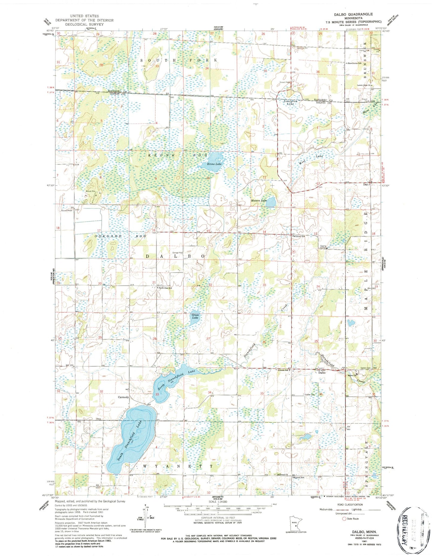
Historical USGS topographic quad map of Dalbo in the state of Minnesota. Map scale may vary for some years, but is generally around 1:24,000. Print size is approximately 24" x 27"
This quadrangle is in the following counties: Isanti, Kanabec.
The map contains contour lines, roads, rivers, towns, and lakes. Printed on high-quality waterproof paper with UV fade-resistant inks, and shipped rolled.
Contains the following named places: Carmody, Carmody Post Office, Dalbo, Dalbo Baptist Church, Dalbo Fire Department, Dalbo Memorial Park, Dalbo Post Office, Dalbo Wildlife Management Area, Day, Day Post Office, Dobe Wildlife Management Area, Grass Lake, Hawthorne School, Karmel Church, Karmel Covenant Cemetery, Karmel School, Krone Bog, Krone Lake, Lewis Lake Church, Lincoln School, Lindgren Lake, Matson Lake, Moss Lake, North Stanchfield Lake, North Star School, Odegard Bog, PFAU Airstrip, Salem Church, Salem Lutheran Cemetery, South Stanchfield Lake, South Stanchfield Lake Dam, Stanchfield Lake, Township of Dalbo, West Lake, Whittier School, ZIP Code: 55017