MyTopo
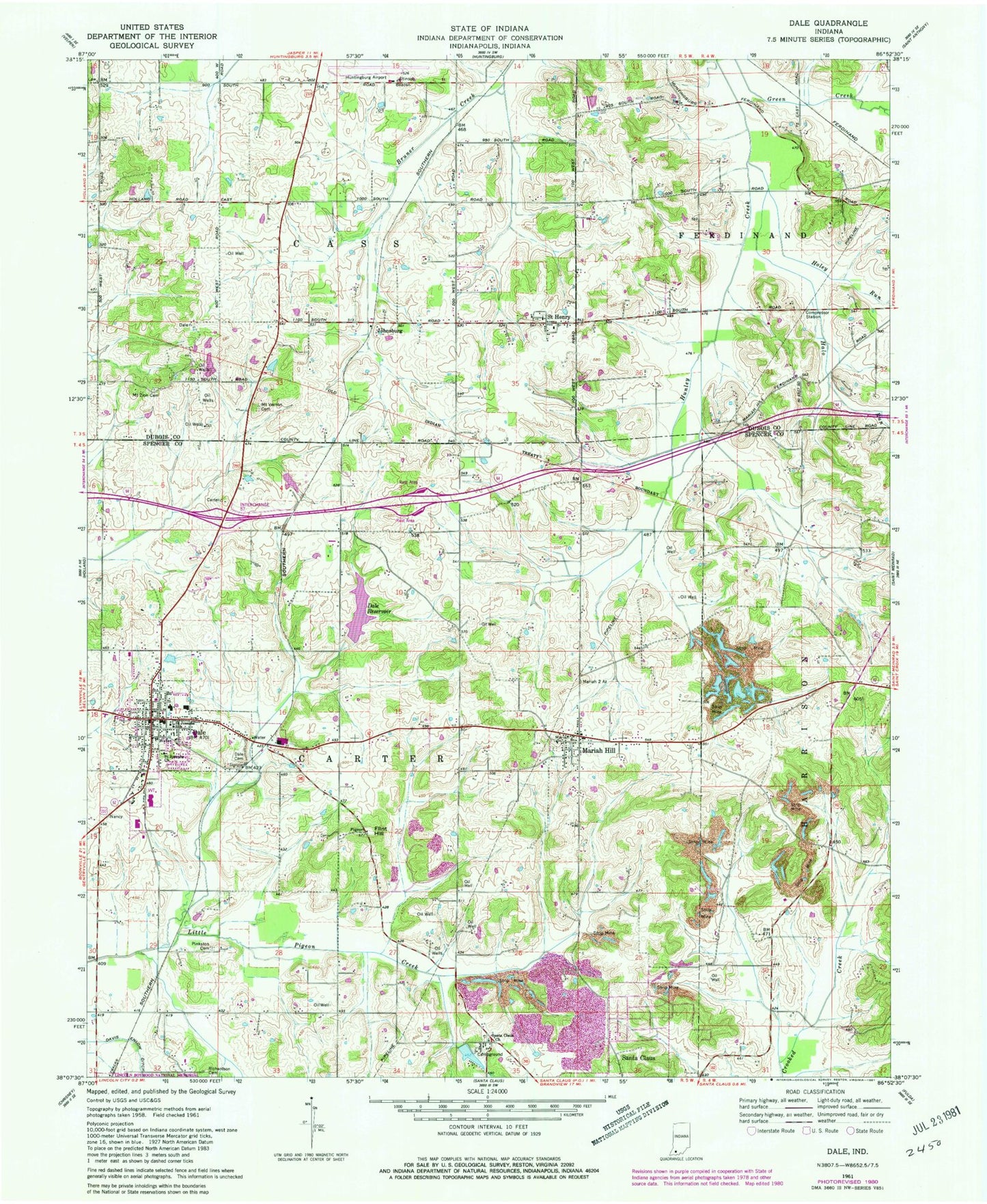
Classic USGS Dale Indiana 7.5'x7.5' Topo Map
Couldn't load pickup availability
Historical USGS topographic quad map of Dale in the state of Indiana. Map scale may vary for some years, but is generally around 1:24,000. Print size is approximately 24" x 27"
This quadrangle is in the following counties: Dubois, Spencer.
The map contains contour lines, roads, rivers, towns, and lakes. Printed on high-quality waterproof paper with UV fade-resistant inks, and shipped rolled.
Contains the following named places: Carter Fire District, Cross Drain, Dale, Dale Cemetery, Dale Post Office, Dale Reservoir, Dale Town Marshal, David Turnham Educational Center, Flint Hill, Halo Run, Holey Run, Huntingburg Airport, Johnsburg, Mariah Hill, Mariah Hill Post Office, Mary Help of Christians Church Cemetery, Mount Vernon Cemetery, Mount Zion Cemetery, Pinkston Cemetery, Richardson Cemetery, Saint Henry, Saint Henry Volunteer Fire Department, Saint Joseph School, Saint Josephs Church, Santa Claus Church, Santa Claus Lake, Spencer County Emergency Ambulance Services, Town of Dale, Township of Carter