MyTopo
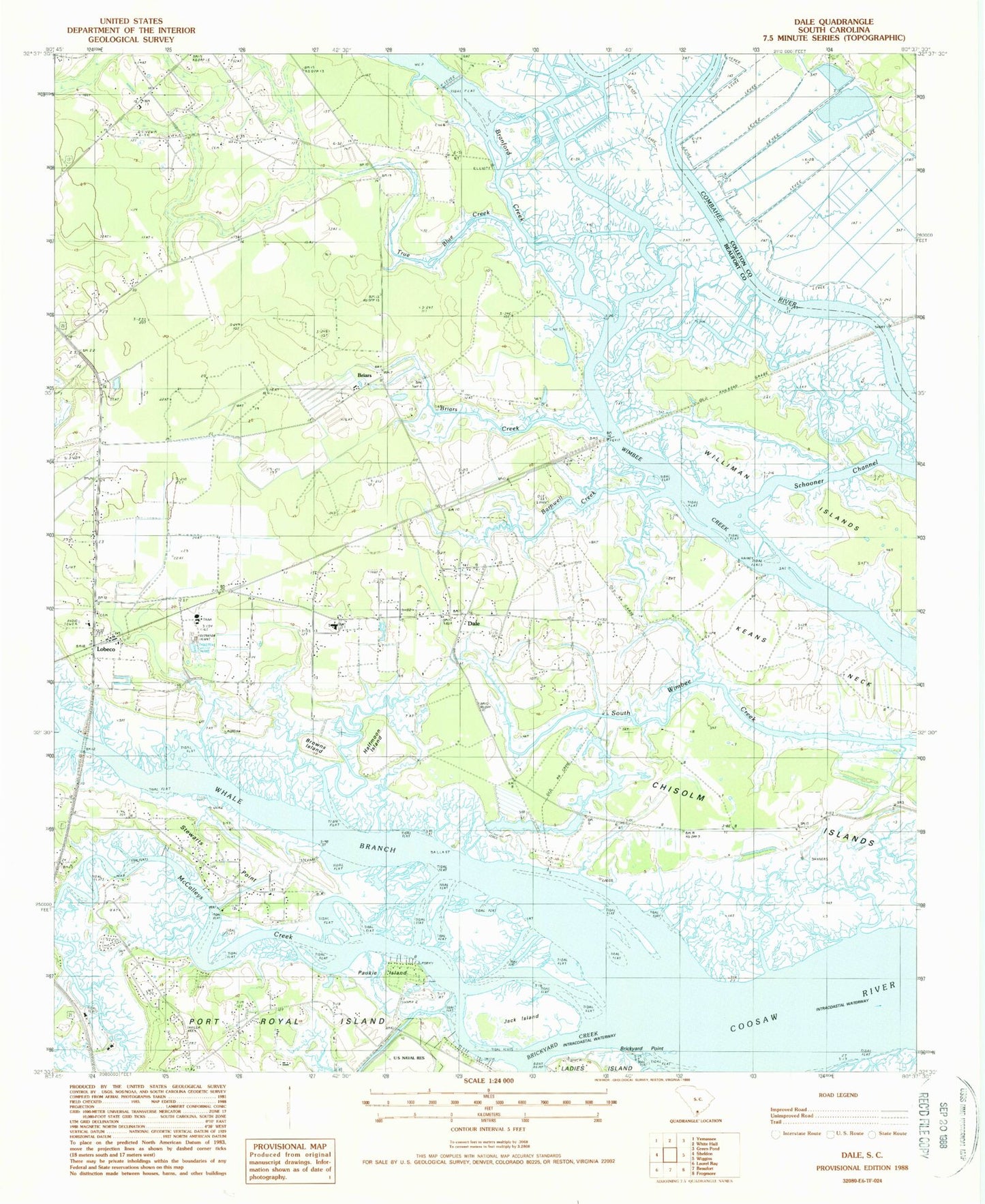
Classic USGS Dale South Carolina 7.5'x7.5' Topo Map
Couldn't load pickup availability
Historical USGS topographic quad map of Dale in the state of South Carolina. Typical map scale is 1:24,000, but may vary for certain years, if available. Print size: 24" x 27"
This quadrangle is in the following counties: Beaufort, Colleton.
The map contains contour lines, roads, rivers, towns, and lakes. Printed on high-quality waterproof paper with UV fade-resistant inks, and shipped rolled.
Contains the following named places: Barnwell Creek, Briars, Briars Creek, Brickyard Point, Browns Island, Halfmoon Island, Jerusalem Church, Keans Neck, Schooner Channel, True Blue Creek, Paukie Island, Branford Creek, Ballast Island, Briars Church, Briars School (historical), Chisolms, Clay Hall Plantation, Coosaw Plantation, James J Davis Elementary School, Dale Station (historical), Gaza (historical), Gethsemane Church, Gethsemane Church (historical), Keans Neck School (historical), Lebeco Methodist Episcopal Church South, Oak Point Landing, Port Royal Ferry (historical), School for Exceptional Children, South Carolina Noname 07003 D-2931 Dam, Jack Island, Lobeco, McCalleys Creek, Dale, Porky Island, Stewarts Point, Williman Islands, Sheldon Division, Sheldon Fire Department Station 41, Whale Branch Middle School, Whale Branch Elementary School, Lobeco Post Office, Lobeco Census Designated Place, Dale Census Designated Place