MyTopo
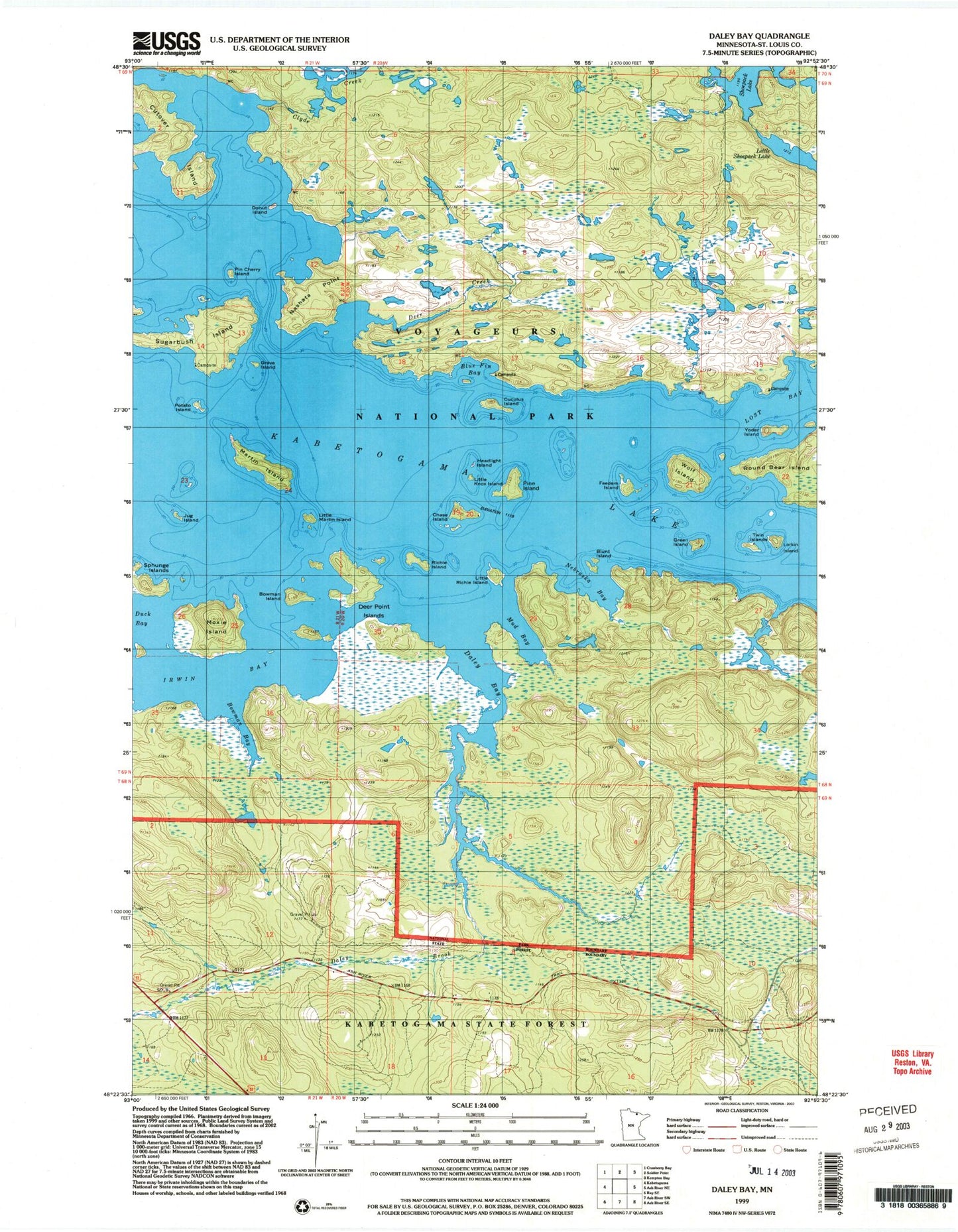
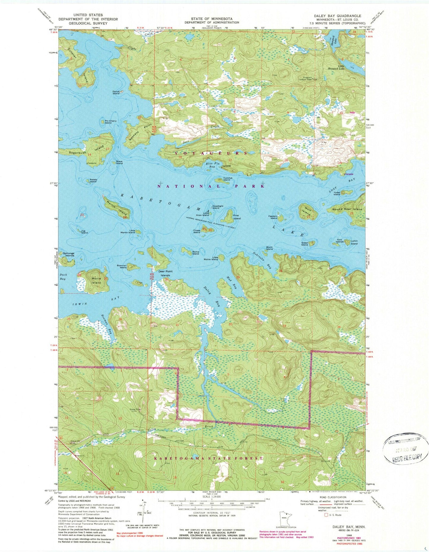
Classic USGS Daley Bay Minnesota 7.5'x7.5' Topo Map
Couldn't load pickup availability
Historical USGS topographic quad map of Daley Bay in the state of Minnesota. Map scale may vary for some years, but is generally around 1:24,000. Print size is approximately 24" x 27"
This quadrangle is in the following counties: St. Louis.
The map contains contour lines, roads, rivers, towns, and lakes. Printed on high-quality waterproof paper with UV fade-resistant inks, and shipped rolled.
Contains the following named places: Ash River Trail, Blue Fin Bay, Blunt Island, Bowman Bay, Bowman Island, Capie Rock, Chase Island, Clyde Creek, Cuculus Island, Cutover Island, Daley Bay, Daley Brook, Deer Creek, Deer Point Islands, Donut Island, Freedom Island, Grave Island, Green Island, Headlight Island, Irwin Bay, Jug Island, Larkin Island, Little Knox Island, Little Martin Island, Little Richie Island, Little Shoepack Lake, Martin Island, Moxie Island, Mud Bay, Nashata Point, Nebraska Bay, Pin Cherry Island, Pine Island, Potato Island, Richie Island, Shoepack Lookout Tower, Slatinski Bay, Sugarbush Island, Twin Islands, Wolf Island, Yoder Island