MyTopo
Classic USGS Dalton Arkansas 7.5'x7.5' Topo Map
Couldn't load pickup availability
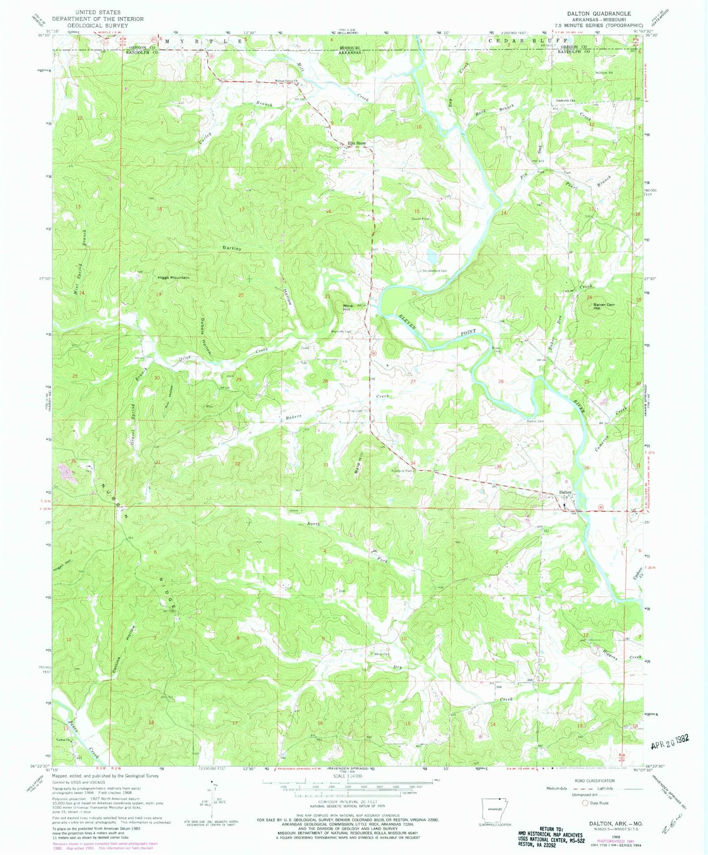
Historical USGS topographic quad map of Dalton in the state of Arkansas. Map scale may vary for some years, but is generally around 1:24,000. Print size is approximately 24" x 27"
This quadrangle is in the following counties: Oregon, Randolph, Ripley.
The map contains contour lines, roads, rivers, towns, and lakes. Printed on high-quality waterproof paper with UV fade-resistant inks, and shipped rolled.
Contains the following named places: Baker Den, Baker Den Church of Christ, Baker Den Creek, Baker Den Hill, Baker Den School, Bakers Creek, Bald Hill, Bartley Hollow, Bay Creek, Brushy Branch, Bryan Cemetery, Cameron Creek, Collins Hollow, Curley Branch, Dalton, Dalton Cemetery, Dalton Church of Christ, Dalton School, Dalton Volunteer Fire Department, Diles Creek, Dubois Hollow, Eaton Cemetery, Elm Store, Gladeville Church, Havy Branch, Higgs Mountain, King Cemetery, Mill Creek, Mine Hill, Mint Spring Branch, Mosely Cemetery, North Fork Dry Creek, Nubbin Ridge, Oconee, Pearl Branch, Pin Oak Creek, Reynolds Cemetery, Stubblefield Cemetery, Township of Baker, Township of Dalton, Township of Davidson, Township of Elm Store, Upshaw Creek, Walnut Grove Cemetery, Walnut Grove Church, White Cemetery, Yadkin Cemetery, Yadkin Church