MyTopo
Classic USGS Dalzell Ohio 7.5'x7.5' Topo Map
Couldn't load pickup availability
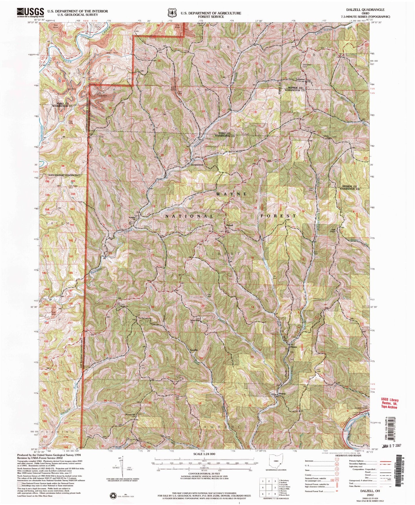
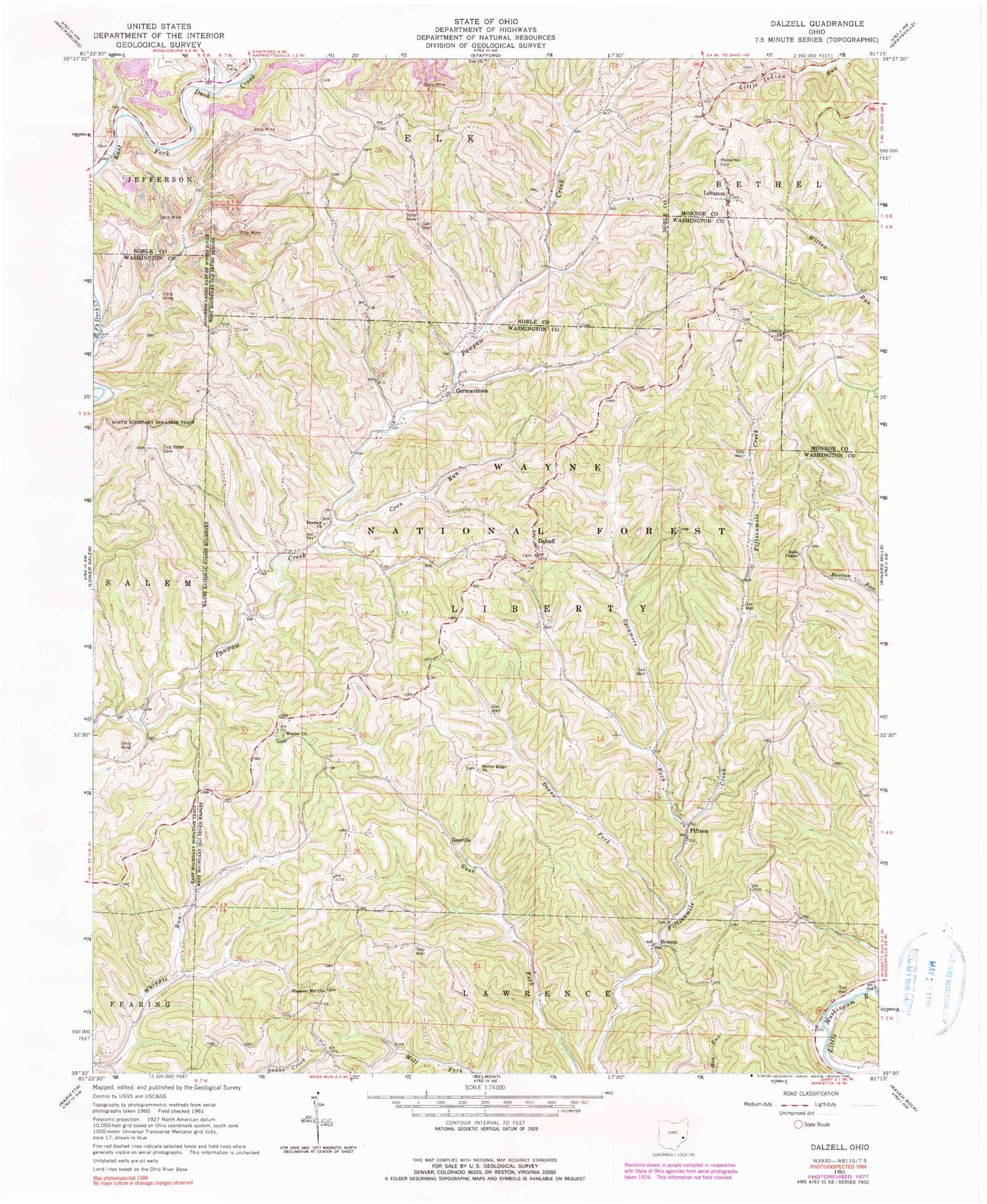
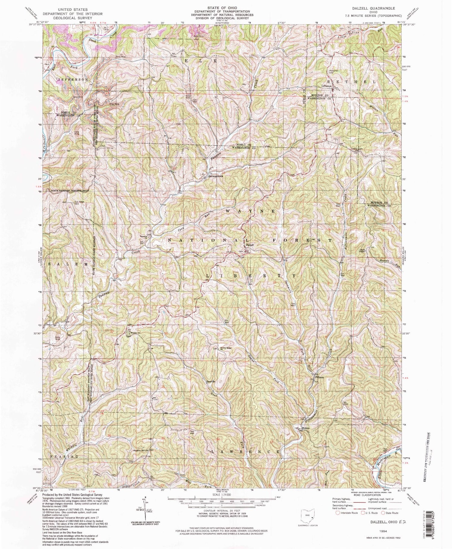
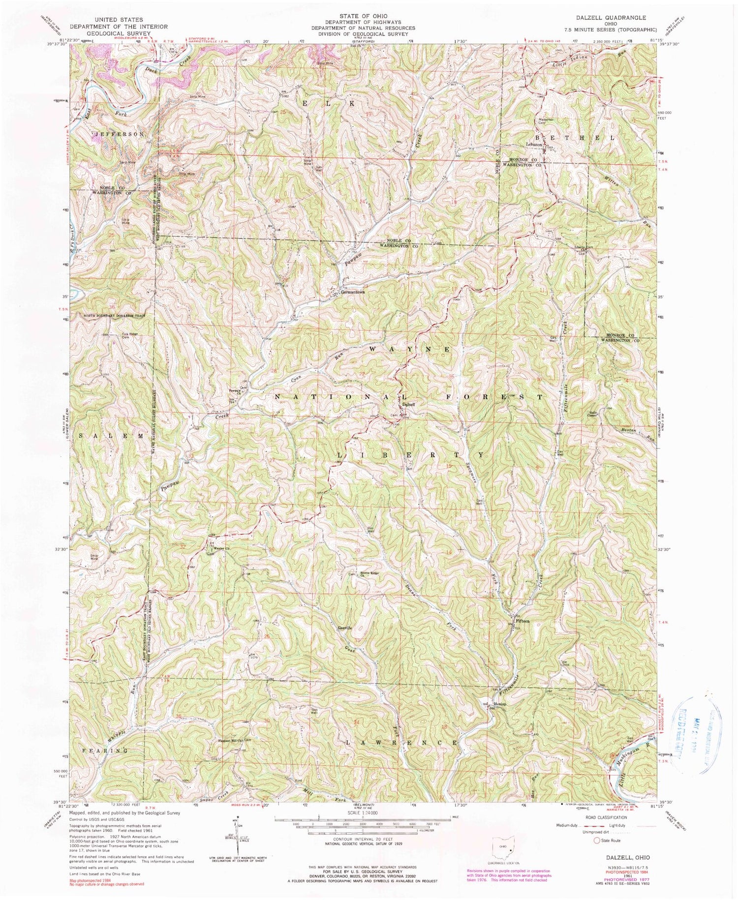
Historical USGS topographic quad map of Dalzell in the state of Ohio. Typical map scale is 1:24,000, but may vary for certain years, if available. Print size: 24" x 27"
This quadrangle is in the following counties: Monroe, Noble, Washington.
The map contains contour lines, roads, rivers, towns, and lakes. Printed on high-quality waterproof paper with UV fade-resistant inks, and shipped rolled.
Contains the following named places: Hune Bridge, Coon Run, Dalzell, Deans Fork, Fifteen, Gasville, Germantown, Halls Chapel, Heslop, Lebanon, Liberty Church, Masterton Cemetery, Middle Fork Duck Creek, PawPaw Church, Pleasant Hill Church, Scotts Ridge Church, Sycamore Fork, Tick Ridge Cemetery, Waxler Church, Zion Church, Rowland Landing, Hune Bridge Canoe Access Area, Hune Covered Bridge, Township of Liberty, Liberty Cemetery, Dalzell Cemetery, Paw Paw Church Cemetery, Pleasant Hill Cemetery, Scotts Ridge Cemetery, Waxler Church Cemetery, Liberty Township Christian Cemetery, Hune Bridge, Coon Run, Dalzell, Deans Fork, Fifteen, Gasville, Germantown, Halls Chapel, Heslop, Lebanon, Liberty Church, Masterton Cemetery, Middle Fork Duck Creek, PawPaw Church, Pleasant Hill Church, Scotts Ridge Church, Sycamore Fork, Tick Ridge Cemetery, Waxler Church, Zion Church, Rowland Landing, Hune Bridge Canoe Access Area, Hune Covered Bridge, Township of Liberty, Liberty Cemetery, Dalzell Cemetery, Paw Paw Church Cemetery, Pleasant Hill Cemetery, Scotts Ridge Cemetery, Waxler Church Cemetery, Liberty Township Christian Cemetery