MyTopo
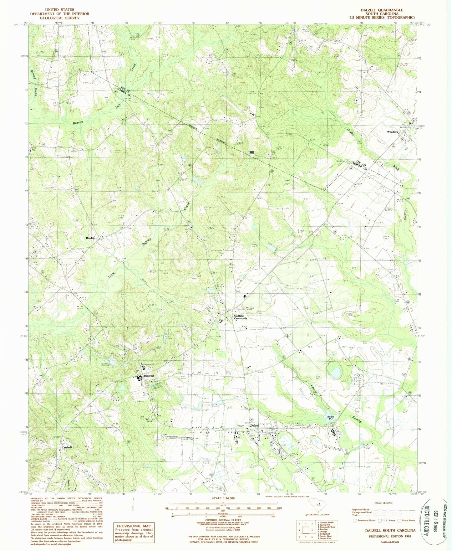
Classic USGS Dalzell South Carolina 7.5'x7.5' Topo Map
Couldn't load pickup availability
Historical USGS topographic quad map of Dalzell in the state of South Carolina. Map scale may vary for some years, but is generally around 1:24,000. Print size is approximately 24" x 27"
This quadrangle is in the following counties: Lee, Sumter.
The map contains contour lines, roads, rivers, towns, and lakes. Printed on high-quality waterproof paper with UV fade-resistant inks, and shipped rolled.
Contains the following named places: Ardis Pond, Ardis Pond Dam D-1979, Barnett Pond, Barnett Pond Dam D-1976, Borden, Borden School, Bracey Mill Creek, Burrows Crossroads, Catchall, Dalzell, Dalzell Census Designated Place, Dalzell Post Office, Dalzell School, Ebenezer School, Elizabeth Cemetery, Elizabeth Church, Evenezer Church, Gaillard Crossroads, Grant Hill Church, Hillcrest, Hillcrest School, Hopewell Church, Horeb Church, Lake View Pond, Lake View Pond Dam D-1977, Mount Carmel Cemetery, Mount Joshua Church, Mount Joshua School, Mount Olive Church, Nebo School, New Hope Church, Norsworthy Pond, Norsworthy Pond Dam D-1975, Pecan Acres, Providence Church, Providence School, Rembert Memorial School, Rock Shed School, Ross Pond, Ross Pond Dam D-1978, Saint James Church, Saint James School, Saint Phillips Church, Sumter County Rural Fire Department Dalzell, Sumter North Division, Thomas Sumter Academy, Tirzah Presbyterian Church, Woodrow, ZIP Code: 29040