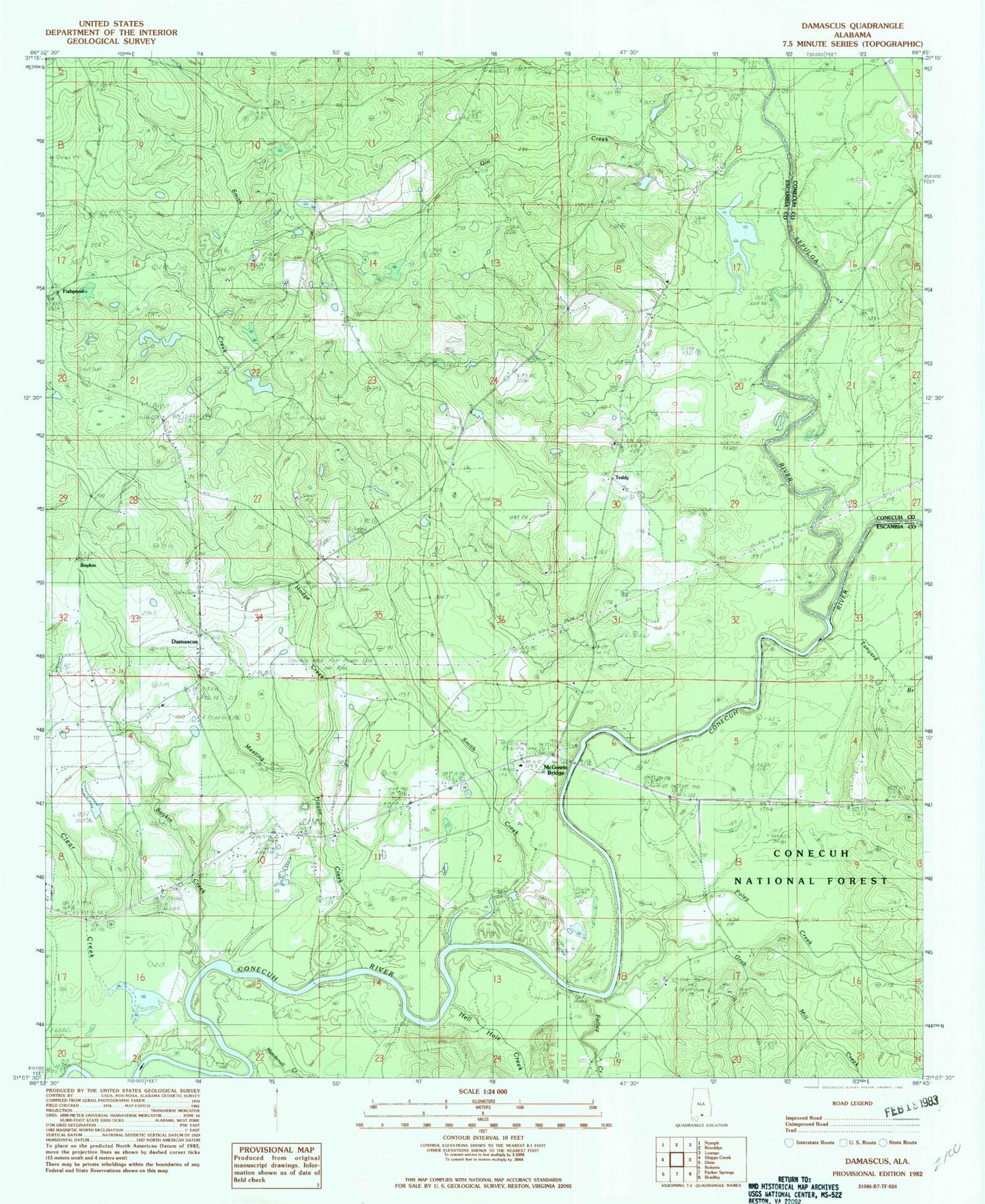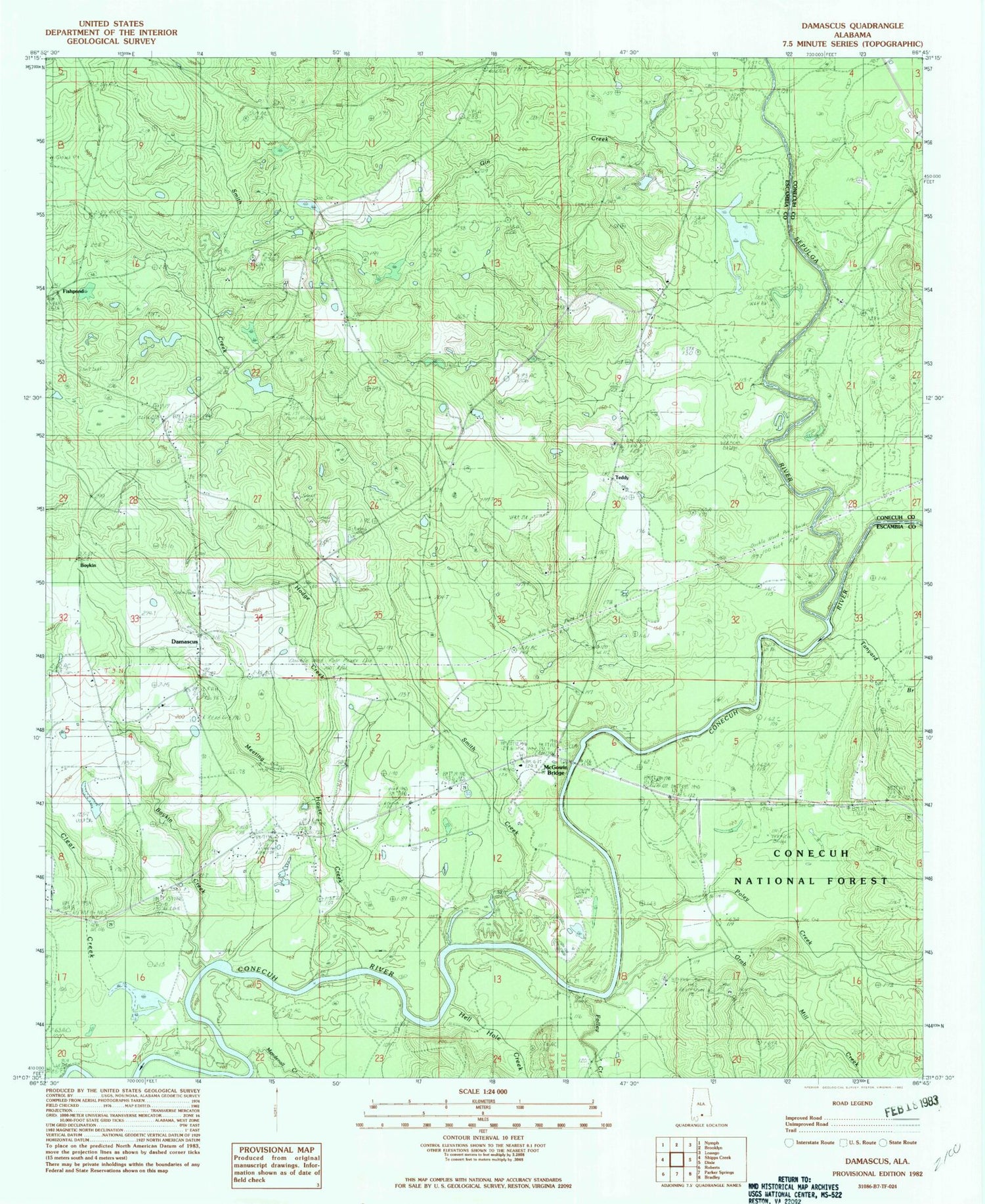
MyTopo
Classic USGS Damascus Alabama 7.5'x7.5' Topo Map
Couldn't load pickup availability
Historical USGS topographic quad map of Damascus in the state of Alabama. Map scale may vary for some years, but is generally around 1:24,000. Print size is approximately 24" x 27"
This quadrangle is in the following counties: Conecuh, Escambia.
The map contains contour lines, roads, rivers, towns, and lakes. Printed on high-quality waterproof paper with UV fade-resistant inks, and shipped rolled.
Contains the following named places: Boykin, Boykin - Damascus Volunteer Fire Department, Boykin Creek, Bush Still, Clear Creek, Cooks Dam, Cooks Lake, Damascus, Damascus Cemetery, Damascus Church, Damascus School, Douglas Chapel United Methodist Church, First Marietta Church, Fishpond, Folley Creek, Foshee Cemetery, Gin Creek, Grab Mill Creek, Hell Hole Creek, Hodge Creek, Hoomesville Church Cemetery, Hoomesville Church of Christ, Marietta, Mason School, McGowan Bridge, McGowin Bridge, McGowin Cemetery, McGowin Ferry Cemetery, Meeting House Creek, Mendenhall Creek, Poley Creek, Saint James Church, Second Bethlehem Baptist Church, Sepulga River, Smith Creek, Tanyard Branch, Teddy