MyTopo
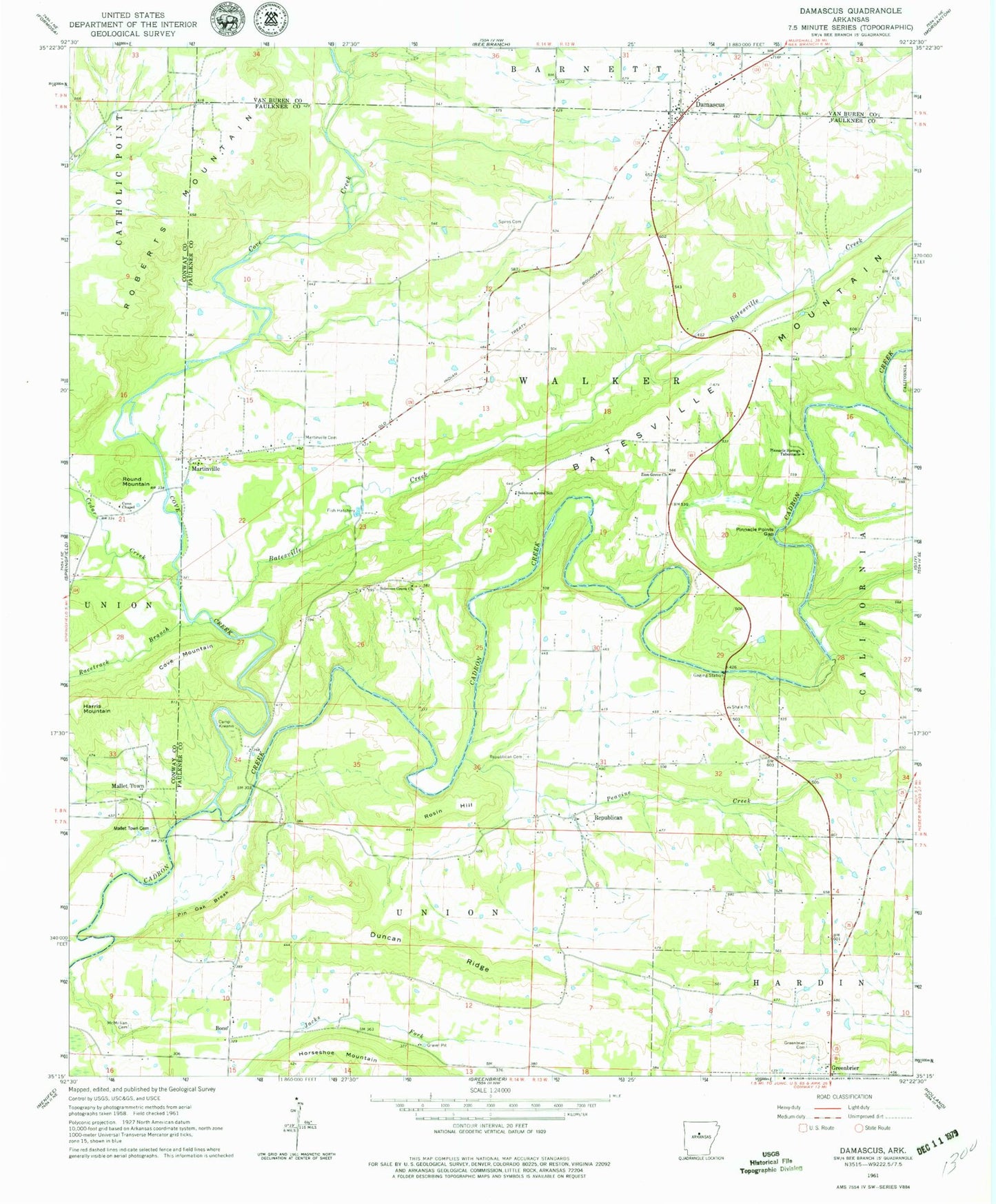
Classic USGS Damascus Arkansas 7.5'x7.5' Topo Map
Couldn't load pickup availability
Historical USGS topographic quad map of Damascus in the state of Arkansas. Typical map scale is 1:24,000, but may vary for certain years, if available. Print size: 24" x 27"
This quadrangle is in the following counties: Conway, Faulkner, Van Buren.
The map contains contour lines, roads, rivers, towns, and lakes. Printed on high-quality waterproof paper with UV fade-resistant inks, and shipped rolled.
Contains the following named places: Batesville Creek, Camp Kiwanis, Cedar Creek, Cove Chapel, Cove Creek, Duncan Ridge, Martinville Cemetery, McMillian Cemetery, Pin Oak Break, Pinnacle Point Gap, Pinnacle Spring Tabernacle, Racetrack Branch, Republican Cemetery, Solomon Grove School, Spires Cemetery, Bono, Cove Mountain, Harris Mountain, Rosin Hill, Round Mountain, Batesville Church (historical), Bono Baptist Church, Chinquapin School (historical), Fishtrap Bridge, Hatcher Branch, Long Point, Mallet Ford, Quinn Ford, Shilling Branch, Township of Union, Township of Walker, Damascus Grade School (historical), Bono School (historical), Republican School (historical), Damascus, Mallet Town, Mallet Town Cemetery, Martinville, Peavine Creek, Republican, Solomon Grove Baptist Church, Zion Grove Baptist Church, Thorn Cemetery, Pinnacle Springs (historical), Damascus Post Office, Twin Groves, Damascus Volunteer Fire Department, Twin Groves Fire Station, Damascus Police Department, Town of Damascus, Town of Twin Groves