MyTopo
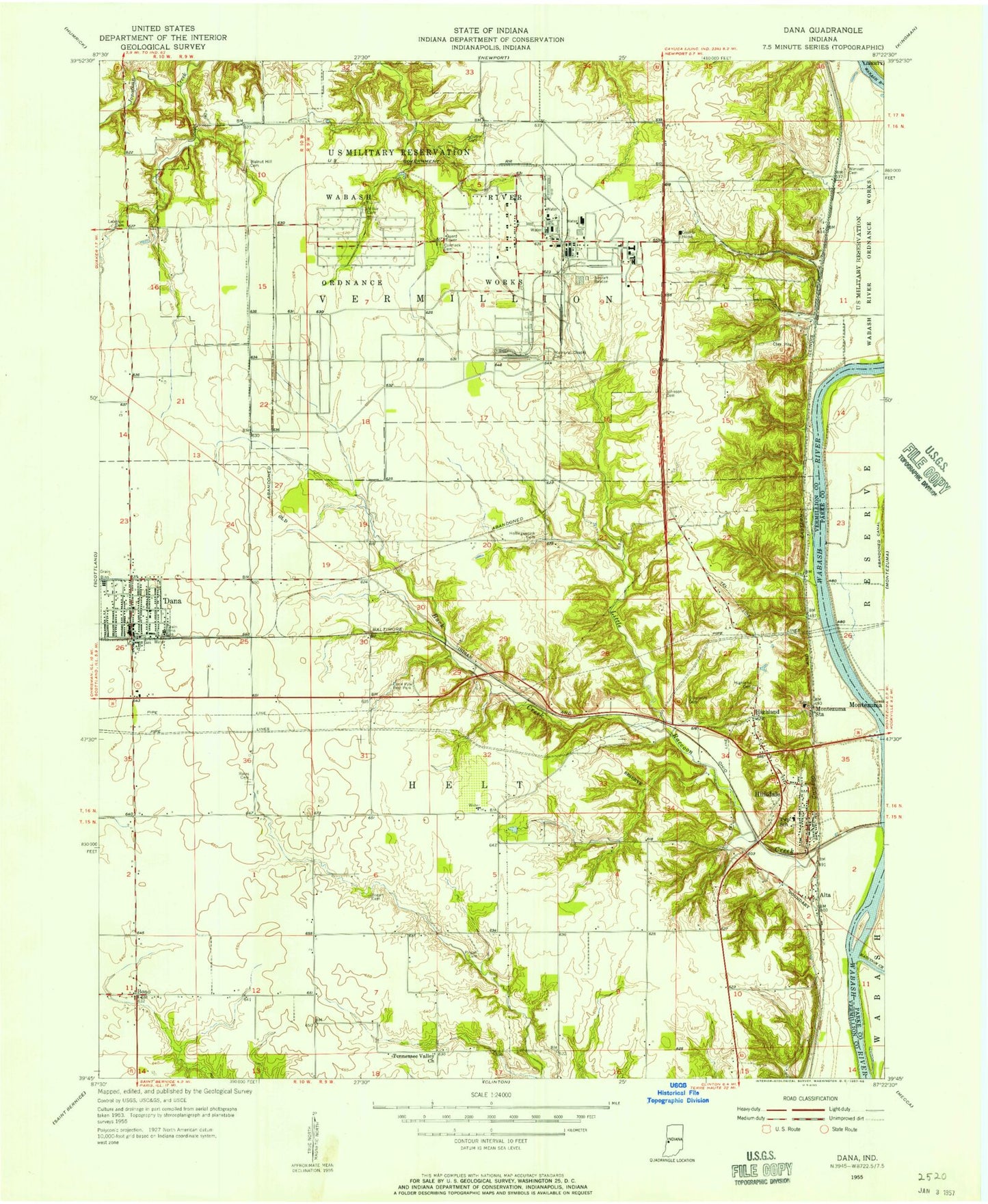
Classic USGS Dana Indiana 7.5'x7.5' Topo Map
Couldn't load pickup availability
Historical USGS topographic quad map of Dana in the state of Indiana. Map scale may vary for some years, but is generally around 1:24,000. Print size is approximately 24" x 27"
This quadrangle is in the following counties: Parke, Vermillion.
The map contains contour lines, roads, rivers, towns, and lakes. Printed on high-quality waterproof paper with UV fade-resistant inks, and shipped rolled.
Contains the following named places: Alta, Bales Cemetery, Big Raccoon Creek, Bogart Cemetery, Bono, Buck Creek, Carmack Cemetery, Dana, Dana Community Volunteer Fire Department, Dana Post Office, Dana Town Marshal, Early Station, Ernie Pyle Rest Park, Highfill Cemetery, Highland, Highland Cemetery, Hillsdale, Hillsdale Junction, Hillsdale Post Office, Hollingsworth Cemetery, Juliet Cemetery, Lebanon Cemetery, Little Raccoon Creek, Memorial Chapel Cemetery, Miller Cemetery, Montezuma Station, Newport Chemical Depot, Pisgah Cemetery, Shell Lake, Shell Lake Dam, Strip Airport, Tennessee Valley Church, Toronto, Town of Dana, Township of Helt, Township of Vermillion, Trowbridge Cemetery, Vermillion County, Vermillion County Sheriff's Office, Walnut Hill Cemetery, Wimsett Cemetery, ZIP Codes: 47847, 47854