
MyTopo
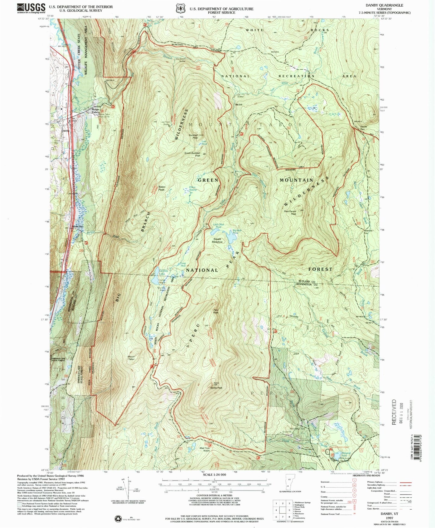
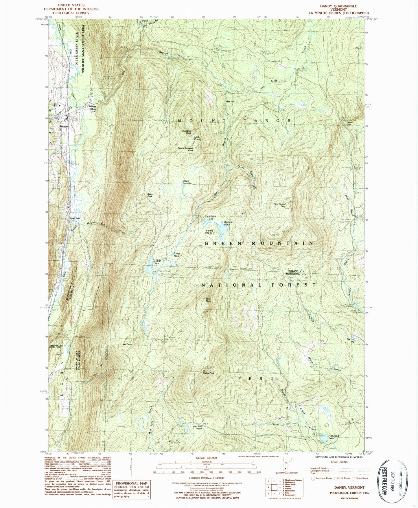
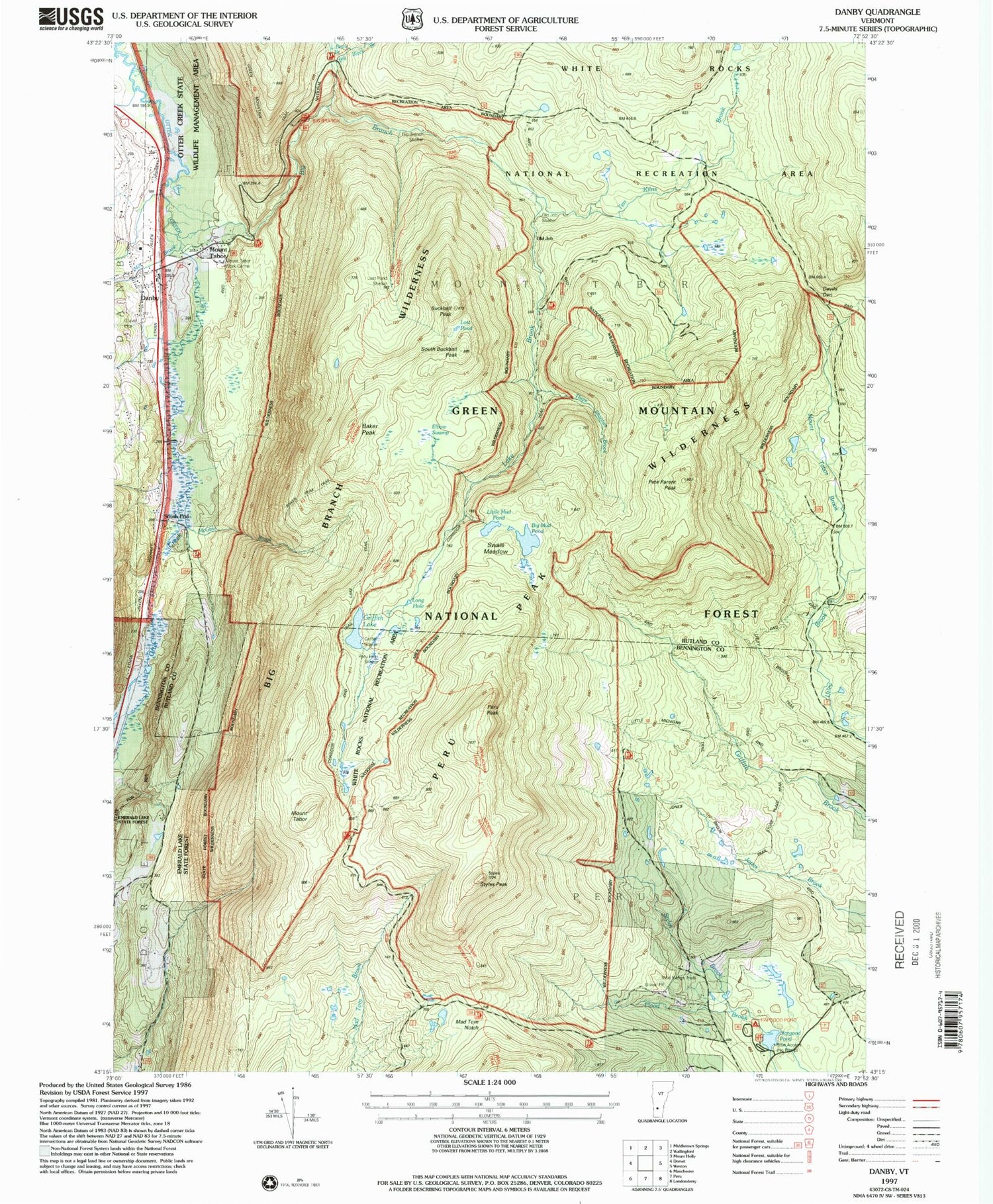
Classic USGS Danby Vermont 7.5'x7.5' Topo Map
Couldn't load pickup availability
Historical USGS topographic quad map of Danby in the state of Vermont. Typical map scale is 1:24,000, but may vary for certain years, if available. Print size: 24" x 27"
This quadrangle is in the following counties: Bennington, Rutland.
The map contains contour lines, roads, rivers, towns, and lakes. Printed on high-quality waterproof paper with UV fade-resistant inks, and shipped rolled.
Contains the following named places: Baker Peak, Big Black Branch, Big Branch, Big Mud Pond, Buckball Peak, Danby, Devils Den, Elbow Swamp, Griffith Lake, Hapgood Pond, Lake Brook, Little Black Branch, Little Mud Pond, Long Hole, Lost Pond, Mad Tom Notch, McGinn Brook, Mill Brook, Mount Tabor Brook, Mount Tabor Cemetery, Old Job, Peru Peak, Pete Parent Peak, South Buckball Peak, South End, Staples Trail, Styles Brook, Styles Peak, Swale Meadow, Mount Tabor, Ten Kilns Brook, Three Shanties Brook, Jones Brook Trail, Hapgood Pond Camp and Picnic Grounds, Wild Wings Winter Sports Area, Peru Peak Wilderness, Big Branch Wilderness, Utley Brook Trail, P.O.R.C. Winter Sports Area (historical), Mount Tabor, Black Branch Recreation Site, Old Job Shelter, Little Michigan Trail, Big Branch Picnic Grounds, Old Job Trail, Baker Peak Trail, Big Branch Shelter, Lost Pond Shelter, Peru Peak Shelter, Lake Trail, Griffith Shelter, Town of Mount Tabor, Town of Peru, Bowen Hill Cemetery, Emerald Lake State Forest, Hapgood Pond Camping Area, Wild Wings Ski Touring Center, Danby Post Office, Danby Town Hall, Danby Village Historic District, Mountain of the Lord Church, Mount Tabor Town Hall, S L Griffith Memorial Library, Tabor Cemetery, Young Cemetery, Danby - Mount Tabor Volunteer Fire Department Station 1, Currier Memorial School, Ardell Flying Field, Danby Census Designated Place