
MyTopo
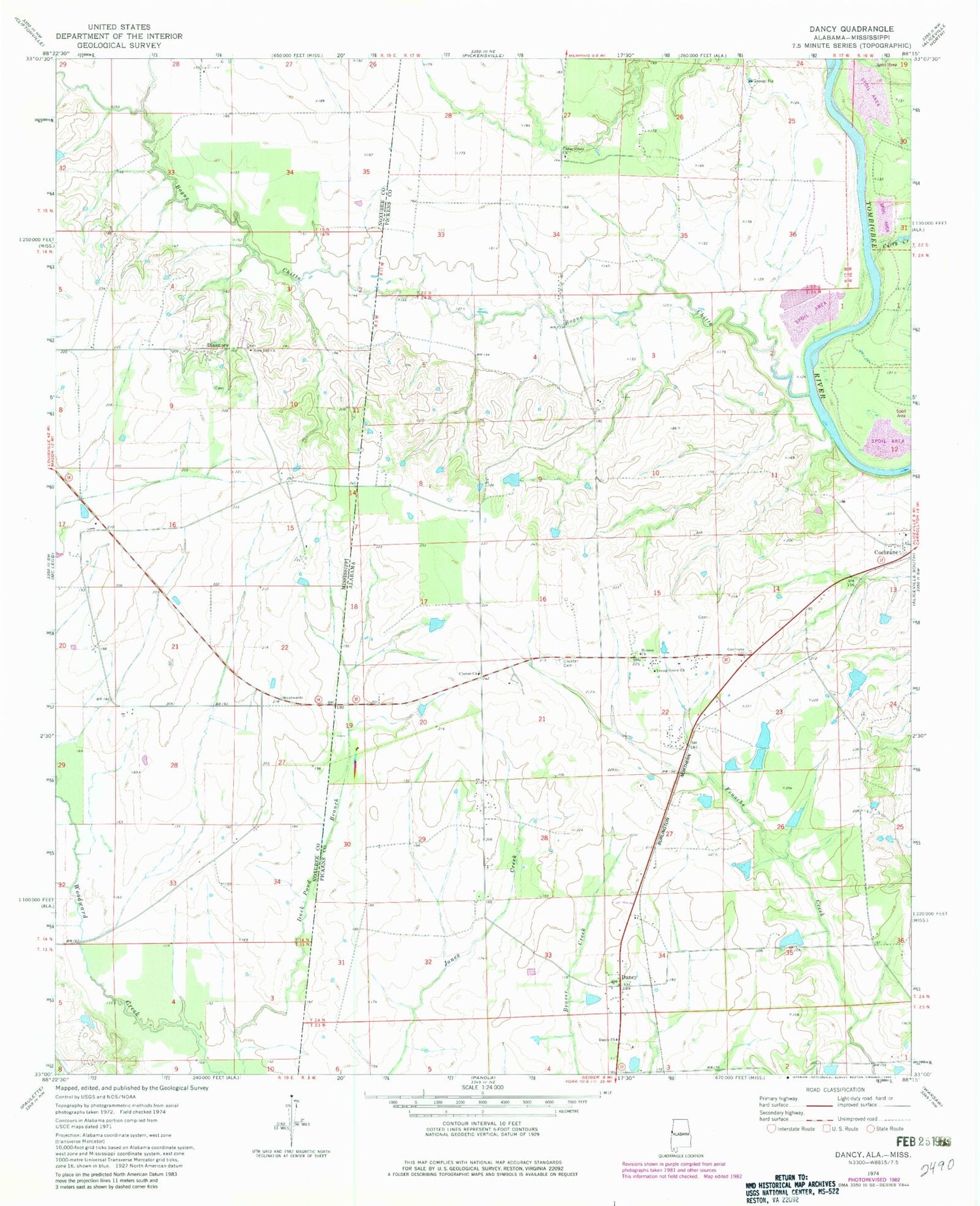
Classic USGS Dancy Alabama 7.5'x7.5' Topo Map
Couldn't load pickup availability
Historical USGS topographic quad map of Dancy in the states of Alabama, Mississippi. Map scale may vary for some years, but is generally around 1:24,000. Print size is approximately 24" x 27"
This quadrangle is in the following counties: Noxubee, Pickens.
The map contains contour lines, roads, rivers, towns, and lakes. Printed on high-quality waterproof paper with UV fade-resistant inks, and shipped rolled.
Contains the following named places: Adams Cemetery, Baldwin Dam, Baldwins Lake, Bogue Chitto, Bogue Chitto Creek Bar, Cedar Creek Bar, Cedar Grove Cemetery, Cedar Grove Church, Clantons Bar, Clantons Landing, Clark, Clarks Store, Clays Store, Cluster Cemetery, Cluster Church, Cluster Elementary School, Cochrane, Cochrane Recreation Area, Colemans Landing, Colemans Shoals, Cooks Landing, Curry Creek, Dancy, Dancy - Cochrane - Memphis Volunteer Fire Department, Dancy Cemetery, Dancy First Baptist Church, Dinsmore, Fairfield, Foxtrap, Foxtrap Prairie, Grims Landing, Hebron Church Cemetery, Hebron Methodist Church, Hickory Grove Church, Hughes Lake Dam, Jett, Johnstons Dam, Johnstons Lake, Kimbrell Number 1 Dam, Kimbrells Lake South, Lower Cedar Creek, Mount Moriah Church, Rock Hill Church, Skinners Landing, Walker Lake Dam, Young Grove Church


