
MyTopo
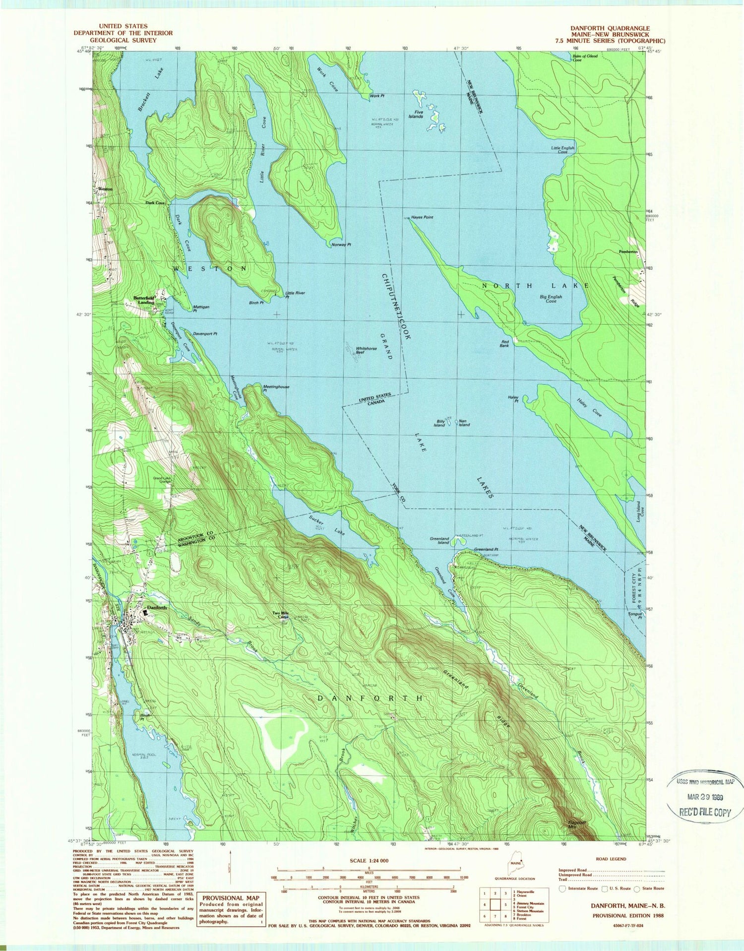
Classic USGS Danforth Maine 7.5'x7.5' Topo Map
Couldn't load pickup availability
Historical USGS topographic quad map of Danforth in the state of Maine. Typical map scale is 1:24,000, but may vary for certain years, if available. Print size: 24" x 27"
This quadrangle is in the following counties: Aroostook, Washington.
The map contains contour lines, roads, rivers, towns, and lakes. Printed on high-quality waterproof paper with UV fade-resistant inks, and shipped rolled.
Contains the following named places: Birch Point, Birch Point, Brackett Lake, Danforth, Hilltop Cemetery, Dark Cove, Davenport Cove, Davenport Point, Five Islands, Grand Lake Grange, Greenland Brook, Greenland Cove, Greenland Island, Greenland Point, Greenland Ridge, Little River Cove, Little River Point, Mattigan Point, Meetinghouse Cove, Meetinghouse Point, Norway Point, Sandy Brook, Sucker Lake, Two Mile Curve, Whitehorse Reef, Work Cove, Work Point, Dark Cove, Butterfield Landing, Grand Lake, Town of Danforth, Town of Weston, Crooked Brook Dam, Crooked Brook Flowage, Danforth Baptist Church, Danforth Post Office, East Grand School, Union Hall, Butterfield Cemetery, Danforth Volunteer Fire Department, Northern Washington Southern Aroostook Regional Ambulance, Brackett Cemetery, Danforth Public Library, Danforth Census Designated Place


