MyTopo
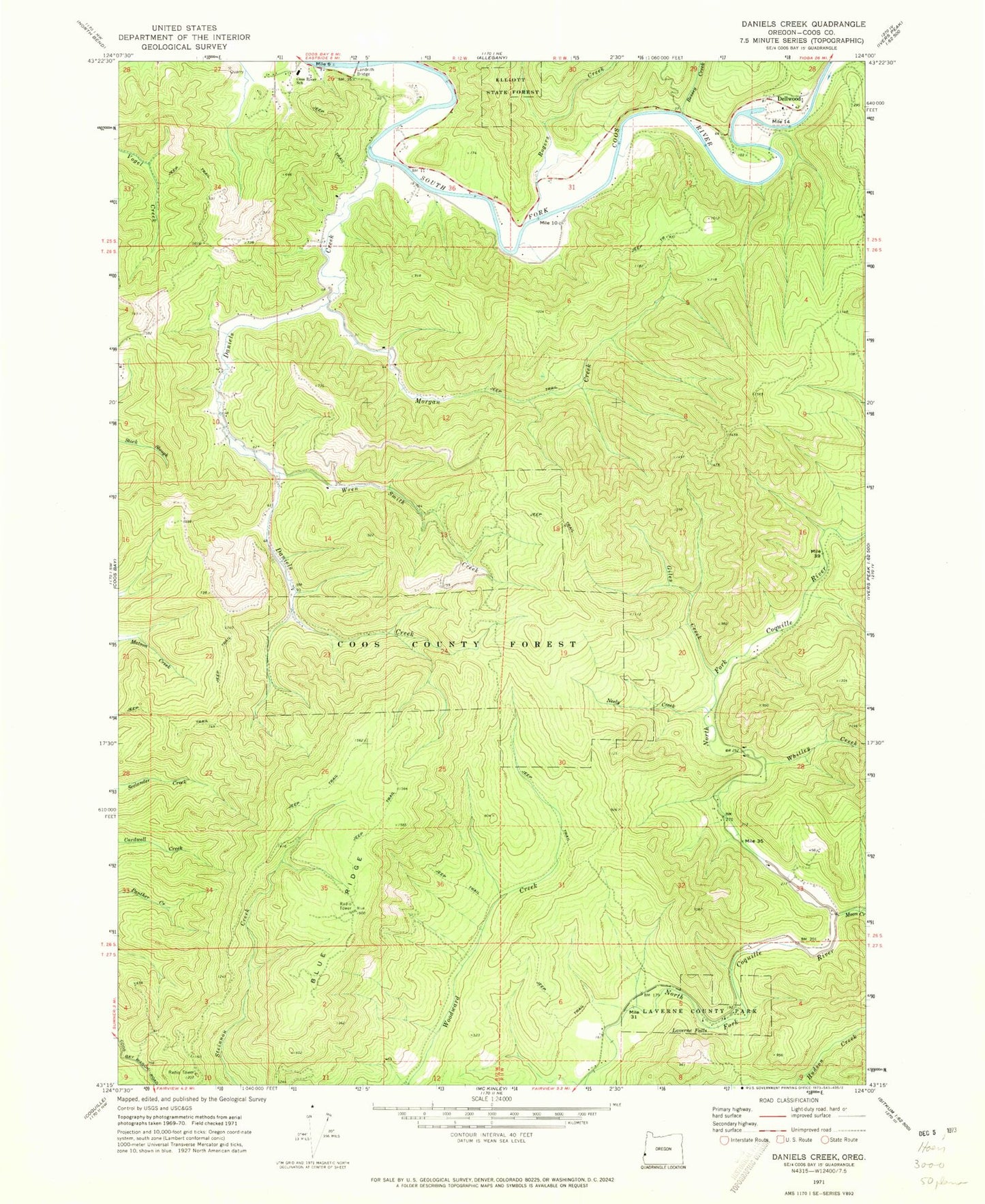
Classic USGS Daniels Creek Oregon 7.5'x7.5' Topo Map
Couldn't load pickup availability
Historical USGS topographic quad map of Daniels Creek in the state of Oregon. Map scale may vary for some years, but is generally around 1:24,000. Print size is approximately 24" x 27"
This quadrangle is in the following counties: Coos.
The map contains contour lines, roads, rivers, towns, and lakes. Printed on high-quality waterproof paper with UV fade-resistant inks, and shipped rolled.
Contains the following named places: Bessey Creek, Blue Creek, Blue Ridge, Bull Pasture, Contrary Bend, Coos River School, Daniels Creek, Dellwood, Dellwood Post Office, Giles Creek, Gillis Creek, KSHR-FM, Landrith Bridge, LaVerne County Park, Laverne Falls, Luse Spring, Moon Creek, Morgan Creek, Myrtle Tree Boat Ramp, Myrtle Tree Hole, Neely Creek, Newcastle Mine, North Fork Creek, Rogers Creek, Rogers Spring, Seaman Creek, West La Verne Park, Whitley Creek, Wren Smith Creek