MyTopo
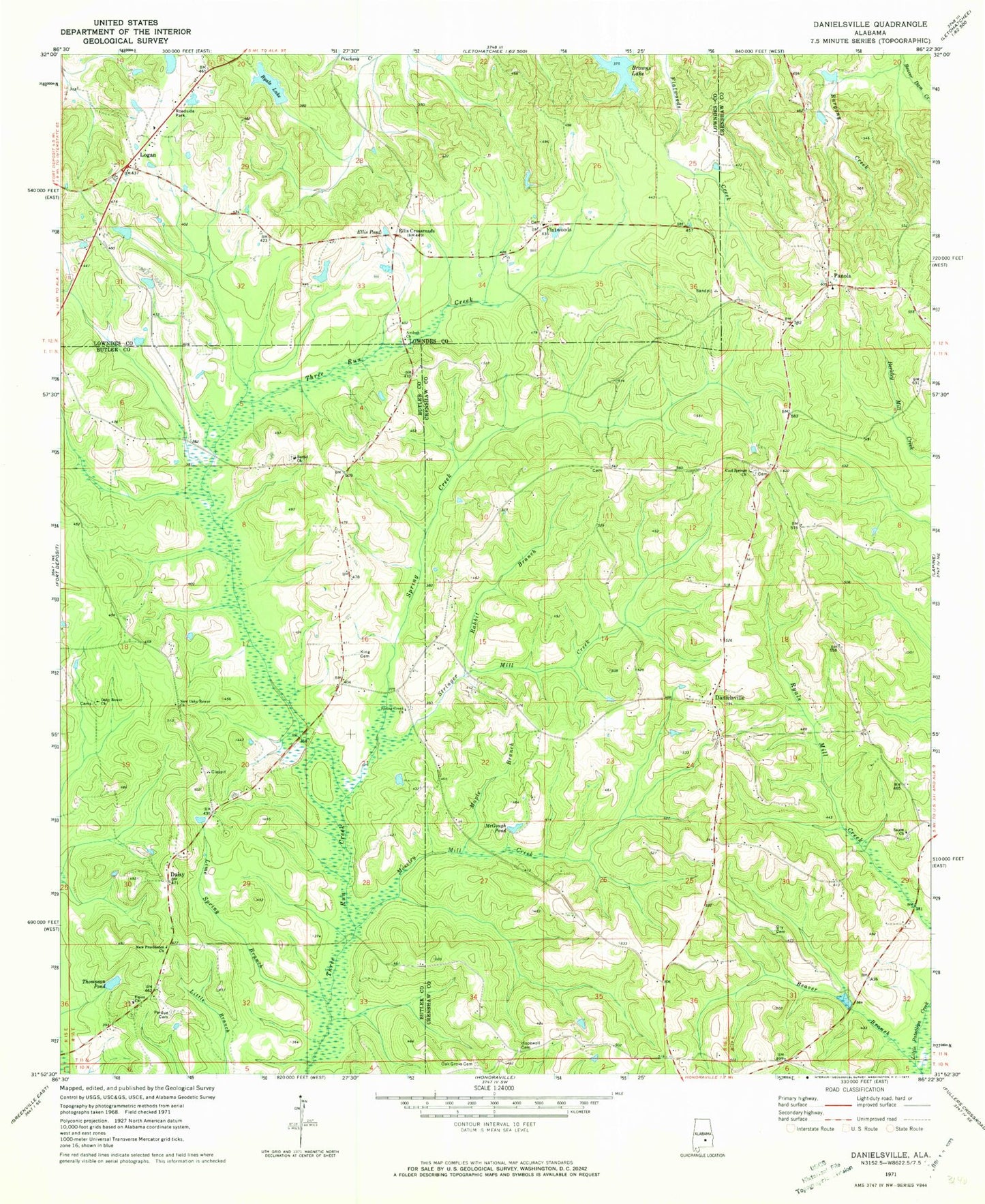
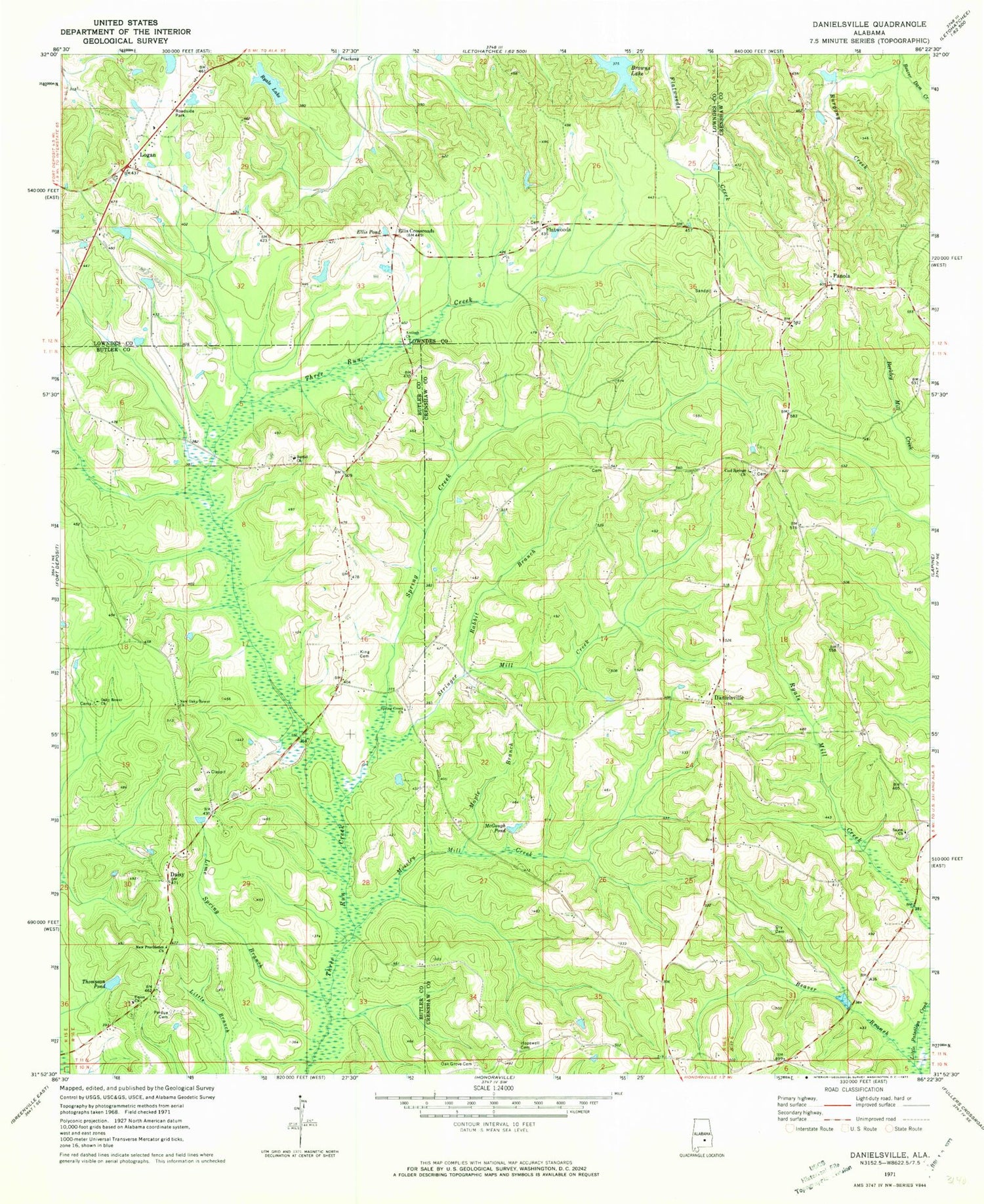
Classic USGS Danielsville Alabama 7.5'x7.5' Topo Map
Couldn't load pickup availability
Historical USGS topographic quad map of Danielsville in the state of Alabama. Map scale may vary for some years, but is generally around 1:24,000. Print size is approximately 24" x 27"
This quadrangle is in the following counties: Butler, Crenshaw, Lowndes.
The map contains contour lines, roads, rivers, towns, and lakes. Printed on high-quality waterproof paper with UV fade-resistant inks, and shipped rolled.
Contains the following named places: Antioch Church, Beaver Branch, Bethel Cemetery, Bethel Methodist Church, Browns Lake, Burgony Creek, Cemetery, Cool Springs Church, Daisy, Daisy School, Danielsville, Danielsville Church, Danielsville School, Dry Cemetery, Ellis Crossroads, Ellis Pond, Flatwood Church, Flatwoods, Hopewell Cemetery, King Cemetery, Lime Spring Branch, Logan, Maple Branch, McGough Pond, Mitchell Dam, Moseley Mill Creek, New Oaky Bower Church, Oak Bowery Cemetery, Oak Bowery Primitive Baptist Church, Oak Grove Cemetery, Panola, Panola Cemetery, Panola Church, Pigeon Creek Swamp, Providence Church of Christ, Rabbit Branch, Rock Branch, Ryals Lake, Salem Church, Spring Creek, Spring Creek Cemetery, Spring Creek Missionary Baptist Church, Spring Creek Volunteer Fire Department, Steiners Store, Stringer Mill Creek, Thompson Pond, Union Church