
MyTopo
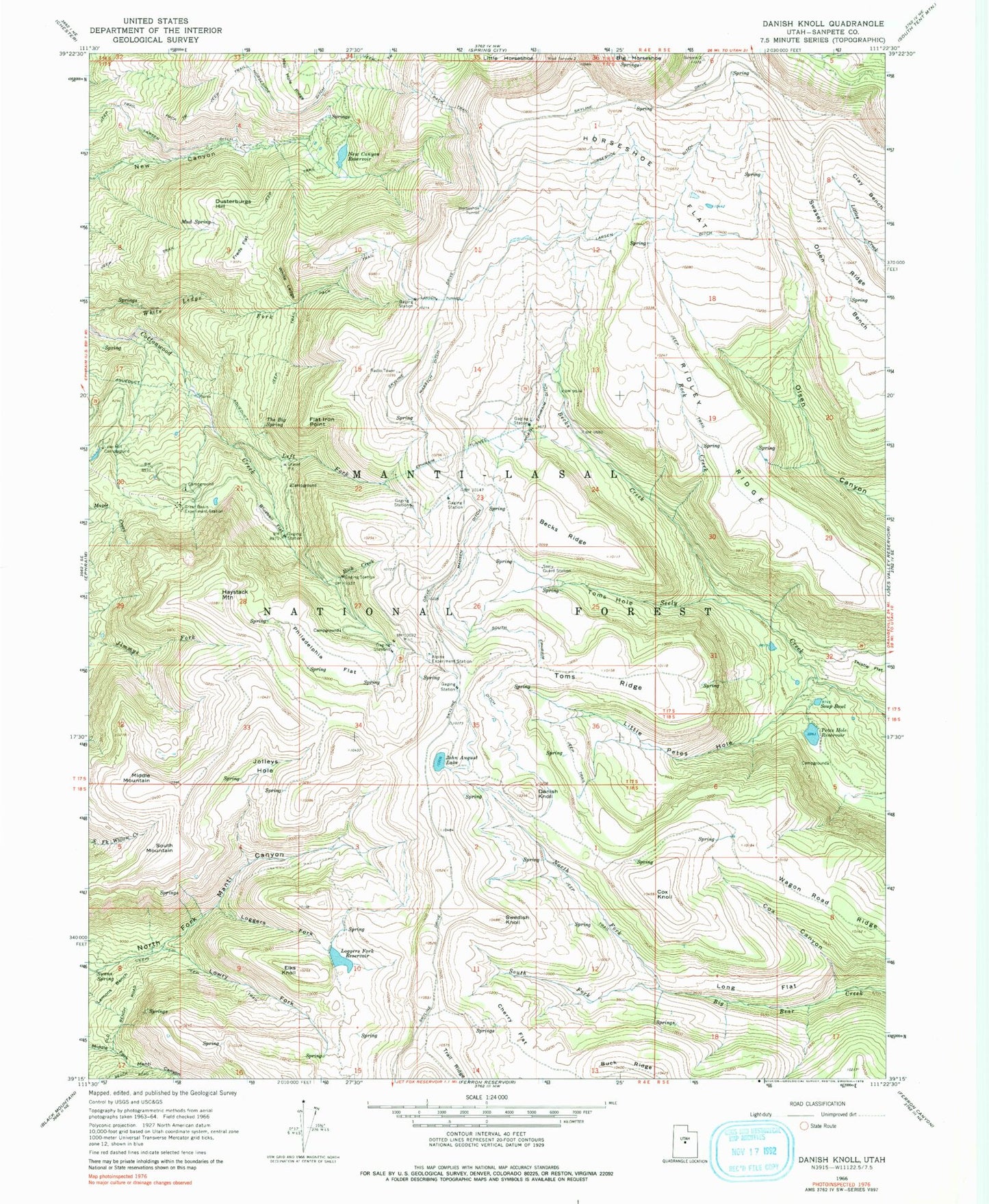
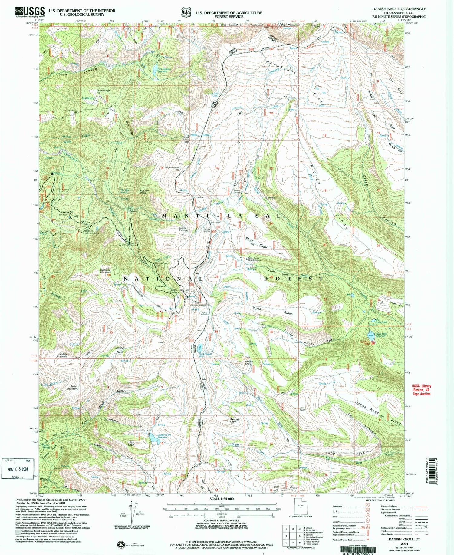
Classic USGS Danish Knoll Utah 7.5'x7.5' Topo Map
Couldn't load pickup availability
Historical USGS topographic quad map of Danish Knoll in the state of Utah. Typical map scale is 1:24,000, but may vary for certain years, if available. Print size: 24" x 27"
This quadrangle is in the following counties: Sanpete.
The map contains contour lines, roads, rivers, towns, and lakes. Printed on high-quality waterproof paper with UV fade-resistant inks, and shipped rolled.
Contains the following named places: Becks Creek, Becks Ridge, Bluebell Flat, Cherry Flat, Cox Canyon, Cox Knoll, Danish Knoll, Dusterburgs Hill, Elks Knoll, Ephiraim Tunnel, Flat Iron Point, Freds Flat, Haystack Mountain, Hell Hole Ridge, Horseshoe Ditch, Horseshoe Flat, Horseshoe Tunnel, John August Lake, Jolleys Hole, Lake Hill Campground, Larsen Ditch, Larson Tunnel, Left Fork Cotton Creek, Lemons Bench, Little Petes Hole, Loggers Fork, Loggers Fork Reservoir, Long Flat, Lowry Fork, Madsen Ditch, Middle Mountain, Mud Spring, New Canyon Reservoir, North Ephraim Ditch, North Fork Big Bear Creek, Philadelphia Flat, Ridley Ridge, Rock Creek, Rock Creek, Seely Guard Station, Soup Bowl, South Ephraim Ditch, South Fork Big Bear Creek, South Mountain, Swasey Ridge, Swedish Knoll, Swens Spring, The Big Spring, Toms Hole, Toms Ridge, Trail Ridge, Wagon Road Ridge, Wasatch Ditch, White Ledge, Loggers Fork Dam, Petes Hole Reservoir, Petes Hole Dam, Beaver Dams, Alpine Experiment Station, Great Basin Experiment Station, Manti-La Sal National Forest, Horseshoe Mountain