
MyTopo
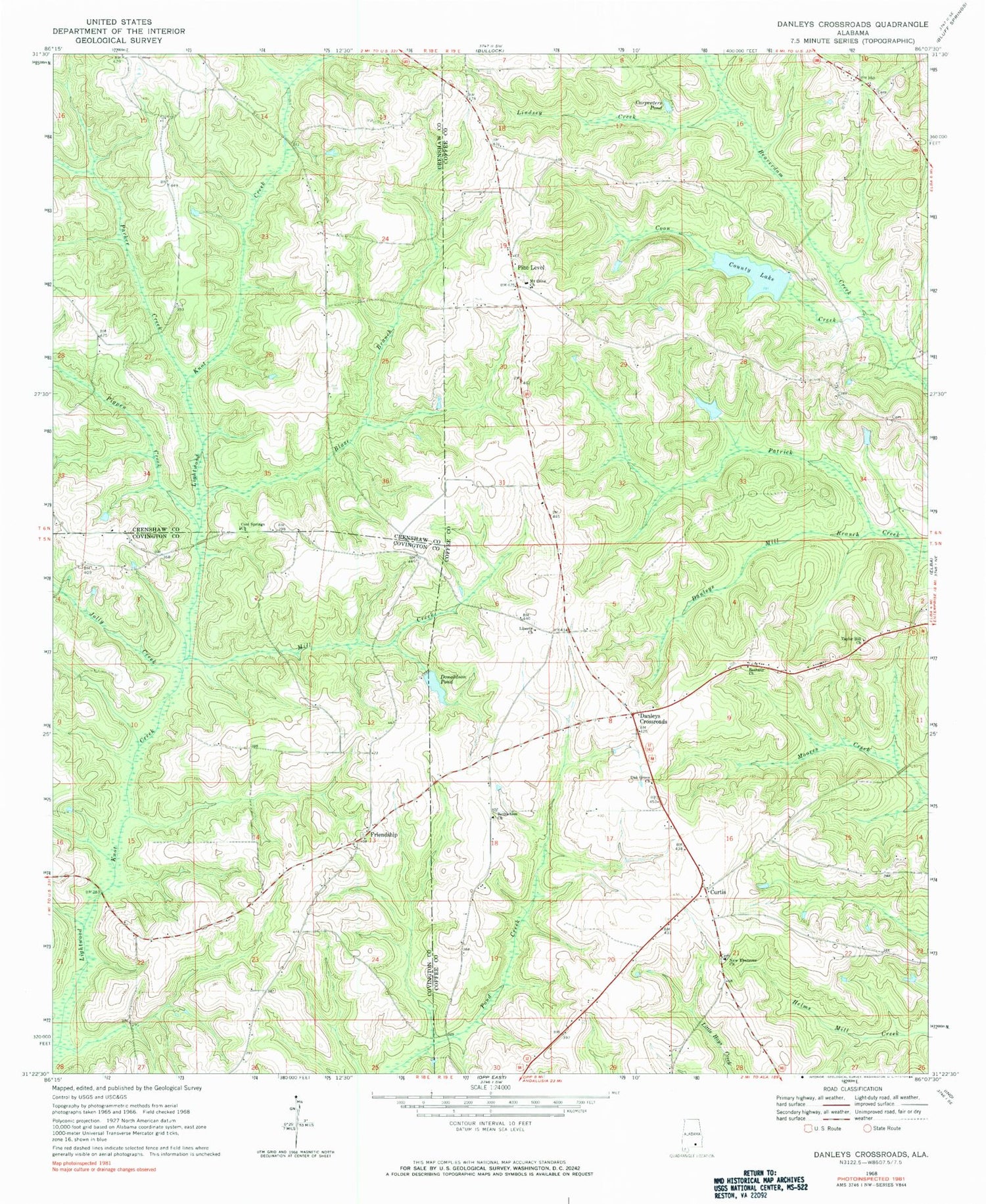
Classic USGS Danleys Crossroads Alabama 7.5'x7.5' Topo Map
Couldn't load pickup availability
Historical USGS topographic quad map of Danleys Crossroads in the state of Alabama. Map scale may vary for some years, but is generally around 1:24,000. Print size is approximately 24" x 27"
This quadrangle is in the following counties: Coffee, Covington, Crenshaw.
The map contains contour lines, roads, rivers, towns, and lakes. Printed on high-quality waterproof paper with UV fade-resistant inks, and shipped rolled.
Contains the following named places: Bethany Cemetery, Bethany Primitive Baptist Church, Bethlehem Baptist Church, Blaze Branch, Carpenters Pond, Coffee County Public Lake Dam, Cool Springs Church, Coon Creek, County Lake, Curtis, Curtis Junior High School, Danley Cross Roads Church, Danleys Crossroads, Danley's Crossroads Cemetery, Danleys Mill Branch, Donaldson Lake Dam, Donaldson Pond, Double School, Friendship, Friendship Church, Friendship Community Cemetery, Gravel Hill School, Hudson Cemetery, Jolly Creek, Liberty Cemetery, Liberty Church, Lindsey Creek, Mill Creek, Miller Branch, Mitchell Cemetery, Morgan School, Mount Olive Baptist Church, Mount Vernon Church, Nasco Lake, National Security Lake Dam, New Ebenezer Baptist Church, New Ebenezer Cemetery, Oak Grove Baptist Church, Oak Grove Cemetery, Parker Creek, Pigpen Creek, Pine Level, Pine Level Cemetery, Pine Level School, Prescott Cemetery, Saddle Hill, Southeast District Sing Convention Church, Taylor Hill Baptist Church, Whitman Branch, Whitman Pond, Whitman Pond Dam


