MyTopo
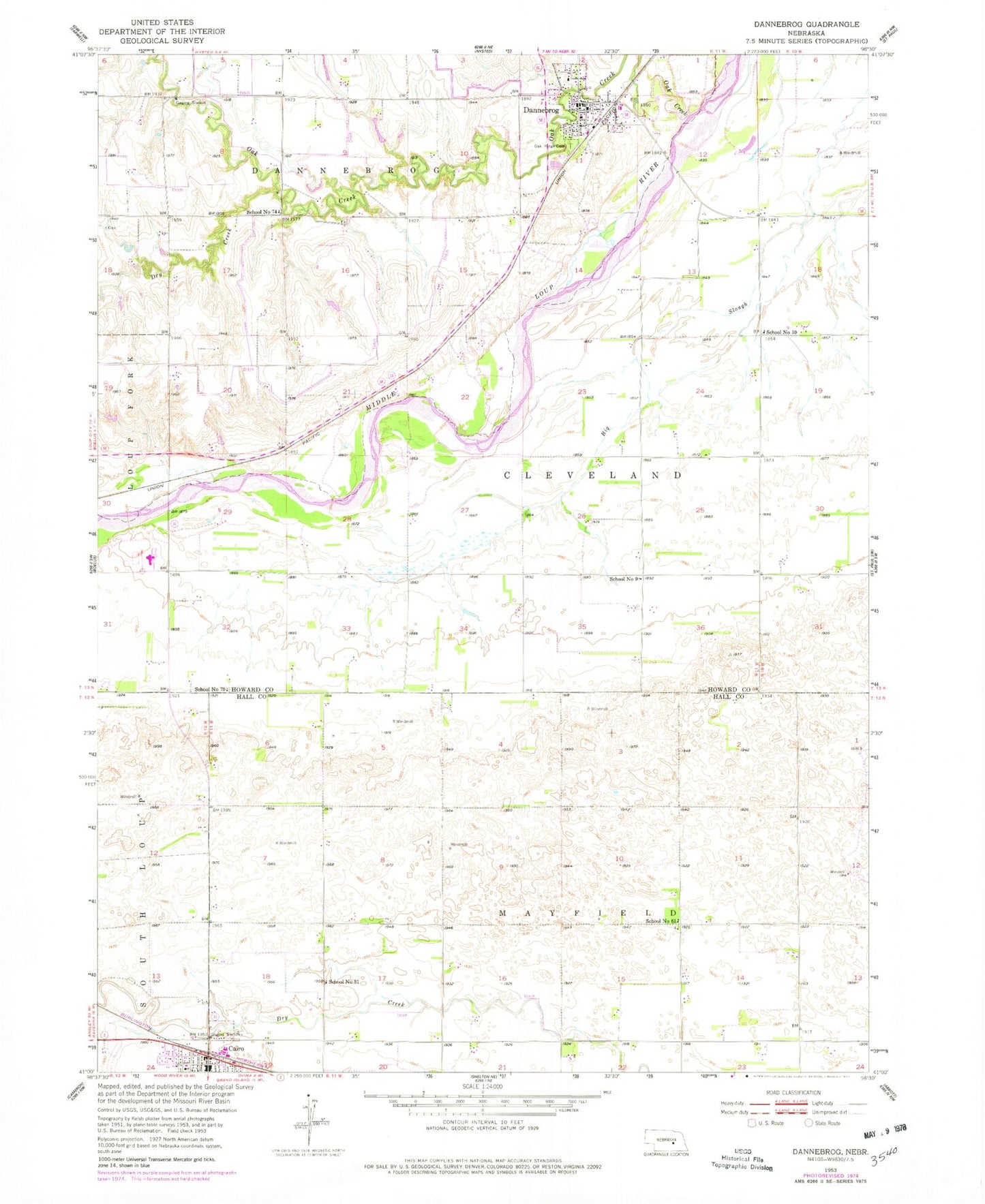
Classic USGS Dannebrog Nebraska 7.5'x7.5' Topo Map
Couldn't load pickup availability
Historical USGS topographic quad map of Dannebrog in the state of Nebraska. Map scale may vary for some years, but is generally around 1:24,000. Print size is approximately 24" x 27"
This quadrangle is in the following counties: Hall, Howard.
The map contains contour lines, roads, rivers, towns, and lakes. Printed on high-quality waterproof paper with UV fade-resistant inks, and shipped rolled.
Contains the following named places: Cairo, Cairo Post Office, Cairo United Methodist Church, Centura Hills Golf Club, Centura Public Schools, Christ Lutheran Church, Cleveland Election Precinct, Dannebrog, Dannebrog Election Precinct, Dannebrog Golf Course, Dannebrog Park, Dannebrog Post Office, Dannebrog Public Library, Dannebrog Trails, Dannebrog Volunteer Fire and Rescue, Dry Creek, First Baptist Church, Fries Dam, Fries Reservoir, National Liars Hall of Fame, New Hope Christian Elementary School, Oak Creek, Oak Ridge Cemetery, Our Saviors Lutheran Church, Saint Peders Evangelical Church, School Number 31, School Number 59, School Number 61, School Number 70, School Number 74, School Number 9, Township of Cleveland, Township of Dannebrog, Township of Mayfield, Village of Cairo, Village of Dannebrog, ZIP Code: 68831