MyTopo
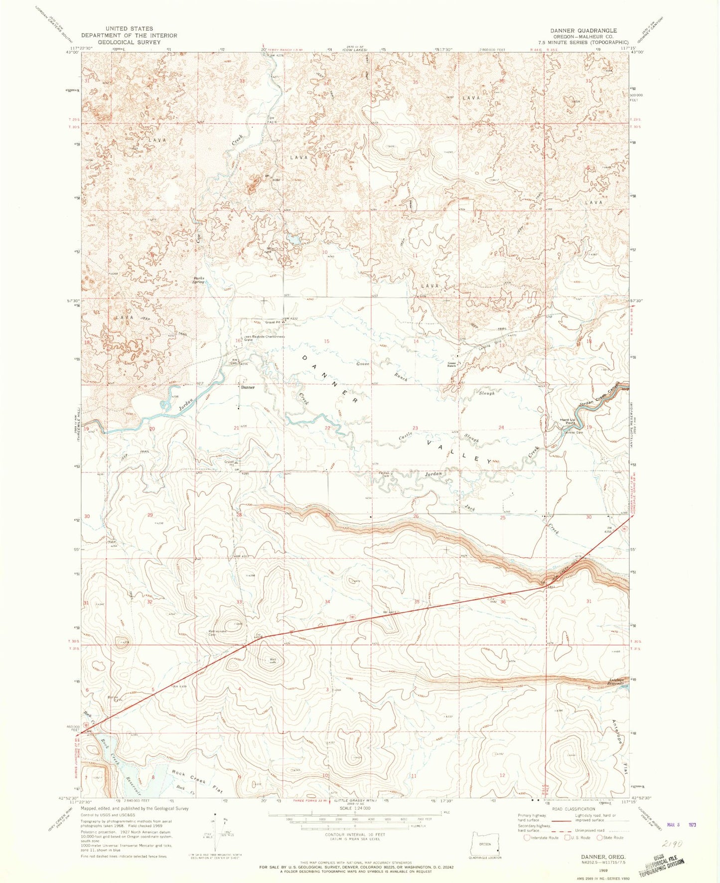
Classic USGS Danner Oregon 7.5'x7.5' Topo Map
Couldn't load pickup availability
Historical USGS topographic quad map of Danner in the state of Oregon. Map scale may vary for some years, but is generally around 1:24,000. Print size is approximately 24" x 27"
This quadrangle is in the following counties: Malheur.
The map contains contour lines, roads, rivers, towns, and lakes. Printed on high-quality waterproof paper with UV fade-resistant inks, and shipped rolled.
Contains the following named places: Barrick and Shannon Ranch, Castle Slough, Cow Creek, Danner, Danner Post Office, Danner Valley, Fort Dobie, Goose Ranch, Goose Ranch Slough, Hard Up Point, Jack Creek, Jack Creek Hill, Jean Baptiste Charbonneau Grave, Jordan Creek Canyon, North Antelope Canal, Palmer Dam, Parks Spring, Rock Creek Dam, Rock Creek Reservoir, Skinner, Skinner Dam, Skinner Ranch Airport, South Antelope Canal