MyTopo
Classic USGS Dansby Arkansas 7.5'x7.5' Topo Map
Couldn't load pickup availability
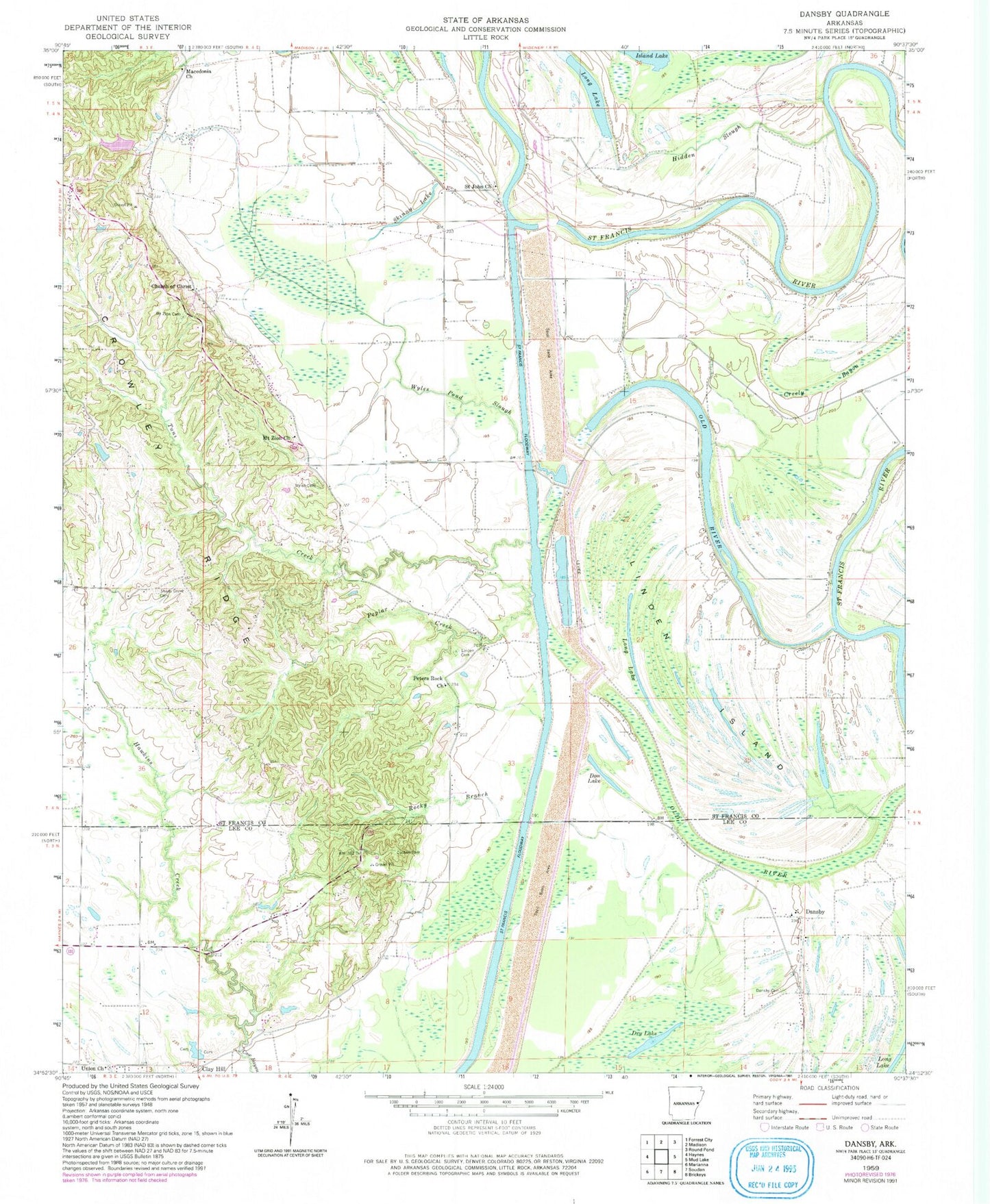
Historical USGS topographic quad map of Dansby in the state of Arkansas. Map scale may vary for some years, but is generally around 1:24,000. Print size is approximately 24" x 27"
This quadrangle is in the following counties: Lee, St. Francis.
The map contains contour lines, roads, rivers, towns, and lakes. Printed on high-quality waterproof paper with UV fade-resistant inks, and shipped rolled.
Contains the following named places: Berry Bend, Blackfish Bayou, Blackfish Cut-off, Blunt Church, Blunt School, Brush Arbor Church, Casteel Cemetery, Castell Crossing, Church of Christ, Church of God, Clay Hill, Clay Hill Cemetery, Coon Island Bend, Creely Bayou, Creely Bend, Danford School, Dansby, Dansby Cemetery, Dansby School, Don Lake, Dry Lake, Fairview School, Hawkins Creek, Hidden Slough, Island Lake, Jarvis Bend, Jarvis Crossing, Linden Cemetery, Linden Island, Loeb Lake, Loeb Lake Dam, Long Lake, Macedonia Church, McDaniel School, McDonald Crossing, Miller Crossing, Mount Zion Cemetery, Mount Zion Church, Old River, Overcup Bend, Peters Rock Church, Pettis Crossing, Pleasant Grove Church, Pleasant Grove School, Point Look About, Point Look Around, Point Look Out, Poplar Creek, Poplar Creek School, Pretty Tree Bend, Quigley Bend, Quigley Crossing, Riverside, Riverview Church, Riverview School, Rocky Branch, Rollinson, Saint John Cemetery, Saint John Church, Saint John School, Sassafrass Bend, School House Bend, Shady Grove Cemetery, Shady Grove School, Skinny Lake, Taylor Chapel, Township of Franks, Tuni, Tuni Church, Tuni Creek, Tuttleton, Tuttleton School, Union Church, Union School, White Rock School, White Wall School, Wyles, Wyles Cemetery, Wyles Pond Slough, Wyles School, ZIP Code: 72335