MyTopo
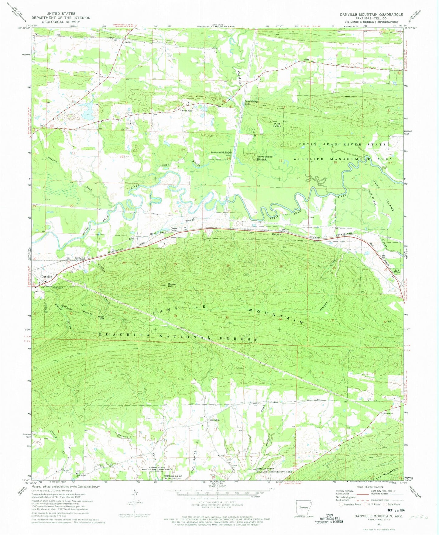
Classic USGS Danville Mountain Arkansas 7.5'x7.5' Topo Map
Couldn't load pickup availability
Historical USGS topographic quad map of Danville Mountain in the state of Arkansas. Map scale may vary for some years, but is generally around 1:24,000. Print size is approximately 24" x 27"
This quadrangle is in the following counties: Yell.
The map contains contour lines, roads, rivers, towns, and lakes. Printed on high-quality waterproof paper with UV fade-resistant inks, and shipped rolled.
Contains the following named places: Achmun Creek, Achmun Creek Bridge, Alpha, Booze Hollow, Bunker Hill, Cane Island, Cane Island Slough, Cape Slough, Chickalah Creek, Danville Mountain, Elm Root Slough, Harris Fish Farm Dam, Harris Fish Farm Reservoir, Jake Creek, Kingston, Lone Pine, Lone Pine School, Melchor Creek, Mickles, New Bethel Cemetery, New Bethel Church, Nimrod State Wildlife Management Area, Peeler Gap, Peeler Lake, Peter George Lake, Prairie Creek, Prairie Creek School, Ranger, Ridge Church, Salem Church, Social Circle School, Surrounded Ridges, Surrounded Ridges Lake, Township of Prairie, Union Grove School