MyTopo
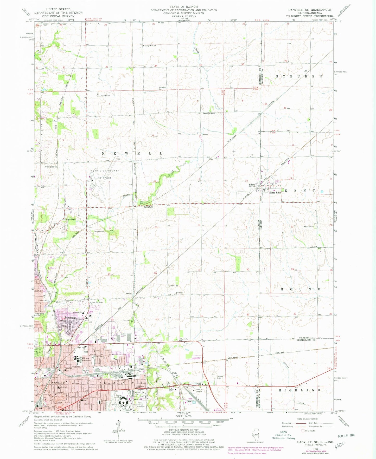
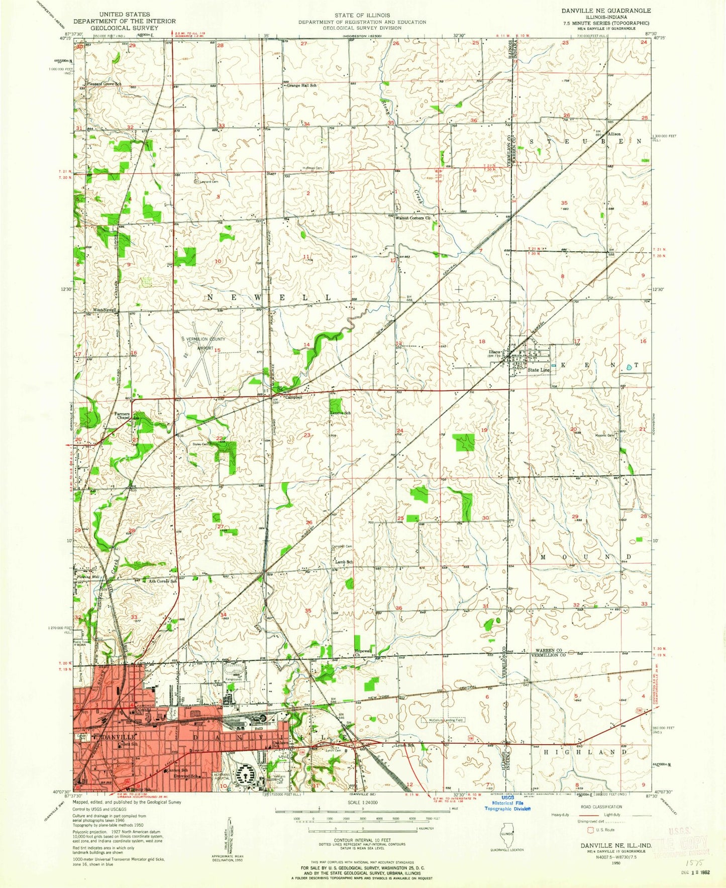
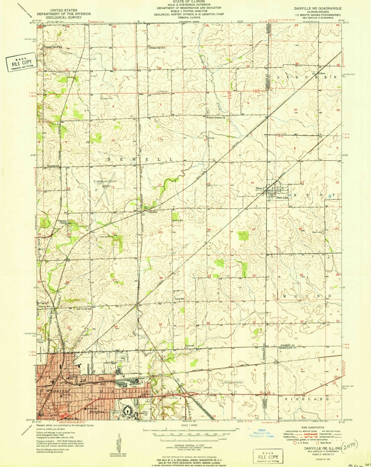
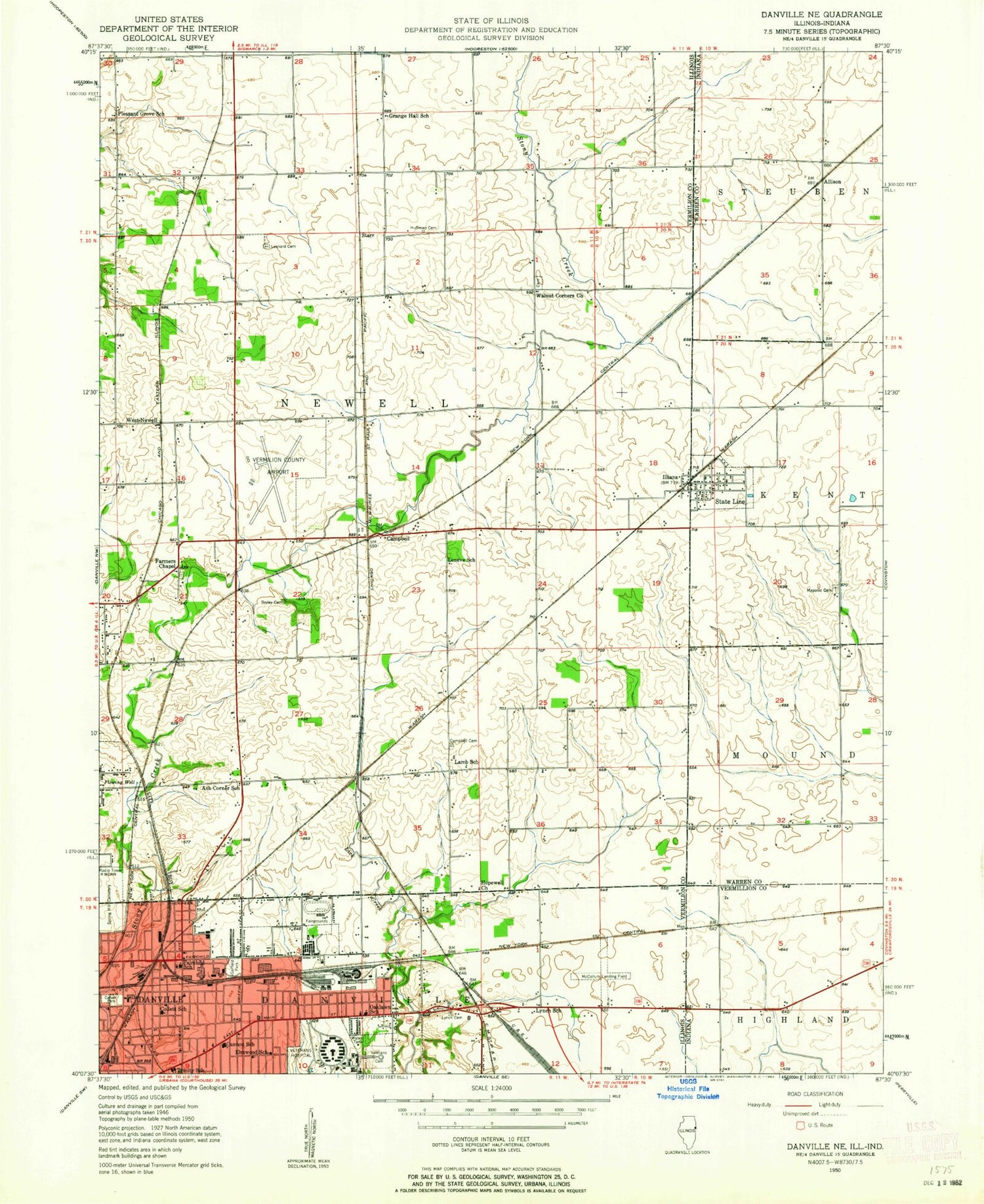
Classic USGS Danville NE Illinois 7.5'x7.5' Topo Map
Couldn't load pickup availability
Historical USGS topographic quad map of Danville NE in the states of Illinois, Indiana. Map scale may vary for some years, but is generally around 1:24,000. Print size is approximately 24" x 27"
This quadrangle is in the following counties: Vermilion, Vermillion, Warren.
The map contains contour lines, roads, rivers, towns, and lakes. Printed on high-quality waterproof paper with UV fade-resistant inks, and shipped rolled.
Contains the following named places: Bible Missionary Church, Bowman Avenue Church of God, Bowman Avenue United Methodist Church, Brierly Cemetery, Campbell, Cannon Elementary School, Carter Metropolitan Christian Methodist Episcopal Church, City of Danville, Collett School, Collett Street Church of Christ, Danville Area Community College, Danville Correctional Center, Danville Correctional Center Heliport, Danville Fire Department Station 3 Headquarters, Danville Fire Department Station 4, Danville National Cemetery, East End Church of God, East Park Church of Christ, East Park Elementary School, Elmwood School, Fairchild School, Farmers Chapel Cemetery, Farmers Chapel United Methodist Church, Garfield Park, Grange Hall School, Holiday Square Shopping Center, Hopewell Church, Huffman Cemetery, Illiana, Immanuel Lutheran Church, Immanuel School, Lamb Cemetery, Latter Day Saints Church, Leonard Cemetery, Lynch Cemetery, Lynch School, Masonic Cemetery, McKinley United Methodist Church, Meade Airport, Meade Park, Meade Park Elementary School, New Hope Church, Newell, North Side Church of the Nazarene, Northeast School, Oaklawn Church of the Nazarene, Oaklawn School, Second Church of Christ, Springhill Cemetery, State Line, State Line City Volunteer Fire Department, State Line Post Office, The Israel of God Church, Town of State Line City, Township of Newell, Trinity Lutheran Church, Trinity School, Union Baptist Church, Vacetta Plaza Industrial Park, Vermilion Regional Airport, Walnut Corner Cemetery, Walnut Corner Church of Christ, Walz, West Newell, ZIP Codes: 47982, 61814