
MyTopo
Classic USGS Danville SE Illinois 7.5'x7.5' Topo Map
Couldn't load pickup availability
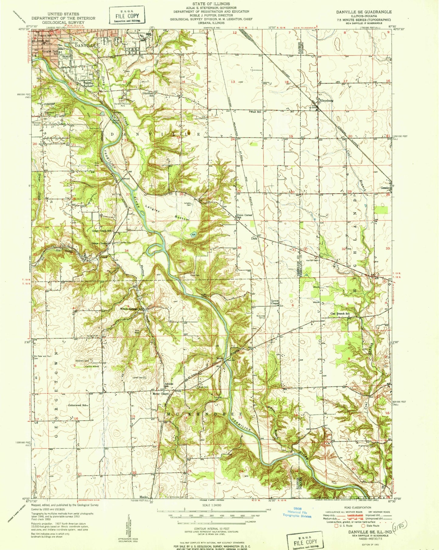
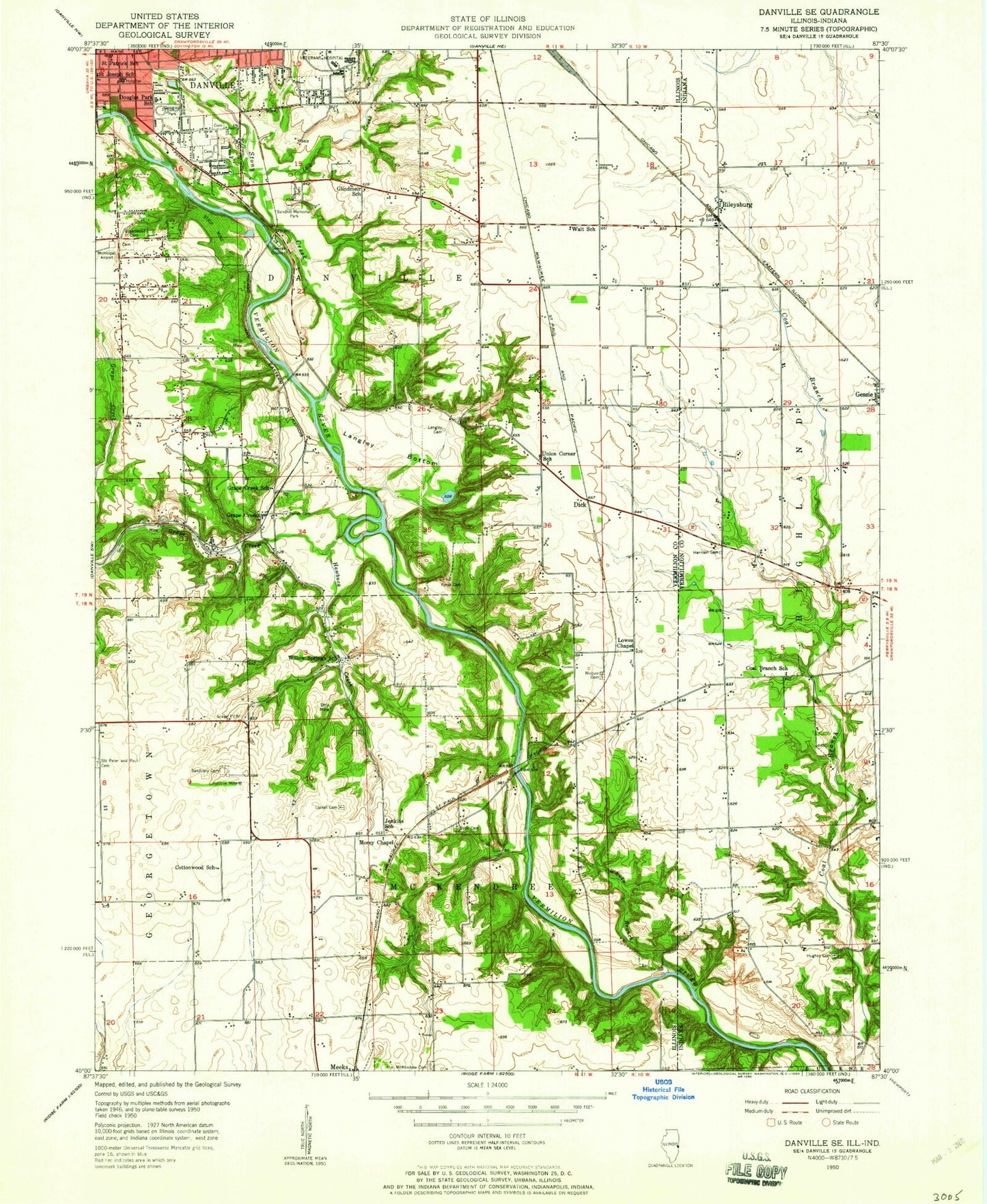
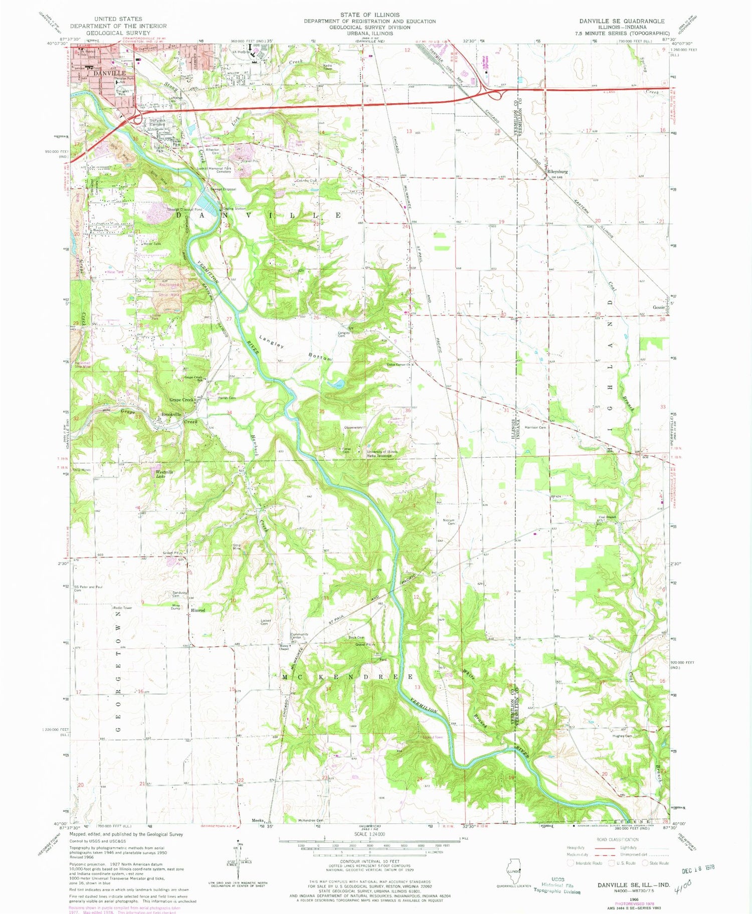
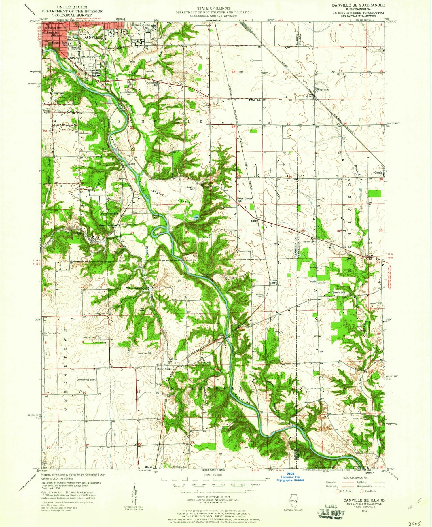
Historical USGS topographic quad map of Danville SE in the states of Illinois, Indiana. Typical map scale is 1:24,000, but may vary for certain years, if available. Print size: 24" x 27"
This quadrangle is in the following counties: Vermilion, Vermillion.
The map contains contour lines, roads, rivers, towns, and lakes. Printed on high-quality waterproof paper with UV fade-resistant inks, and shipped rolled.
Contains the following named places: Atherton Cemetery, Bock Cemetery, Brookville, Douglas Park, Douglas Park School, Forse Cemetery, Grape Creek, Grape Creek, Grape Creek School, Greenwood Cemetery, Hawbuck Creek, Langley Bottom, Langley Cemetery, Lick Creek, Locket Cemetery, McKendree Cemetery, McKendree Church, Morey Chapel Church of Christ, Niccum Cemetery, Parish Cemetery, Resurrection Cemetery, Saint Patrick School, Sandusky Cemetery, Sanhill Memorial Park Cemetery, Stoney Creek, Union Corner United Methodist Church, Westville Lake, White Branch, Himrod, Township of Danville, Township of McKendree, Hooten Church of Christ, University of Illinois Radio Telescope, Lutheran Cemetery, Eastgate Industrial Park, Forest Glen Preserve, United Samaritans Medical Center-Sager Campus, Vermilion Hills Country Club, Doris Westfall Prairie Restoration Nature Preserve, Forest Glen Seep Nature Preserve, Howards Hollow Seep Nature Preserve, Russell M Duffin Nature Preserve, Douglas Park Church of the Nazarene, Saint Josephs Roman Catholic Church, Danville United Church of Christ, Holy Family Catholic Church, Veterans Affairs Illiana Health Care System Medical Center, Lynch Fire Protection District Perrysville Station, Coal Branch Church, Harrison Cemetery, Hughes Cemetery, Rileysburg, Gessie Airport, Atherton Cemetery, Bock Cemetery, Brookville, Douglas Park, Douglas Park School, Forse Cemetery, Grape Creek, Grape Creek, Grape Creek School, Greenwood Cemetery, Hawbuck Creek, Langley Bottom, Langley Cemetery, Lick Creek, Locket Cemetery, McKendree Cemetery, McKendree Church, Morey Chapel Church of Christ, Niccum Cemetery, Parish Cemetery, Resurrection Cemetery, Saint Patrick School, Sandusky Cemetery, Sanhill Memorial Park Cemetery, Stoney Creek, Union Corner United Methodist Church, Westville Lake, White Branch, Himrod, Township of Danville, Township of McKendree, Hooten Church of Christ, University of Illinois Radio Telescope, Lutheran Cemetery, Eastgate Industrial Park, Forest Glen Preserve, United Samaritans Medical Center-Sager Campus, Vermilion Hills Country Club, Doris Westfall Prairie Restoration Nature Preserve, Forest Glen Seep Nature Preserve, Howards Hollow Seep Nature Preserve, Russell M Duffin Nature Preserve, Douglas Park Church of the Nazarene, Saint Josephs Roman Catholic Church, Danville United Church of Christ, Holy Family Catholic Church, Veterans Affairs Illiana Health Care System Medical Center, Lynch Fire Protection District Perrysville Station, Coal Branch Church, Harrison Cemetery, Hughes Cemetery, Rileysburg, Gessie Airport