MyTopo
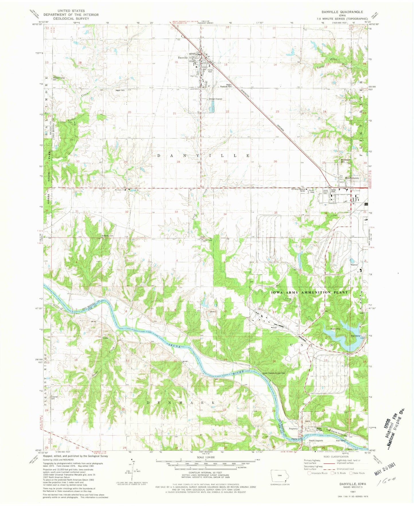
Classic USGS Danville Iowa 7.5'x7.5' Topo Map
Couldn't load pickup availability
Historical USGS topographic quad map of Danville in the state of Iowa. Typical map scale is 1:24,000, but may vary for certain years, if available. Print size: 24" x 27"
This quadrangle is in the following counties: Des Moines, Henry, Lee.
The map contains contour lines, roads, rivers, towns, and lakes. Printed on high-quality waterproof paper with UV fade-resistant inks, and shipped rolled.
Contains the following named places: Augusta, Danville, Middletown, South Augusta, Iowa Army Ammunition Plant Dam, Long Creek Church, Danville Center, Township of Danville, Township of Denmark, Lower Augusta Access Area, Deeds Creek, Welter County Park, Woodmansee Cemetery, Upper Augusta Access Area, Middletown Cemetery, Blakeway Cemetery, Harmony Church, Waters Roadside Park, Jaggar Cemetery, Pleasant Grove Cemetery, Augusta Access, Gray's Landing, Hauck Cemetery, First Presbyterian Church, Middleton City Hall, Middletown Post Office, Middletown, Danville Post Office, Danville Care Center, Danville Chiropractic Office, Danville City Hall, Danville Fire Department, Danville Police Department, United Methodist Church, First Baptist Church, Congregational United Church, The Secret Garden, Danville Elementary School, Danville, Parrish Post Office (historical), Augusta Post Office (historical), Lee Burial Plot, Augusta Cemetery, Long Creek Methodist Cemetery, Old Danville Cemetery, Renner Farm Cemetery, City of Danville, City of Middletown, General Dynamics Ordinance and Tactical Systems Ambulance, Mccoy Airport (historical), Danville Junior / Senior High School, Augusta Census Designated Place