
MyTopo
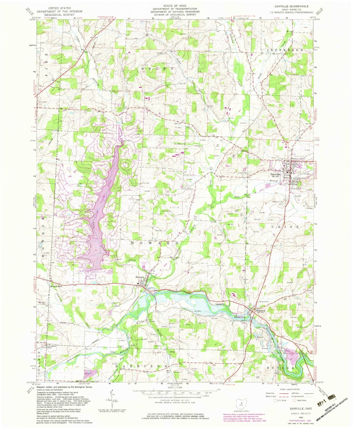
Classic USGS Danville Ohio 7.5'x7.5' Topo Map
Couldn't load pickup availability
Historical USGS topographic quad map of Danville in the state of Ohio. Typical map scale is 1:24,000, but may vary for certain years, if available. Print size: 24" x 27"
This quadrangle is in the following counties: Knox.
The map contains contour lines, roads, rivers, towns, and lakes. Printed on high-quality waterproof paper with UV fade-resistant inks, and shipped rolled.
Contains the following named places: Amity Cemetery, Danville, Dowd Creek, East Branch Jelloway Creek, Honey Run, Millwood Cemetery, Mount Zion Cemetery, Saint Lukes Cemetery, Stone Quarry Chapel, Valley View Cemetery, Workman Cemetery, Berry School (historical), Apple Valley Golf Course, Locust Grove School (historical), Union School (historical), Wildcat School (historical), East Knox High School, School Number 3 (historical), Danville High School, Danville Elementary School, Pleasant Hill School (historical), Harrisburg School (historical), Little Jelloway Creek, Howard, Buckeye City, Millwood, Monroe Mills, Barney Run, Indianfield Run, Jelloway Creek, Sapps Run, Schenck Creek, Shadley Valley Creek, Doudy Valley, Pleasant Valley (historical), Ransoms Run, Hedge Farm (historical), Linn Wood Farm (historical), School Number 1 (historical), School Number 2 (historical), School Number 3 (historical), School Number 5 (historical), School Number 6 (historical), School Number 7 (historical), Grove Falls, Apple Valley Lake Dam, Apple Valley Lake, Township of Howard, Banbury Cemetery, Branstool - Critchfield - Shrimplin Cemetery, Quarry Chapel Cemetery, Millwood Post Office (historical), Monroe Mills Post Office (historical), Danville Post Office, Howard Post Office, Buckeye City Post Office (historical), Village of Danville, Eastern Knox County Joint Fire District Station 2, Eastern Knox County Joint Fire District Station 1, Skyline Turkey Farm, Apple Valley Census Designated Place, Howard Census Designated Place, Apple Valley, Grassydell Farms, Howard Sewage Treatment Plant, Blanchard Swine Farms, Horn Farms, Bullock Farms, Valley Fruit Farm, Autumn Hills Farm, Bratton Hog Farm


