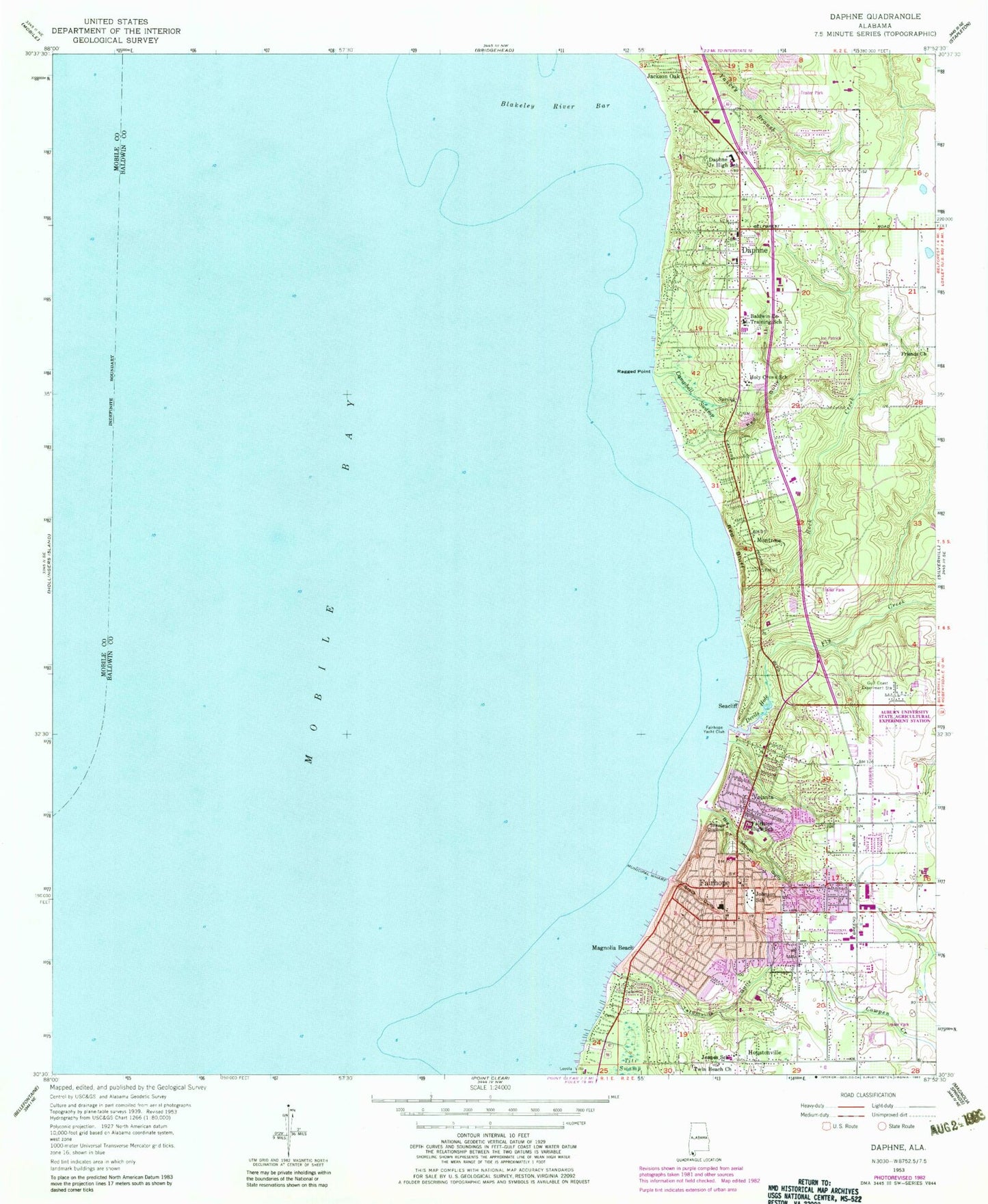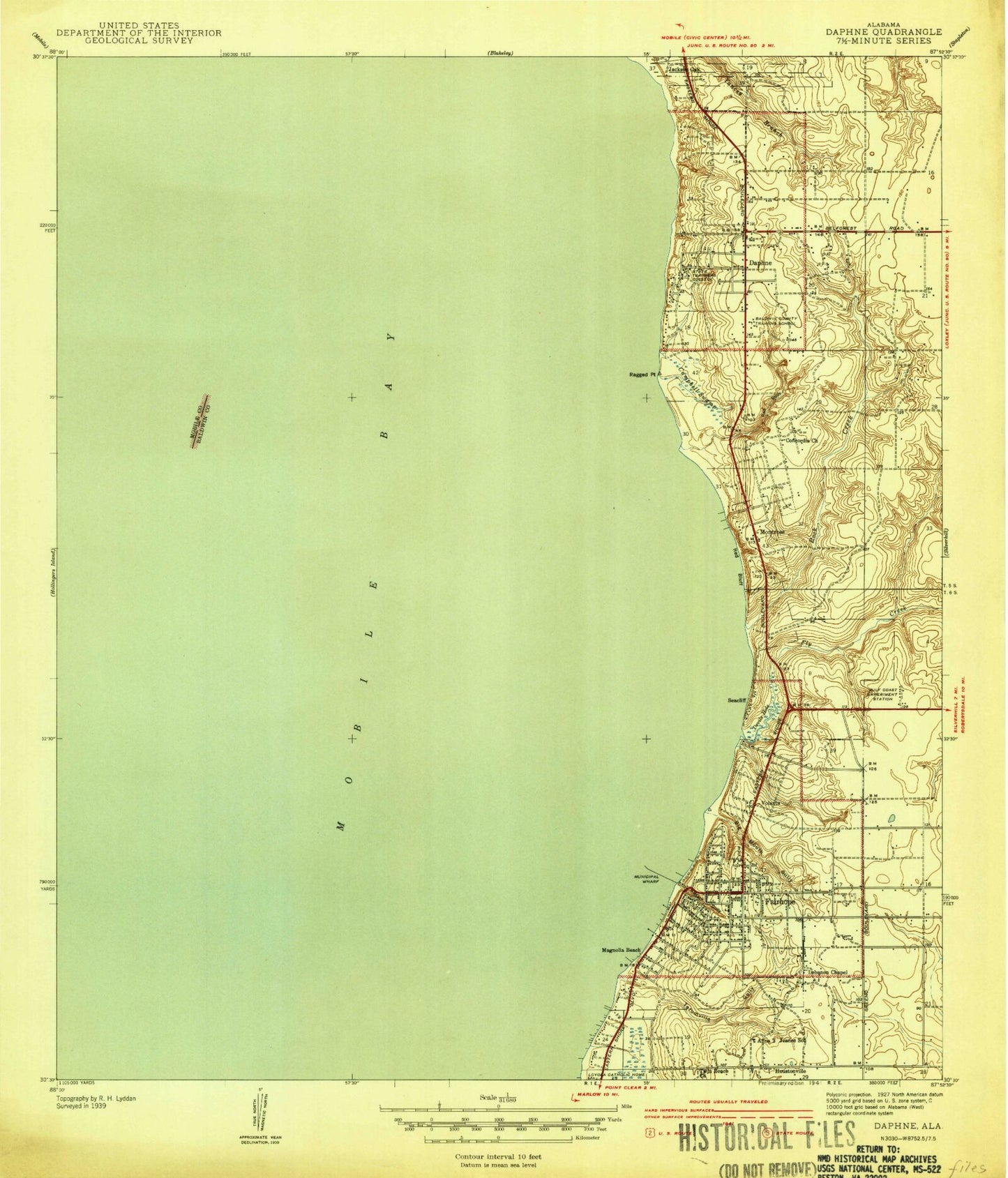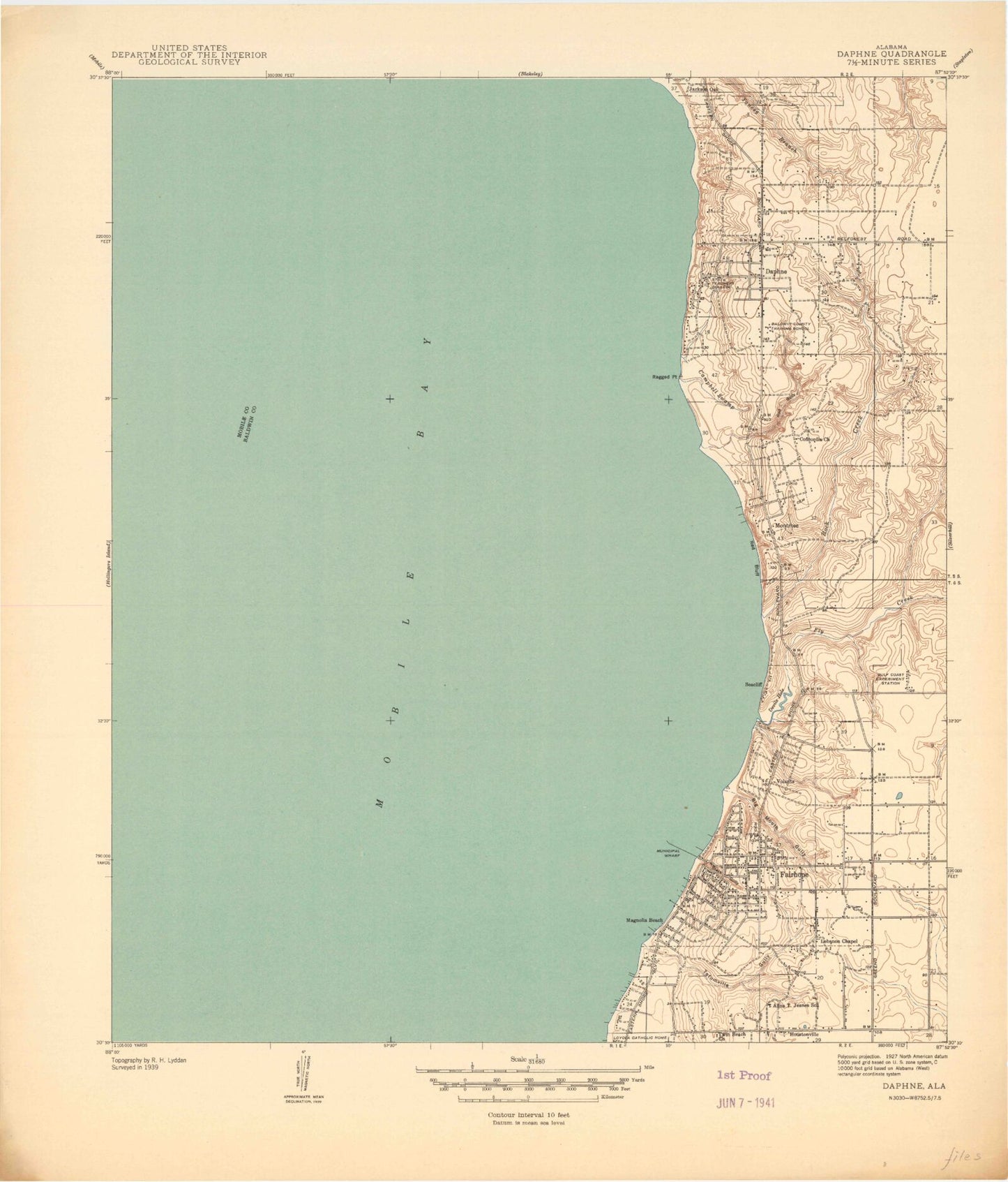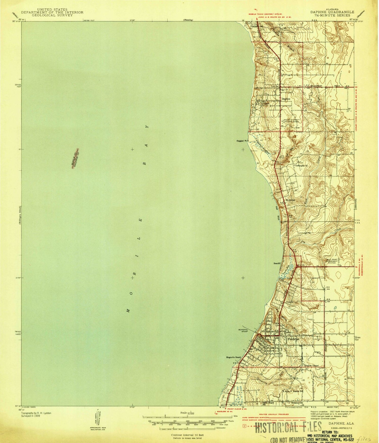

MyTopo
Classic USGS Daphne Alabama 7.5'x7.5' Topo Map
Couldn't load pickup availability
Historical USGS topographic quad map of Daphne in the state of Alabama. Map scale may vary for some years, but is generally around 1:24,000. Print size is approximately 24" x 27"
This quadrangle is in the following counties: Baldwin, Mobile.
The map contains contour lines, roads, rivers, towns, and lakes. Printed on high-quality waterproof paper with UV fade-resistant inks, and shipped rolled.
Contains the following named places: Auburn University State Agricultural Experiment Station, Baldwin County Sheriff's Office, Baldwin County Training School, Baldwin Square Shopping Center, Beverly Living Center, Big Mouth Gully, Blakeley River Bar, Brantley 1 Dirt Pit, Campbell Swamp, Carroll Place Assisted Living Facility, Celebration Church of Fairhope, Centennial Park, Christ Presbyterian Church, Christ the King Church, Christ the King School, Christian Valley Baptist Church, Church of God, Church of the Apostles, City of Fairhope, City of Fairhope Civic Center, Colony Cemetery, Covenant Presbyterian Church, Daphne, Daphne Elementary School, Daphne Fire Department Station 1, Daphne Junior High School, Daphne Mobile Home Park, Daphne Police Department, Daphne Post Office, Daphne Public Library, Daphne Shopping Center, Daphne United Methodist Church, Del-Fair Shopping Center, Devils Hole, East Bay Church, East Park Plaza Mobile Home Park, Eastern Shore Art Center, Eastern Shore Church of Christ, Eastern Shore Marina, Eastern Shore Mobile Home Village, Eastern Shore Presbyterian Church, Eastern Shore Shopping Center, Fairhope, Fairhope Christian Church, Fairhope Church of Christ, Fairhope Elementary School, Fairhope High School, Fairhope Middle School, Fairhope Municipal Park, Fairhope Police Department, Fairhope Post Office, Fairhope Public Library, Fairhope Public Utilities Wastewater Treatment Plant, Fairhope Satellite Courthouse, Fairhope Seventh Day Adventist Church, Fairhope United Methodist Church, Fairhope Volunteer Fire Department, Fairhope Yacht Club, First Baptist Church of Fairhope, Fly Creek, Fly Creek Marina, Friends Church, Grace Anglican Church, Gulf Coast Experiment Station, Holy Cross School, Houstonville, Jackson Oak, James P Nix Center, Jeanes School, Jehovah's Witness Church, Joe Patrick Park, Johnson School, Knoll Park, Lebanon Chapel African Methodist Episcopal Church, Living Word Church of Christ, Lott Park, Loyola Villa, Magnolia Beach, Marietta Johnson Museum, Memory Gardens of Fairhope, Montrose, Montrose Bay Health and Rehabilitation Center, Montrose Cemetery, Montrose Post Office, New Era Baptist Church, Pina's Mobile Home Park, Ragged Point, Red Bluff, Red Gully, Redeemer Lutheran Church, Rock Creek, Rock Creek Golf Club, Saint James Episcopal Church, Saint Lawrence Catholic Church, Seacliff, SouthernCare - Daphne, Stack Gully, Tatumville Gully, The Gardens of Daphne, The Huntingdon at Homestead Village, Thomas Hospital, Trinity Presbyterian Church, Twin Beach African Methodist Episcopal Church, Volanta, WABF-AM (Fairhope), Weeks Bay Reserve Foundation, WHSP-FM (Fairhope), Winterhaven Court Mobile Home Park, WMOO-AM (Fairhope), WMOO-AM (Mobile), ZIP Code: 36559