MyTopo
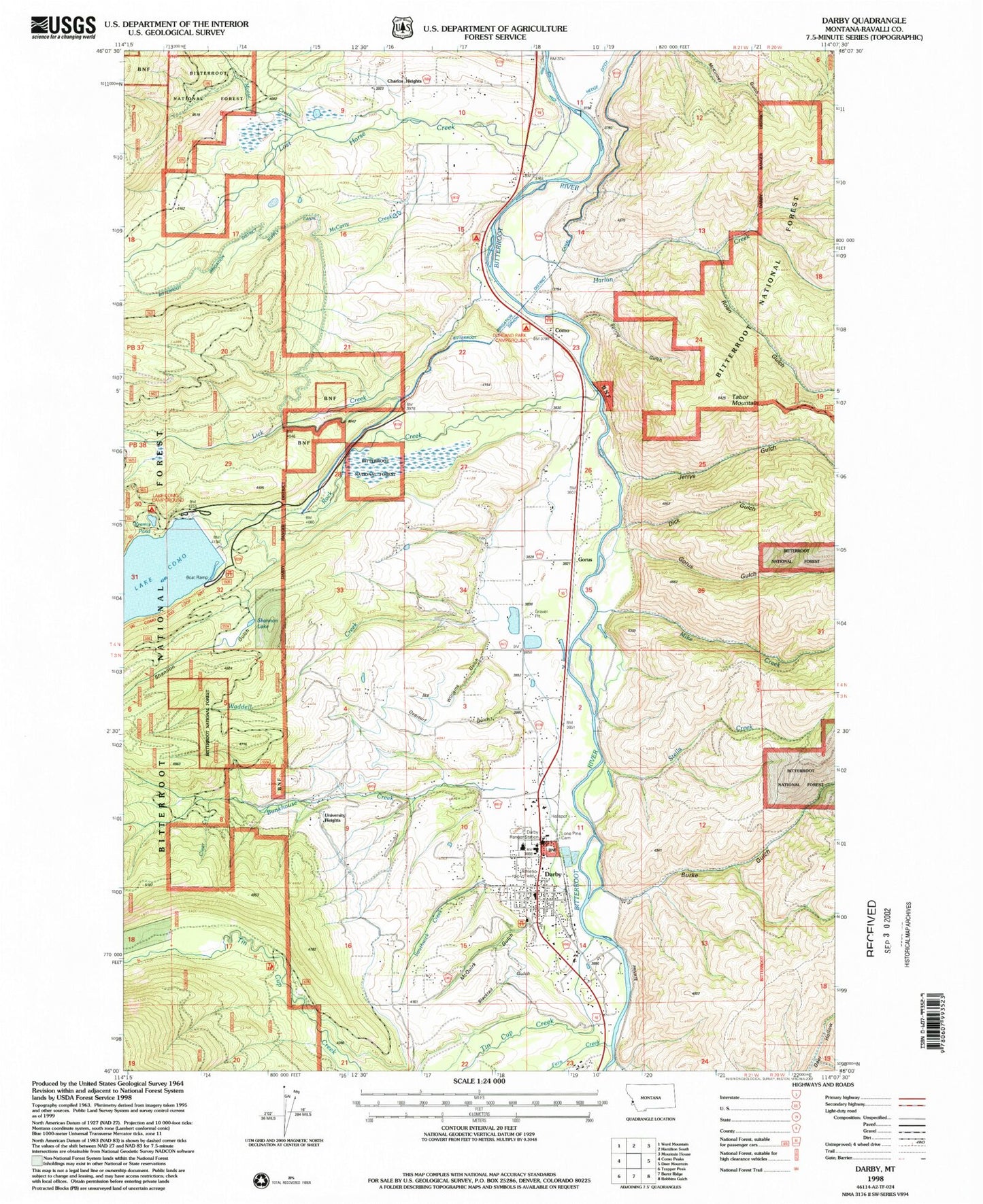
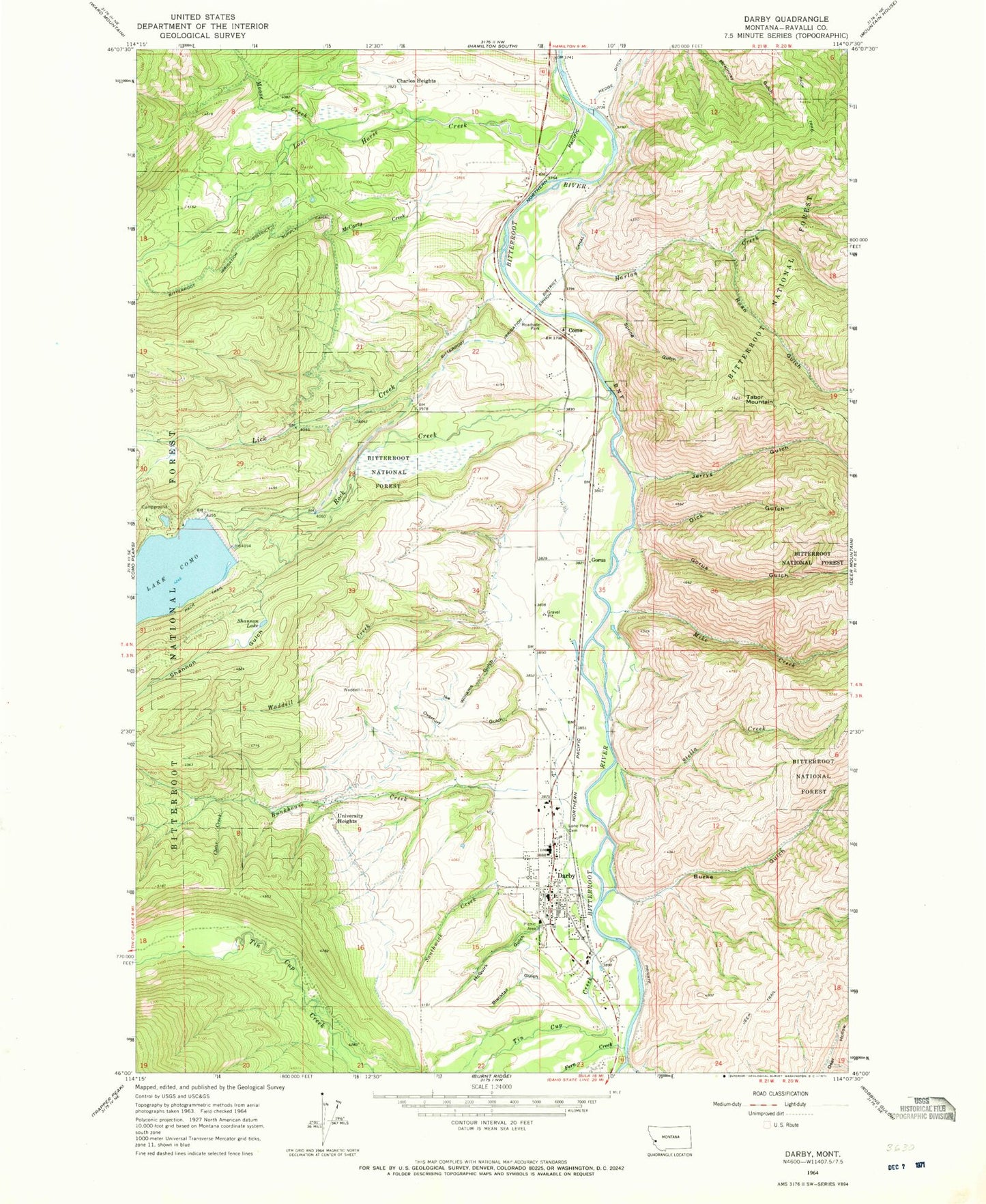
Classic USGS Darby Montana 7.5'x7.5' Topo Map
Couldn't load pickup availability
Historical USGS topographic quad map of Darby in the state of Montana. Map scale may vary for some years, but is generally around 1:24,000. Print size is approximately 24" x 27"
This quadrangle is in the following counties: Ravalli.
The map contains contour lines, roads, rivers, towns, and lakes. Printed on high-quality waterproof paper with UV fade-resistant inks, and shipped rolled.
Contains the following named places: 03N21W10DADD01 Well, 03N21W14BBDA01 Well, 03N21W14CAAA01 Well, 03N21W15CCCD01 Well, 03N21W22BDA_01 Well, 04N21W14CBAD01 Well, 04N21W16DDDD01 Well, 04N21W17BCBB01 Well, 04N21W28DDDD01 Well, 04N21W30DCDD01 Well, 04N21W32BDAA01 Well, 04N21W33AADA01 Well, 04N21W35CCBA01 Well, Bean, Bike Hostel Recreation Site, Bitterroot River Bridge, Blacktail Gulch, Boulanger Field, Bunkhouse Creek, Burke Gulch, Clear Creek, Community Christian School, Como, Como Lake Dam, Como Post Office, Como School, Darby, Darby Ambulance, Darby Division, Darby Elementary School, Darby High School, Darby Park, Darby Police Department, Darby Post Office, Darby Public Library, Darby Volunteer Fire Department, Dick Gulch, Durland Park Campground, Family Fellowship Church, Fern Creek, First Baptist Church, Fox Field, Gorus, Gorus Gulch, Harlan Creek, Historic Forest Service Museum, Holtet Court, Ike Williams Gulch, Jerrys Gulch, Kramis Pond, Lake Como Campground, Lick Creek, Lick Creek Campground, Lone Pine Cemetery, Lost Horse Creek, McCarty Creek, McQuirk Gulch, Mike Creek, Mister Ts Wildlife Museum, Moose Creek, Overturf Gulch, Pioneer Museum, Roan Gulch, Rock Creek, Rock Creek Horse Camp, Rock Creek Trailhead, Saint Philip Benizi Mission, Shannon Gulch, Shannon Lake, Southwick Creek, Spring Gulch, Stella Creek, Tabor Mountain, The Church of Jesus Christ of Latter Day Saints, Tin Cup Creek, Tin Cup Creek Bridge, Town of Darby, University Heights, Upper Como Campground, Waddell Creek, Wallace Crawford Memorial Fishing Access Site