MyTopo
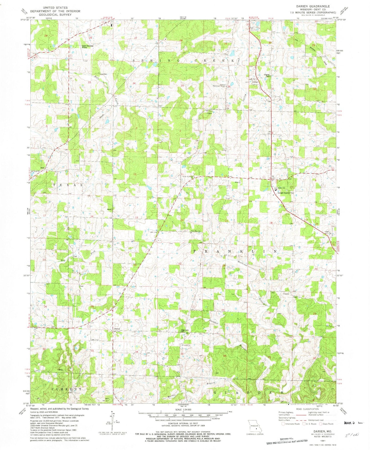
Classic USGS Darien Missouri 7.5'x7.5' Topo Map
Couldn't load pickup availability
Historical USGS topographic quad map of Darien in the state of Missouri. Map scale may vary for some years, but is generally around 1:24,000. Print size is approximately 24" x 27"
This quadrangle is in the following counties: Dent.
The map contains contour lines, roads, rivers, towns, and lakes. Printed on high-quality waterproof paper with UV fade-resistant inks, and shipped rolled.
Contains the following named places: Cage Cemetery, Cage School, Corinth Baptist Church Cemetery, Corinth Church, Custer, Darien, Dent County, Dent County Farm, Dry Fork School, Hobson School, Jack, Jamison Full Gospel Temple, Jamison School, KFPS-AM (Salem), Love Cemetery, New Hope, New Hope Church, New Hope School, Oak Hill R-1 School, Pleasant View School, Salem Apostolic Church, Salem Memorial Airport, South Ozark School, Stagner Cemetery, Township of Franklin, West Whiteoak School, ZIP Code: 65560