MyTopo
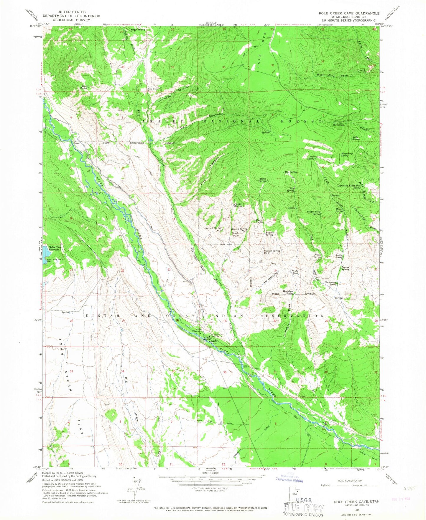
Classic USGS Dark Canyon Utah 7.5'x7.5' Topo Map
Couldn't load pickup availability
Historical USGS topographic quad map of Dark Canyon in the state of Utah. Typical map scale is 1:24,000, but may vary for certain years, if available. Print size: 24" x 27"
This quadrangle is in the following counties: Duchesne.
The map contains contour lines, roads, rivers, towns, and lakes. Printed on high-quality waterproof paper with UV fade-resistant inks, and shipped rolled.
Contains the following named places: Ant Reservoirs, Beaver Spring, Blank Spring, Boundary Spring, Buffalo Spring, Bull Elk Creek, Cart Hollow, Center Fork Spring, Coyote Spring, Dark Canyon, East Cart Hollow, Elk Spring, Fawn Spring, First Canyon, Grits Spring, Hackamore Spring, Harmston Canyon, Henry Spring, Lightning Killed Bull Spring, Mugwump Spring, Nephi Draw, Nephi Pond, Pole Creek, Pole Creek Canal, Powerplant Canal, Preece Spring, Puppy Spring, Ray Spring, Rock Spring, Saddle Spring, Trail Spring, Uintah Canyon Youth Camp, West Fork Farm Creek, Zeagher Cabin, Uinta Canyon Summer Homes, Lower Vinta Canal Bridge, Upper Uinta Canal Bridge, Uinta River Bridge, Russell Spring Number 1, Russell Spring Number 2, Russell Spring Number 3, Uintah Powerplant, Uinta Canyon Summer Homes, Zeagher Cabin